Ábádán
| Ábádán آبادان | |
|---|---|
 Rafinerie v Ábádánu | |
| Poloha | |
| Souřadnice | 30°21′ s. š., 48°17′ v. d. |
| Časové pásmo | UTC+3:30 |
| Stát | |
| Provincie | Chúzistán |
| Rozloha a obyvatelstvo | |
| Počet obyvatel | 217 988 (2006) |
| Etnické složení | Peršané,Arabové |
| Náboženské složení | Muslimové |
| Některá data mohou pocházet z datové položky. | |
Ábádán (persky آبادان) je přístavní město na jihozápadě Íránu. V roce 2005 mělo 217 988 obyvatel. Je centrem zpracování ropy.
Ábádán leží na hranicích s Irákem, přibližně 50 kilometrů od Perského zálivu na ostrově s rozlohou 270 km² na řece Šatt al-Arab. Ve městě je mezinárodní letiště a technologický institut založený v roce 1939.
V roce 1847 se bývalé turecké území stalo součástí Íránu. V roce 1908 zde byla objevena ropa a o rok později vznikla první rafinérie. Během irácko-íránské války v roce 1980 bylo město částečně zničeno.
Reference
V tomto článku byl použit překlad textu z článku Ábádán na slovenské Wikipedii.
Externí odkazy
 Obrázky, zvuky či videa k tématu Ábádán na Wikimedia Commons
Média použitá na této stránce
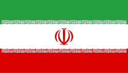
Flag of Iran. The tricolor flag was introduced in 1906, but after the Islamic Revolution of 1979 the Arabic words 'Allahu akbar' ('God is great'), written in the Kufic script of the Qur'an and repeated 22 times, were added to the red and green strips where they border the white central strip and in the middle is the emblem of Iran (which is a stylized Persian alphabet of the Arabic word Allah ("God")).
The official ISIRI standard (translation at FotW) gives two slightly different methods of construction for the flag: a compass-and-straightedge construction used for File:Flag of Iran (official).svg, and a "simplified" construction sheet with rational numbers used for this file.
Anglo-Iranian Oil Company, Abadan, Iran
Autor: Uwe Dedering, Licence: CC BY-SA 3.0
Location map of Iran.
Equirectangular projection. Stretched by 118.0%. Geographic limits of the map:
* N: 40.0° N
* S: 24.5° N
* W: 43.5° E
* E: 64.0° E
Made with Natural Earth. Free vector and raster map data @ naturalearthdata.com.


