Ílám
| Provincie Ílám استان ایلام | |
|---|---|
 Darreh Shahr | |
| Geografie | |
| Hlavní město | Ílám |
| Souřadnice | 33°38′18″ s. š., 46°25′21″ v. d. |
| Rozloha | 20 133 km² |
| Nejvyšší bod | Kabír Kúh (2 970 m n. m.) |
| Geodata (OSM) | OSM, WMF |
| Obyvatelstvo | |
| Počet obyvatel | 545 787 |
| Hustota zalidnění | 27,1 obyv./km² |
| Jazyk | Perština, Kurdština |
| Náboženství | Islám |
| Správa regionu | |
| Druh celku | Provincie |
| Podřízené celky | 8 krajů |
| Některá data mohou pocházet z datové položky. | |
Provincie Ílám (persky استان ایلام) je íránskou provincií v jihozápadní části země. Hraničí s Irákem a provinciemi Chúzestán, Lorestán a Kermanšáh. Hlavním městem provincie je Ílám.
Podnebí
Provincie Ílám patří mezi nejteplejší oblasti Íránu, ačkoliv v hornatých oblastech na severu a východě provincie je poměrně chladno. Průměrné roční srážky dosahují 578 mm. Nejvyšší horou je Kabír Kúh s výškou 2 790 m a součástí pohoří Zagros.
Externí odkazy
 Obrázky, zvuky či videa k tématu Ílám na Wikimedia Commons
Média použitá na této stránce
Flag of Iran. The tricolor flag was introduced in 1906, but after the Islamic Revolution of 1979 the Arabic words 'Allahu akbar' ('God is great'), written in the Kufic script of the Qur'an and repeated 22 times, were added to the red and green strips where they border the white central strip and in the middle is the emblem of Iran (which is a stylized Persian alphabet of the Arabic word Allah ("God")).
The official ISIRI standard (translation at FotW) gives two slightly different methods of construction for the flag: a compass-and-straightedge construction used for File:Flag of Iran (official).svg, and a "simplified" construction sheet with rational numbers used for this file.
Autor: Milad2017, Licence: CC BY-SA 3.0
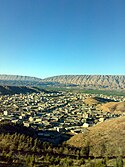
Darreh Shahr is a city in Ilam Province, Iran.
Autor: Дмитрий-5-Аверин, Licence: CC BY-SA 3.0
Flag-map of Iran (tricolour)


