Íránská vysočina
| Íránská vysočina | |
|---|---|
 | |
| Stát | |
| Souřadnice | 36°17′ s. š., 59°3′ v. d. |
| Některá data mohou pocházet z datové položky. | |

Íránská vysočina je hornatá oblast v jihozápadní Asii, která je tvořena velkou bezodtokovou náhorní plošinou s průměrnou výškou 1200 m n. m. Na západě je ohraničena řekami Eufrat a Tigris, na východě pohořím Hindúkuš a Sulajmánským pohořím. Severní hranici tvoří pohoří Elborz a Kopet Dag, jižní hranici tvoří Perský záliv a Arabské moře.
Ve starověku se zde nacházely státy Elam, Médie, Persie. Dnes se na tomto území nachází Írán, Afghánistán a částečně Pákistán.
Externí odkazy
 Obrázky, zvuky či videa k tématu Íránská vysočina na Wikimedia Commons
Média použitá na této stránce
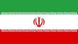
Flag of Iran. The tricolor flag was introduced in 1906, but after the Islamic Revolution of 1979 the Arabic words 'Allahu akbar' ('God is great'), written in the Kufic script of the Qur'an and repeated 22 times, were added to the red and green strips where they border the white central strip and in the middle is the emblem of Iran (which is a stylized Persian alphabet of the Arabic word Allah ("God")).
The official ISIRI standard (translation at FotW) gives two slightly different methods of construction for the flag: a compass-and-straightedge construction used for File:Flag of Iran (official).svg, and a "simplified" construction sheet with rational numbers used for this file.
Zagros Mountains, Iran. Photo center point: 28.0° N, 54.0° E (near Banaruyeh). NASA Space Shuttle photo STS047-151-35.JPG. One of the most beautifully folded mountain ranges in the world, the southern Zagros Mountains of western Iran can be seen in this south-southwest looking low oblique view. Pushed up by the collision of crustal plates, the Zagros Mountains were buckled into high folds, or anticlines, and depressions, or synclines. Extending from northwest to southeast is a broad zone of long parallel lines of enormous hogback ridges and deep intervening valleys (right center to upper center of the image). There are numerous salt marshes in many of the valleys, such as Lake Bakhtegan, visible in the lower left portion of the image. Iran's major oil fields lie along the western foothills, where salt domes have trapped oil. The Persian Gulf is visible in the upper right portion of the image.
Autor: Sadalmelik, Licence: CC BY-SA 3.0
Topographic map of the Iranian plateau in Central Asia, connecting to Anatolia in the west and Hindu Kush and Himalaya in the east.


