Územní nároky na Antarktidu
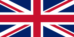
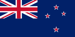
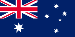
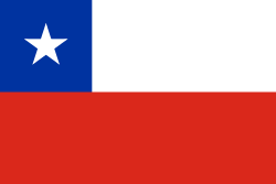
K roku 2012 vznáší územní nároky na území v Antarktidě sedm různých států. Jejich požadavky jsou spíše formální, politický status Antarktidy upravuje Smlouva o Antarktidě (konkrétně článek 4), která byla uzavřena 1. prosince 1959 ve Washingtonu a vstoupila v platnost 23. června 1961. Smlouvě o Antarktidě podléhá veškerá pevná zem jižně od 60. rovnoběžky včetně plovoucích šelfových ledovců. Nejdůležitějšími body smlouvy jsou mírová vědecká spolupráce, zákaz vojenského využití a pozastavení všech nároků na suverenitu nad jakoukoliv částí Antarktidy (na současných mapách jsou nadále vyznačovány zábory jednotlivých zemí, které byly vzneseny před rokem 1959, protože nebyly zrušeny, jen pozastaveny).[1]
Přehled území
Všechna nárokovaná územní jsou kruhové výseče se středem na jižním pólu a obvodovou kružnicí umístěnou na 60. rovnoběžce jižní šířky. Výjimkou je ostrov Petra I. Občas se k Antarktickému smluvnímu systému mylně přiřazují i blízké subarktické ostrovy severně od 60. jižní rovnoběžky, které Smlouvě o Antarktidě nepodléhají (mimo jiné Bouvetův ostrov, Jižní Georgie a Jižní Sandwichovy ostrovy, Crozetovy ostrovy, Kergueleny a Heardův ostrov a McDonaldovy ostrovy, Macquarie a Ostrovy prince Edvarda).
| Rok | Země | Území | Vymezení | Mapa |
|---|---|---|---|---|
| 1908 | 20°W až 80°W[2] | (c) Lokal_Profil, CC BY-SA 2.5 | ||
| 1923 | 150°W až 160°E[3] | (c) Lokal_Profil, CC BY-SA 2.5 | ||
| 1924 | 142°2'E až 136°11'E[4] | (c) Lokal_Profil, CC BY-SA 2.5 | ||
| 1929 | 68°50′ j. š., 90°35′ z. d.[5] |  | ||
| 1933 | 160°E až 142°2'E a 136°11'E až 44°38'E[6] | (c) Lokal_Profil, CC BY-SA 2.5 | ||
| 1939 | 44°38'E až 20°W[7] |  | ||
| 1940 | 53°W až 90°W[8] | (c) Lokal_Profil, CC BY-SA 2.5 | ||
| 1943 | 25°W až 74°W[9] | (c) Lokal_Profil, CC BY-SA 2.5 | ||
| – | Žádná | Nenárokované území (Země Marie Byrdové) | 90°W to 150°W (mimo ostrov Petra I.) |  |
Územní nároky Spojeného království, Chile a Argentiny se překrývají. Na kontinentě se nachází i území, na které ještě nebyl vznešen teritoriální požadavek. Jedná se o zemi Marie Byrd, která se rozkládá mezi Rossovou dependencí a Britským antarktickým územím. V minulosti si část území na Antarktidě (Nové Švábsko) nárokovalo i nacistické Německo.
Odkazy
Reference
- ↑ Secretariat of the Artarctic Treatry [online]. The Antarctic Treaty [cit. 2012-06-03]. Dostupné v archivu pořízeném dne 2011-06-03. (anglicky)
- ↑ BRITISH ANTARCTIC TERRITORY TODAY [online]. Foreign & Commonwealts Office [cit. 2012-06-03]. Dostupné v archivu pořízeném dne 2011-03-12. (anglicky)
- ↑ New Zealand and Antarctica [online]. New Zealand Ministry of Foreign Affairs & Trade [cit. 2012-06-03]. Dostupné v archivu pořízeném dne 2010-05-22. (anglicky)
- ↑ La Terre Adélie (Antarctique) [online]. Terres australes et antarctiques françaises [cit. 2012-06-03]. Dostupné v archivu pořízeném dne 2012-07-01. (francouzsky)
- ↑ Peter I Øy [online]. Norsk Polarinstitutt [cit. 2012-06-03]. Dostupné online. (norsky)
- ↑ Australian Antarctic History [online]. Australian Government, Australian Antarctic Division [cit. 2012-06-03]. Dostupné online. (anglicky)
- ↑ Dronning Maud Land [online]. Norsk Polarinstitutt [cit. 2012-06-03]. Dostupné v archivu pořízeném dne 2012-07-21. (norsky)
- ↑ FIJA TERRITORIO CHILENO ANTARTICO [online]. MINISTERIO DE RELACIONES EXTERIORES DE CHILE [cit. 2012-06-03]. Dostupné online. (španělsky)
- ↑ ARGENTINA EN LA ANTÁRTIDA [online]. El Instituto Antártico Argentino [cit. 2012-06-03]. Dostupné v archivu pořízeném dne 2012-06-18. (španělsky)
Související články
Externí odkazy
 Obrázky, zvuky či videa k tématu Územní nároky na Antarktidu na Wikimedia Commons
  Dílo Smlouva o Antarktidě ve Wikizdrojích
Média použitá na této stránce
Flag of Australia, when congruence with this colour chart is required (i.e. when a "less bright" version is needed).
See Flag of Australia.svg for main file information.Při zobrazení tohoto souboru lze snadno přidat orámování
Flag of Tierra del Fuego Province, Argentina. The flag was nicknamed the Albatross, wherein the orange portion reflected the geography of Tierra del Fuego, and the blue symbolizes the sky and sea surrounding the province, while the Southern Cross reflects the night sky and the albatross itself is a local bird that represents freedom through flight.[1]
(c) Lokal_Profil, CC BY-SA 2.5
Map showing the territorial claim to Antarctica by the country in the filename. Also on the map are is the 60° S Parallel, Antarctic Circle, 0/180 latitude line and (in red) the borders of the claims by other states.
(c) Lokal_Profil, CC BY-SA 2.5
Map showing the territorial claim to Antarctica by the country in the filename. Also on the map are is the 60° S Parallel, Antarctic Circle, 0/180 latitude line and (in red) the borders of the claims by other states.
(c) Lokal_Profil, CC BY-SA 2.5
Map showing the territorial claim to Antarctica by the country in the filename. Also on the map are is the 60° S Parallel, Antarctic Circle, 0/180 latitude line and (in red) the borders of the claims by other states.
(c) Lokal_Profil, CC BY-SA 2.5
Map showing the territorial claim to Antarctica by the country in the filename. Also on the map are is the 60° S Parallel, Antarctic Circle, 0/180 latitude line and (in red) the borders of the claims by other states.
(c) Lokal_Profil, CC BY-SA 2.5
Map showing the territorial claims to Antarctica
Autor: TUBS
Location of XY (see filename) on the globe.
(c) Lokal_Profil, CC BY-SA 2.5
Map showing the territorial claim to Antarctica by the country in the filename. Also on the map are is the 60° S Parallel, Antarctic Circle, 0/180 latitude line and (in red) the borders of the claims by other states.
Autor: (of code) B1mbo and cs:User:-xfi-, Licence: CC BY-SA 3.0
Flag of the Magallanes and Chilean Antarctica Region, Chile.
(c) Lokal_Profil, CC BY-SA 2.5
Map showing the territorial claim to Antarctica by the country in the filename. Also on the map are is the 60° S Parallel, Antarctic Circle, 0/180 latitude line and (in red) the borders of the claims by other states.
Flag of the en:French Southern and Antarctic Lands, official since 23 February 2007
Autor: Chipmunkdavis, Licence: CC BY-SA 3.0
A map of the unclaimed area of Antarctica


