Čerkesie
| Čerkesie Адыгэ Хэку (ady) Хэкужъ (ady)
| |||||||||||
| Motto Псэм ипэ напэ / Psem ipe nape („Čest před životem!“) | |||||||||||
Geografie
| |||||||||||
82 000 km² | |||||||||||
| Obyvatelstvo | |||||||||||
| |||||||||||
| Státní útvar | |||||||||||
| |||||||||||
žádná oficiální měna, jako měna bylo užíváno osmanských mincí | |||||||||||
Zánik | |||||||||||
| Státní útvary a území | |||||||||||
| |||||||||||
Čerkesie nebo Čerkesko (adygejsky Адыгэ Хэку, „Adygejská vlast“) je bývalá země, zaniklý stát a historický region na severním Kavkaze a na severovýchodním pobřeží Černého moře.[1] Je domovem Čerkesů (Adygejců), kteří jsou příbuzní Abchazů, ale vyznáním převážně muslimové. Sami Čerkesové však tento pojem nepoužívají a svou zemi ve svém jazyce nazývají Адыгэ Хэку (Adıgə Xəku) nebo Адыгей (Adıgey). Jako stát byla Čerkesie po většinu času konfederací mnoha feudálních knížectví, před svým zánikem byla krátce republikou. Byla zničena během rusko-čerkeské války (1763–1864), která začala ruskou okupací a postupně bylo 91 % Čerkesů z tohoto regionu vyhnáno. Ruská generalita považovala Čerkesy jen za horaly a horské bandity. Dnes většina Čerkesů žije v exilu.
Historicky Čerkesie pokrývala jižní polovinu dnešního Krasnodarského kraje, Adygejsko, Karačajsko-Čerkesko, Kabardsko-Balkarsko a části Severní Osetie-Alanie a Stavropolský kraj, ohraničené řekou Kubáň na severu, která ji oddělovala od carského Ruska.
Geografie
Symbolika
- vlajka:
Odkazy
Reference
- ↑
 Dílo 1911 Encyclopædia Britannica/Circassia ve Wikizdrojích (anglicky)
Externí odkazy
 Obrázky, zvuky či videa k tématu Čerkesko na Wikimedia Commons
Média použitá na této stránce
No official flag.
Autor: Adigabrek, Licence: CC BY-SA 4.0
Circassia during the rule of Inal the Great. Circa 1450. Map designed by my friend Kayra Atakan for Wikipedia.
Autor: Гвына Юсыф Т., Licence: CC BY-SA 4.0
Map of Circassian Independence Majlis in 1860
Autor: Гвына Юсыф Т., Licence: CC BY-SA 4.0
Flag of Circassia in XIX. century and the Grand Assembly of Independence in 1861.
Autor: Athoremmes, Licence: CC0
digitalized according to https://sourcedblazons.miraheze.org/wiki/Russia_(1882-1917)
Autor: Гвына Юсыф Т., Licence: CC BY-SA 4.0
Banner of Kuchuka Jankhot the supreme prince of Kabardia.
Autor: Vorziblix, Licence: CC0
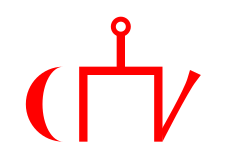
The flag of the Golden Horde, as shown in Angelino Dulcert's 1339 map. A similar flag appears in the later Catalan Atlas (1375), providing corroboration.
See also Early Mongol Flags at crwflags.com:
- One of the charges is a crescent and the other looks like a simplified form of the tamga from the flag of Idel Ural. On different copies of the flag, the crescent has different size; it is often smaller than shown here, sometimes even reduced into a simple oblique stroke and conjoined with the other charge into a si[n]gle symmetrical object; the other charge also sometimes lacks the oblique part [2, 3]. It was obviously difficult to draw the charges always the same way. The cities with this flag which are easy to identify are [2, 7, 8]: Sarai, the capital (spelled Sarra) - there is also a depiction of the ruler, "Jani Beg Lord of Sarai" ("Jambech senyor de Sarra"); Tana, present-day Azov, Russia; and Urgench, Uzbekistan (spelled Organci, with a cedilla under the c; nowadays ruined). This flag is a variant of the flag of "Emperor of Sarai" ("Emperador de Sara") from "Libro del conoscimiento de los reinos" [7] and might be the one that had really existed, considering the similarity of its charges with those from the flag of Idel Ural.
- [2] Enciclopedia universal ilustrada, vol. XXI, Espan~a Madrid: Espasa-Calpe S.A., 1968
- [3] Istorija otkric'a i istraz<ivanja, vol. I: Poc<etak istraz<ivanja; Mladinska knjiga, Ljubljana, 1979; Original title: A History of Discovery and Exploration, vol. I: The Search Begins;(C) 1973 Aldus Books Limited, London
- [7] Libro del Conoscimiento. Viajes medievales, vol. I Madrid: Fundacio'n Jose' Antonio de Castro, 2005 ISBN 84-96452-11-5 (complete edition) ISBN 84-96452-12-3 (vol. I) [e9s50]
- [8] A[p]pendices. (Ibid.)
- Tomislav Todorovic, 21 April 2007


