Čogha Zanbíl
| Čogha Zanbíl | |
|---|---|
| Světové dědictví UNESCO | |
 | |
| Smluvní stát | |
| Souřadnice | 32°0′30″ s. š., 48°31′15″ v. d. |
| Typ | kulturní dědictví |
| Kritérium | iii, iv |
| Odkaz | 113 (anglicky) |
| Oblast | Asie |
| Zařazení do seznamu | |
| Zařazení | 1979 (3. zasedání) |
Čogha Zanbíl (persky: چُغازَنبیل) bylo posvátné město starověké civilizace Elam a jehož pozůstatky se dnes nachází na území Íránu. Zdejší stavby představují jedny z mála zikkuratů, které byly nalezeny mimo území Mezopotámie. Město bylo vystavěno někdy okolo roku 1250 př. n. l.
V roce 1979 byla archeologická lokalita zapsána na seznam světového dědictví UNESCO.
Reference
V tomto článku byl použit překlad textu z článku Chogha Zanbil na anglické Wikipedii.
Externí odkazy
 Obrázky, zvuky či videa k tématu Čogha Zanbíl na Wikimedia Commons
Média použitá na této stránce
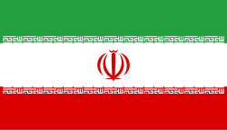
Flag of Iran. The tricolor flag was introduced in 1906, but after the Islamic Revolution of 1979 the Arabic words 'Allahu akbar' ('God is great'), written in the Kufic script of the Qur'an and repeated 22 times, were added to the red and green strips where they border the white central strip and in the middle is the emblem of Iran (which is a stylized Persian alphabet of the Arabic word Allah ("God")).
The official ISIRI standard (translation at FotW) gives two slightly different methods of construction for the flag: a compass-and-straightedge construction used for File:Flag of Iran (official).svg, and a "simplified" construction sheet with rational numbers used for this file.

