Administrativní dělení Belgie

Belgie je federálním státem a skládá se ze tří regionů, ve kterých žijí nizozemsky mluvící Vlámové, frankofonní Valoni a německá komunita.
Jazyková společenství
Podle tohoto jazykového principu je Belgie rozdělena následovně do tří společenství.
| Společenství | Vlámské společenství | Francouzské společenství (Valonsko-bruselská federace) | Německojazyčné společenství |
|---|---|---|---|
| název - nizozemsky | Vlaamse Gemeenschap | Franse Gemeenschap | Duitstalige Gemeenschap |
| název - francouzsky | Communauté flamande | Communauté française | Communauté germanophone |
| název - německy | Flämische Gemeinschaft | Französische Gemeinschaft | Deutschsprachige Gemeinschaft |
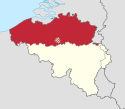
| Poloha |  |  |  |
| Vlajka |  |  |  |
| Hlavní město | Brusel | Brusel | Eupen |
| Web | www.vlaanderen.be | www.federation-wallonie-bruxelles.be | www.dglive.be |
Regiony
Podle administrativně-správního principu je Belgie členěna do 3 regionů. Vlámský a Valonský region se dále dělí na provincie; Bruselský region se dělí na 19 obcí.
| Region | Vlámský region | Bruselský region | Valonský region |
|---|---|---|---|
| název - nizozemsky | Vlaams Gewest | Brussels Hoofdstedelijk Gewest | Waals Gewest |
| název - francouzsky | Région flamande | Région de Bruxelles-Capitale | Région wallonne |
| název - německy | Flämische Region | Region Brüssel-Hauptstadt | Wallonische Region |
| Poloha |  | 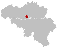 |  |
| Vlajka |  |  |  |
| Hlavní město | Brusel | Brusel | Namur |
| ISO 3166-2:BE | BE-VLG | BE-BRU | BE-WAL |
| Rozloha | 13 522 km² (44,29%) | 161 km² (0,53%) | 16 844 km² (55,18%) |
| Provincie | Antverpy Limburk Vlámský Brabant Východní Flandry Západní Flandry | žádné | Henegavsko Lucemburk Lutych Namur Valonský Brabant |
| Počet obyvatel 2015 | 6 444 127 (57.5%) | 1 175 173 (10.5%) | 3 589 744 (32.0%) |
| Hustota zalidnění | 476 obyv./km² | 7 300 obyv./km² | 213 v/km² |
| Web | www.vlaanderen.be | be.brussels | www.wallonie.be |
Provincie
| Mapa | Vlajka | Znak | Provincie | ISO kód | Hlavní město | Obyvatelstvo (2015) | Rozloha (km²) | Hustota zalidnění (obyv./km²) | Počet okresů | Počet obcí | Geodeta (OSM) |
|---|---|---|---|---|---|---|---|---|---|---|---|
 | Antverpy | BE-VAN | Antverpy | 1 813 282 | 2 867 | 632 | 3 | 70 | OSM, WMF | ||
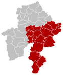
 |  | Limburk | BE-VLI | Hasselt | 860 204 | 2 422 | 355 | 3 | 44 | OSM, WMF | |
 | Východní Flandry | BE-VOV | Gent | 1 477 346 | 2 982 | 495 | 6 | 65 | OSM, WMF | ||
 | Vlámský Brabant | BE-VBR | Lovaň | 1 114 299 | 2 106 | 529 | 2 | 65 | OSM, WMF | ||
 | Západní Flandry | BE-VWV | Bruggy | 1 178 996 | 3 144 | 375 | 8 | 64 | OSM, WMF | ||
 |  | Valonský Brabant | BE-WBR | Wavre | 393 700 | 1 091 | 361 | 1 | 27 | OSM, WMF | |
 |  |  | Henegavsko | BE-WHT | Mons | 1 335 360 | 3 786 | 353 | 7 | 69 | OSM, WMF |
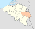 |  | Lutych | BE-WLG | Lutych | 1 094 791 | 3 862 | 283 | 4 | 84 | OSM, WMF | |
 | Lucemburk | BE-WLX | Arlon | 278 748 | 4 440 | 63 | 5 | 44 | OSM, WMF | ||
 |  | Namur | BE-WNA | Namur | 487 145 | 3 666 | 133 | 3 | 38 | OSM, WMF |
Okresy
| Mapa | Okres (arrondissement) | Nadřazená provincie | Obyvatelstvo (2015) | Rozloha (km²) | Hustota zalidnění (obyv./km²) | Počet obcí |
|---|---|---|---|---|---|---|
 | Okres Antverpy | Antverpy | 1 027 342 | 1 000 | 632 | 30 |
 | Okres Mechelen | Antverpy | 335 418 | 510 | 658 | 13 |
 | Okres Turnhout | Antverpy | 450 522 | 1 357 | 332 | 27 |
 | Okres Hasselt | Limburk | 420 777 | 906 | 464 | 18 |
 | Okres Maaseik | Limburk | 238 338 | 884 | 270 | 13 |
 | Okres Tongeren | Limburk | 201 089 | 632 | 318 | 13 |
 | Okres Halle-Vilvoorde | Vlámský Brabant | 617 330 | 942 | 655 | 35 |
 | Okres Lovaň | Vlámský Brabant | 496 969 | 1 169 | 425 | 30 |
 | Okres Aalst | Východní Flandry | 283 609 | 469 | 605 | 10 |
 | Okres Dendermonde | Východní Flandry | 197 806 | 342 | 578 | 10 |
 | Okres Eeklo | Východní Flandry | 83 517 | 334 | 250 | 6 |
 | Okres Gent | Východní Flandry | 544 959 | 944 | 577 | 21 |
 | Okres Oudenaarde | Východní Flandry | 122 629 | 419 | 293 | 11 |
 | Okres Sint-Niklaas | Východní Flandry | 244 826 | 474 | 517 | 7 |
 | Okres Bruggy | Západní Flandry | 280 153 | 661 | 424 | 10 |
 | Okres Diksmuide | Západní Flandry | 50 844 | 362 | 140 | 5 |
 | Okres Kortrijk | Západní Flandry | 285 509 | 403 | 708 | 12 |
 | Okres Ostende | Západní Flandry | 154 577 | 291 | 531 | 7 |
 | Okres Roeselare | Západní Flandry | 148 778 | 271 | 549 | 8 |
 | Okres Tielt | Západní Flandry | 91 910 | 275 | 334 | 9 |
 | Okres Veurne | Západní Flandry | 60 930 | 275 | 222 | 5 |
 | Okres Ypry | Západní Flandry | 106 295 | 549 | 194 | 8 |
 | Okres Brusel (Bruselský region) | - | 1 175 173 | 161 | 7 209 | 19 |
 | Okres Ath | Henegavsko | 86 167 | 487 | 177 | 8 |
 | Okres Charleroi | Henegavsko | 429 854 | 554 | 776 | 14 |
 | Okres Mons | Henegavsko | 257 804 | 584 | 441 | 13 |
 | Okres Mouscron | Henegavsko | 75 200 | 101 | 745 | 2 |
 | Okres Soignies | Henegavsko | 188 389 | 517 | 364 | 8 |
 | Okres Thuin | Henegavsko | 151 115 | 934 | 162 | 14 |
 | Okres Tournai | Henegavsko | 146 831 | 607 | 242 | 10 |
 | Okres Arlon | Lucemburk | 60 656 | 317 | 191 | 5 |
 | Okres Bastogne | Lucemburk | 46 857 | 1 043 | 45 | 8 |
 | Okres Marche-en-Famenne | Lucemburk | 55 857 | 954 | 59 | 9 |
 | Okres Neufchâteau | Lucemburk | 62 099 | 1 354 | 46 | 12 |
 | Okres Virton | Lucemburk | 53 279 | 771 | 69 | 10 |
 | Okres Huy | Lutych | 111 839 | 659 | 170 | 17 |
 | Okres Lutych | Lutych | 618 887 | 797 | 777 | 24 |
 | Okres Verviers | Lutych | 285 214 | 2 016 | 141 | 29 |
 | Okres Waremme | Lutych | 78 851 | 390 | 202 | 14 |
| Okres Nivelles | Valonský Brabant | 393 700 | 1 090 | 361 | 27 | |
 | Okres Dinant | Namur | 108 941 | 1 592 | 68 | 15 |
 | Okres Namur | Namur | 311 684 | 1 165 | 268 | 16 |
 | Okres Philippeville | Namur | 66 520 | 909 | 73 | 7 |
Externí odkazy
 Obrázky, zvuky či videa k tématu Administrativní dělení Belgie na Wikimedia Commons
Média použitá na této stránce
Autor: Vascer, Licence: CC BY-SA 3.0
Location map of Province of Limburg, Belgium
Equirectangular projection, N/S stretching 150 %. Geographic limits of the map: * N: 51.8° N * S: 49.2° N * W: 2.2° E * E: 6.9° E
Autor: Westermarck, Licence: CC BY-SA 3.0
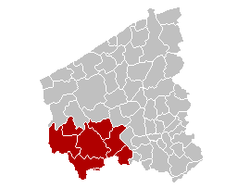
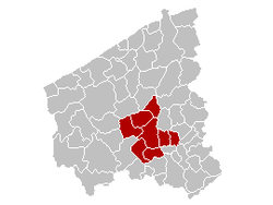
Location of Arrondissement Ieper in Belgium.
Autor: Tom Lemmens, Licence: CC0
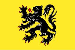
Flag of Flanders (Belgium), the region and community.
Autor: Westermarck, Licence: CC BY-SA 3.0
Location of Arrondissement Tielt in Belgium.
Autor: w:nl:Gebruiker:Westermarck, Licence: CC BY-SA 3.0
This map indicates (in red) the location of administrative and judicial arrondissements of Turnhout in the province of Antwerp, Belgium. Both maps are the same and fill all the province of Antwerp. In this case, a redirection is available at File:Judicial_Arrondissement_Turnhout_Belgium_Map.png for an easy and intuitive access to judicial arrondissement map.
Autor: Benzebuth198, Licence: CC BY-SA 3.0
Blason couronné de la province de Hainaut (Belgique).
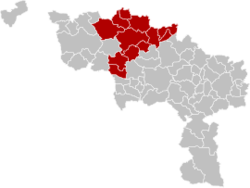
Map of Charleroi District in province of Hainaut, Belgium.
Kaart Franse Gemeenschap
Map of Hasselt District in province of Limburg, Belgium.
Pavillon de la province Flamande du Brabant (Belgique)
Autor: w:nl:Gebruiker:Westermarck, Licence: CC BY-SA 3.0
Location of Arrondissement Mechelen in Belgium.
Autor: Westermarck, Licence: CC BY-SA 3.0
Location of Arrondissement Veurne in Belgium.
Map of Ath District in province of Hainaut, Belgium.
Autor: TUBS
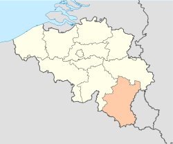
Location of xy province/ region/ community (see filename) in Belgium.
Autor: Vascer, Licence: CC BY-SA 3.0
Location map of Province of Antwerp, Belgium
Equirectangular projection, N/S stretching 150 %. Geographic limits of the map: * N: 51.8° N * S: 49.2° N * W: 2.2° E * E: 6.9° E
Map of the province East Flanders, showing Aalst arrondissement in red.
Tento vektorový obrázek byl vytvořen programem Adobe Illustrator.
Autor: Westermarck, Licence: CC BY-SA 3.0
Location of Arrondissement Diksmuide in Belgium.
Autor:
- Belgium_location_map.svg: NordNordWest
- derivative work: Corent1 (talk)
Location map of Belgium
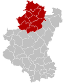
Map of Marche-en-Famenne District in province of Luxembourg, Belgium.
Colors changed by me, based on work from w:nl:Gebruiker:LennartBolks/kaartenhoekje also in PD.
Autor: NikNaks, Licence: CC BY-SA 4.0
Cropped version of Blank map of Europe.svg, coloured blue.
Flag of Walloon Brabant
Autor:
- Belgium_location_map.svg: NordNordWest
- derivative work: Corent1 (talk)
Location map of Province of Luxembourg Belgium
Flag of the Belgian province of East-Flanderes
Map of Tongeren District in province of Limburg, Belgium.
Autor:
- Belgium_location_map.svg: NordNordWest
- derivative work: Corent1 (talk)
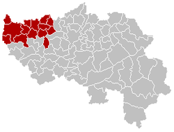
Location map of Province of Liege Belgium
Autor: w:nl:Gebruiker:Westermarck, Licence: CC BY-SA 3.0
Location of Arrondissement Antwerpen in Belgium.
Autor: Benzebuth198, Licence: CC BY-SA 3.0
Blason de la Province de Namur (Belgique)
Map of Soignies District in province of Hainaut, Belgium.
Map of the province West-Flanders, showing Kortijk arrondissement in red.
Map of Mouscron District in province of Hainaut, Belgium.
Autor: Westermarck, Licence: CC BY-SA 3.0
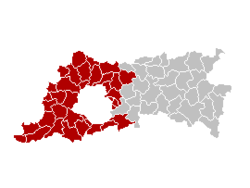
Location of Arrondissement Halle-Vilvoorde in Belgium.
Shows the flag of the province of Namur in Belgium.
Map of the province East-Flanders, showing Eeklo arrondissement in red.
Autor: Westermarck, Licence: CC BY-SA 3.0
Location of Arrondissement Leuven in Belgium.
Map of the province East-Flanders, showing Dendermonde arrondissement in red.
Autor: Westermarck, Licence: CC BY-SA 3.0
Location of Arrondissement Brugge in Belgium.
Autor: Westermarck, Licence: CC BY-SA 3.0
Location of Arrondissement Roeselare in Belgium.
Map of Neufchâteau District in province of Luxembourg, Belgium.
Colors changed by me, based on work from w:nl:Gebruiker:LennartBolks/kaartenhoekje also in PD.
Autor: Westermarck, Licence: CC BY-SA 3.0
Location of Arrondissement Oostende in Belgium.
Autor:
- Belgium_location_map.svg: NordNordWest
- derivative work: Corent1 (talk)
Location map of Province of Namur Belgium
Autor: DerekvG, Licence: CC BY-SA 4.0
Trace Brussel Capital region
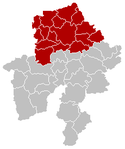
Map of Namur District in province of Namur, Belgium.
Map of Philippeville District in province of Namur, Belgium.
Map of the province East-Flanders, showing Ghent arrondissement in red.
Map of Tournai District in province of Hainaut, Belgium.
Autor: TUBS
Location of xy province/ region/ community Vlaamse Gemeenschap in Belgium in Belgium.
Map of Mons District in province of Hainaut, Belgium.
Autor: Vascer, Licence: CC BY-SA 3.0
Location map of Province of West Flanders, Belgium
Equirectangular projection, N/S stretching 150 %. Geographic limits of the map: * N: 51.8° N * S: 49.2° N * W: 2.2° E * E: 6.9° E
Map of Maaseik District in province of Limburg, Belgium.
Map of Arlon District in province of Luxembourg, Belgium.
Colors changed by me, based on work from w:nl:Gebruiker:LennartBolks/kaartenhoekje also in PD.
Autor: Ch1902, Min's, Licence: CC BY-SA 3.0
Flag of the Belgian province Liege.
map of Belgium showing the autonomous "German Speaking Community" in red.
Map of Thuin District in province of Hainaut, Belgium.
Map of Bastogne District in province of Luxembourg, Belgium.
Colors changed by me, based on work from w:nl:Gebruiker:LennartBolks/kaartenhoekje also in PD.
Autor: Westermarck, Licence: CC BY-SA 3.0
Map of the province East-Flanders, showing Oudenaarde arrondissement in red.
Autor:
- Belgium_location_map.svg: NordNordWest
- derivative work: Corent1 (talk)
Location map of Province of Hainaut Belgium
Autor: Vascer, Licence: CC BY-SA 3.0
Location map of Province of Flemish Brabant, Belgium
Equirectangular projection, N/S stretching 150 %. Geographic limits of the map: * N: 51.8° N * S: 49.2° N * W: 2.2° E * E: 6.9° E
Tento vektorový obrázek byl vytvořen programem Adobe Illustrator.
Autor: Lordsutch, based on Greek version by Wikibelgiaan, Licence: CC BY-SA 4.0
Map of the provinces of Belgium, with coats of arms, labeled in English.
Autor: Benzebuth198, Licence: CC BY-SA 3.0
Blason couronné de la province de Liège
Autor: Vascer, Licence: CC BY-SA 3.0
Location map of Province of East Flanders, Belgium
Equirectangular projection, N/S stretching 150 %. Geographic limits of the map: * N: 51.8° N * S: 49.2° N * W: 2.2° E * E: 6.9° E
This map indicates (in red) the location of administrative and judicial arrondissements of Nivelles in the province of Brabant Wallon, Belgium. Both maps are the same and fill all the province of Brabant Wallon. In this case, a redirection is available at File:Judicial_Arrondissement_Nivelles_Belgium_Map.png for an easy and intuitive access to judicial arrondissement map. Colors changed based on work from w:nl:Gebruiker:LennartBolks/kaartenhoekje also in PD
Autor: w:nl:Gebruiker:Westermarck, Licence: CC BY-SA 3.0
Map of the province East-Flanders, showing Sint-Niklaas arrondissement in red.
Map of Virton District in province of Luxembourg, Belgium.
Flag of the German-speaking Community of Belgium, SVG version of File:BE DG Fahne randlos.png. Note: by Decree, the official flag has the same ratio as the Belgian national flag (13:15), but the 2:3 version is used almost exclusively instead, similar to the Belgian national flag.
Map of Dinant District in province of Namur, Belgium.

