Aiguille Blanche de Peuterey
| Aiguille Blanche de Peuterey | |
|---|---|
 Aiguille Blanche de Peuterey | |
| Vrchol | 4112 m n. m. |
| Prominence | 178 m |
| Seznamy | Alpské čtyřtisícovky |
| Poloha | |
| Světadíl | Evropa |
| Stát | |
| Pohoří | Montblanský masiv, Grajské Alpy, Západní Alpy |
| Souřadnice | 45°49′28″ s. š., 6°52′58″ v. d. |
| Prvovýstup | 31. červenec 1885, Henry Seymour King, Emile Rey, Ambros Supersaxo a Aloys Anthamatten |
| Některá data mohou pocházet z datové položky. | |
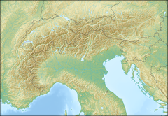
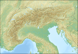
Aiguille Blanche de Peuterey (4112 m n. m.) je hora v Montblanském masivu v Grajských Alpách. Leží v západní Itálii v regionu Valle d'Aosta. Na vrchol lze vystoupit od Bivacco Alberico e Brogna (3679 m), Rifugio Monzino (2590 m), Bivacco Piero Craveri (3490 m) a Bivouac de la Brenva (3060 m).
Hora má tři vrcholky:
- Pointe Güssfeldt (4112 m),
- Pointe Seymour King (4107 m),
- Pointe Jones (4104 m).
Jako první na horu vystoupili 31. července 1885 Henry Seymour King, Emile Rey, Ambros Supersaxo a Aloys Anthamatten.
Reference
V tomto článku byl použit překlad textu z článku Aiguille Blanche de Peuterey na polské Wikipedii.
Externí odkazy
 Obrázky, zvuky či videa k tématu Aiguille Blanche de Peuterey na Wikimedia Commons
Média použitá na této stránce
This is a solid red equilateral triangle, which can symbolize or indicate many things, including the the symbol for fire in the books by Franz Bardon.
Blanche de Peuterey depuis la Pointe Helbronner


