Aiguille de la Grande Sassière
| Aiguille de la Grande Sassière | |
|---|---|
(c) Henk Monster, CC BY 3.0 Aiguille de la Grande Sassière | |
| Vrchol | 3 747 m n. m. |
| Prominence | 792 m |
| Izolace | 11,2 km |
| Poloha | |
| Světadíl | Evropa |
| Stát | |
| Pohoří | Grajské Alpy |
| Souřadnice | 45°30′18″ s. š., 6°59′59″ v. d. |
| Hornina | břidlice |
| Některá data mohou pocházet z datové položky. | |
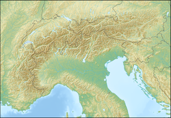
Aiguille de la Grande Sassière je hora v Grajských Alpách. Nachází se na francouzsko-italské hranici, v departementu Savojsko, v regionu Auvergne-Rhône-Alpes, na italské straně leží v regionu Údolí Aosty.[1][2] Aiguille de la Grande Sassière je šestou nejvyšší horou Grajských Alp[3] a náleží mezi nejvyšší vrcholy Itálie a nejvyšší vrcholy Francie s prominencí vyšší než 500 metrů. Hora leží jihozápadně od údolí Val di Rhêmes.[2] Části hor hraničního hřebene jsou zaledněné.[4]
Reference
- ↑ Aiguille de la Grande Sassière, France/Italy [online]. Peakbagger.com, 1987 [cit. 2022-04-16]. Dostupné online. (anglicky)
- ↑ a b Italia. Ostfildern, Stuttgart: Marco Polo, 2017. 168 s. ISBN 978-3-8297--3706-7. S. 32.
- ↑ Graian Alps [online]. Peakbagger.com, 1987 [cit. 2022-04-16]. Dostupné online. (anglicky)
- ↑ IVO, Petr. Francouzské Alpy. 1. vyd. Ostrava: Mirago, 1999. 141 s. ISBN 80-85922-62-2. S. 19.
Externí odkazy
 Obrázky, zvuky či videa k tématu Aiguille de la Grande Sassière na Wikimedia Commons
Média použitá na této stránce
This is a solid red equilateral triangle, which can symbolize or indicate many things, including the the symbol for fire in the books by Franz Bardon.
(c) Henk Monster, CC BY 3.0
The Grande Sassiere 3747 m as seen from the road just beneath le Saut with the ruined houses


