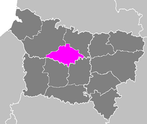
Arrondissement Montdidier
| Arrondissement Montdidier | |
|---|---|
| Geografie | |
| Hlavní město | Montdidier |
| Souřadnice | 49°39′ s. š., 2°34′ v. d. |
| Rozloha | 916,25 km² |
| Geodata (OSM) | OSM, WMF |
| Obyvatelstvo | |
| Počet obyvatel | 54 896 (2009) |
| Hustota zalidnění | 59,9 obyv./km² |
| Správa regionu | |
| Stát | |
| Region | Hauts-de-France |
| Departement | Somme |
| Druh celku | Arrondissement |
| Podřízené celky | Kantony: 4 Obce: 132 |
| Některá data mohou pocházet z datové položky. | |
Arrondissement Montdidier (fr. Arrondissement de Montdidier) je správní územní jednotka ležící v departementu Somme a regionu Hauts-de-France ve Francii. Člení se dále na čtyři kantony a 132 obce.
Kantony
Média použitá na této stránce
Autor: Patricia.fidi, Licence: CC0
"Lion of Flandres appearing", used on the flag of the Belgian Flanders (located partly in the west of Belgium). It is also sometimes used for French Flanders (western department of northern France). Artois and Hainault (adjacent to this area) have different flags, as well as the Nord-Pas-de-Calais)
Maps of arrondissements and cantons of France: Arrondissement de Montdidier.PNG


