Australské státy a teritoria

Australské státy a teritoria spolu tvoří šestou největší zemi světa podle rozlohy. Austrálie se skládá ze šesti států a mnoha teritorií; Pevninská Austrálie je tvořena pěti státy a třemi teritorii (včetně malého Teritoria Jervis Bay), přičemž šestý australský stát – ostrov Tasmánie – leží na jih od mateřské Austrálie. Austrálii ještě patří šest ostrovních, externích, teritorií. Austrálie si také dělá nárok na část Antarktidy (na Australské antarktické území).[p 1]
Všechny státy a dvě teritoria (Severní teritorium a Teritorium hlavního města Austrálie) mají vlastní parlamenty a samosprávu; všechna zbývající teritoria jsou spravovány federální vládou.
Státy a teritoria
 |
| Vlajka | Název celku | ISO kód | Poštovní zkratka | Typ celku | Hlavní město |
|---|---|---|---|---|---|
| Teritorium hlavního města Austrálie | AU-ACT | ACT | Teritorium | Canberra | |
| Teritorium Jervis Bay | JBT | Teritorium | Jervis Bay Village | ||
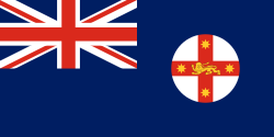
| Nový Jižní Wales | AU-NSW | NSW | Stát | Sydney | |
| Severní teritorium | AU-NT | NT | Teritorium | Darwin | |
| Queensland | AU-QLD | QLD | Stát | Brisbane | |
| Jižní Austrálie | AU-SA | SA | Stát | Adelaide | |
| Tasmánie | AU-TAS | TAS | Stát | Hobart | |
| Viktorie | AU-VIC | VIC | Stát | Melbourne | |
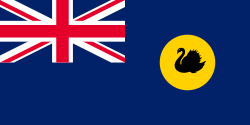
| Západní Austrálie | AU-WA | WA | Stát | Perth |
Vnější teritoria, Antarktida
| Vlajka | Název celku | ISO kód | Správní středisko | Rozloha (km²)[1] | Počet obyvatel[2] |
|---|---|---|---|---|---|
| Ashmorův a Cartierův ostrov | 5 | - | |||
| Vánoční ostrov | CX | Flying Fish Cove | 135 | 2 205 | |
| Kokosové ostrovy | CC | West Island | 14 | 596 | |
| Ostrovy Korálového moře | 3 | - | |||
| Heardův ostrov a McDonaldovy ostrovy | HM | 412 | - | ||
| Norfolk | NF | Kingston | 36 | 2 210 | |
| Australské antarktické území[p 1] | 5 896 500 | pouze vědečtí pracovníci |
Statistické údaje
| Stát / Teritorium | Rozloha (km²)[3] | Počet obyvatel (06/2015)[4] | Hustota zalidnění (obyv./km²) | % obyvatelstva žijícího v metropolitní oblasti hlavního města[5] |
|---|---|---|---|---|
| Teritorium hlavního města Austrálie | 2 358 | 390 800 | 165,73 | 100% |
| Nový Jižní Wales | 800 642 | 7 618 200 | 9,52 | 64,60% |
| Viktorie | 227 416 | 5 938 100 | 26,11 | 76,28% |
| Queensland | 1 730 648 | 4 779 400 | 2,76 | 48,31% |
| Jižní Austrálie | 983 482 | 1 698 600 | 1,73 | 77,52% |
| Západní Austrálie | 2 529 875 | 2 591 600 | 1,02 | 78,68% |
| Tasmanie | 68 401 | 516 600 | 7,55 | 42,78% |
| Severní teritorium | 1 349 129 | 244 600 | 0,18 | 58,18% |
| Teritorium Jervisova zátoka | 72 | 378[p 2] | 5,25 | - |
Odkazy
Poznámky
- ↑ a b Všechny územní nároky na Antarktidu jsou pozastaveny na základě Smlouvy o Antarktidě.
- ↑ Údaj o počtu obyvatel Jervisovy zátoky pochází ze sčítání z roku 2011.
Reference
V tomto článku byl použit překlad textu z článku Štáty a teritóriá Austrálie na slovenské Wikipedii.
- ↑ The World Factbook: COUNTRY COMPARISON :: AREA [online]. Central Intelligence Agency [cit. 2016-12-25]. Dostupné v archivu pořízeném dne 2018-12-26. (anglicky)
- ↑ The World Factbook: COUNTRY COMPARISON :: POPULATION [online]. Central Intelligence Agency [cit. 2016-12-25]. Dostupné v archivu pořízeném dne 2017-12-01. (anglicky)
- ↑ Area of Australia - States and Territories [online]. Australian Government - Geoscience Australia - National Location Information [cit. 2016-12-25]. Dostupné online. (anglicky)
- ↑ 3101.0 - Australian Demographic Statistics, Jun 2015 [online]. Australian Bureau of Statistics [cit. 2016-12-25]. Dostupné online. (anglicky)
- ↑ ESTIMATED RESIDENT POPULATION - Greater Capital City Statistical Areas (GCCSAs) [online]. Australian Bureau of Statistics [cit. 2016-12-25]. Dostupné v archivu pořízeném dne 2016-10-01. (anglicky)
Externí odkazy
 Obrázky, zvuky či videa k tématu Australské státy a teritoria na Wikimedia Commons
Média použitá na této stránce
State flag and government ensign (internal waters only) of Victoria.
Autor:
- Původní dílo: Golbez
- Odvozené dílo: User:Roke~commonswiki
Animation of Australian history. Shows some of the evolution of colonial boundaries, and the evolution of Australia's states and territories.
Flago de la Kokosinsuloj, uzo ne oficiala
State flag and government ensign (internal waters only) of Queensland.
FIAV 110010.svg:
Mapa Austrálie a Oceánie
Autor: user:Dbenbenn, Licence: CC0
The flag of the Australian Capital Territory
It is from openclipart.org, specifically australia_capital_territory.svg by Caleb Moore
Autor: Lasunncty, Licence: CC BY-SA 4.0
Labelled version of Australia states and territories blank.svg.
The flag of the Northern Territory (adopted on July 1, 1978 on the first day of self-government) was designed by the Australian artist Robert Ingpen, of Drysdale Victoria, after consultation with members of the community at the invitation of the Northern Territory Government. The flag incorporates the three official Territorian colours of black, white and ochre and is divided into two panels, black at the hoist side taking up one third the length of the flag while the remainder is equal to two third the length of the flag in ochre. The black panel display the five white stars that form the constellation of the Southern Cross, using the Victorian configuration of the Southern Cross with stars having between five to eight points. The flag also features the official Northern Territory floral emblem on the red ochre panel, a stylisation of the Sturt's Desert Rose, which uses seven petals encircling a seven-pointed black star of the federation in the centre. The seven petals symbolises the six Australian states plus the Northern Territory. The Northern Territory Flag was the first official flag that did not contain the Union Jack.


