Bandar Abbás
| Bandar Abbás بندرعَباس | |
|---|---|
 | |
| Poloha | |
| Souřadnice | 27°11′11″ s. š., 56°16′51″ v. d. |
| Nadmořská výška | 9 m n. m. |
| Časové pásmo | UTC+03:30 |
| Stát | |
| Provincie | Hormozgán |
| Rozloha a obyvatelstvo | |
| Počet obyvatel | 526 648 (2016)[1][2] |
| Etnické složení | Peršané |
| Náboženské složení | Šíité |
| Správa | |
| Oficiální web | bandarabbas |
| Telefonní předvolba | 0761 |
| PSČ | 79177 |
| Některá data mohou pocházet z datové položky. | |
Bandar Abbás (persky بندرعباس) nebo Bandar-e Abbás (persky بندر عباس;) je hlavní město íránské provincie Hormozgán a stejnojmenného okresu. Město se nachází na pobřeží Perského zálivu na strategickém místě Hormuzského průlivu. Patří mezi nejdůležitější íránské mezinárodní přístavy.[3] Je zde také hlavní základna Íránského námořnictva. Žije zde přibližně 527 tisíc[1][2] obyvatel.
Historie
První zmínky o městu pocházejí z dob vlády Dareia I., kdy jeho velitel Silacus, vyrážel z Bandar Abbásu do Indie a Rudého moře. Během Alexandrova dobývání Perské říše se město nazývalo Hormirzad.
Reference
V tomto článku byl použit překlad textu z článku Bandar Abbas na anglické Wikipedii.
- ↑ a b Dostupné online.
- ↑ a b جمعیت به تفکیک تقسیمات کشوری. Dostupné online. [cit. 2023-10-29].
- ↑ Souhrnná teritoriální informace Írán
Externí odkazy
 Obrázky, zvuky či videa k tématu Bandar Abbás na Wikimedia Commons
Média použitá na této stránce
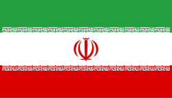
Flag of Iran. The tricolor flag was introduced in 1906, but after the Islamic Revolution of 1979 the Arabic words 'Allahu akbar' ('God is great'), written in the Kufic script of the Qur'an and repeated 22 times, were added to the red and green strips where they border the white central strip and in the middle is the emblem of Iran (which is a stylized Persian alphabet of the Arabic word Allah ("God")).
The official ISIRI standard (translation at FotW) gives two slightly different methods of construction for the flag: a compass-and-straightedge construction used for File:Flag of Iran (official).svg, and a "simplified" construction sheet with rational numbers used for this file.
Autor: Uwe Dedering, Licence: CC BY-SA 3.0
Location map of Iran.
Equirectangular projection. Stretched by 118.0%. Geographic limits of the map:
* N: 40.0° N
* S: 24.5° N
* W: 43.5° E
* E: 64.0° E
Made with Natural Earth. Free vector and raster map data @ naturalearthdata.com.
Autor: Abed, Licence: GFDL
Bandar Abbas, Iran, a view of Taleghani Boulevard.


