Bitva u Mylae
| Bitva u Mylae | |||
|---|---|---|---|
| konflikt: První punská válka | |||
 Bitva u Mylae, J. S. Davis (kolem roku 1900) | |||
| Trvání | 260 př. n. l. | ||
| Místo | pobřežní vody u Mylae, severní pobřeží Sicílie | ||
| Souřadnice | 38°13′ s. š., 15°14′0″ v. d. | ||
| Výsledek | římské vítězství | ||
| Strany | |||
| Velitelé | |||
| |||
| Síla | |||
| |||
| Ztráty | |||
| |||
| Některá data mohou pocházet z datové položky. | |||
Bitva u Mylae byla první námořní bitva v rámci první punské války. Floty Římanů a Kartaginců se v ní roku 260 př. n. l. srazily u severního pobřeží Sicílie, nedaleko Mylae (dnes Milazzo).
Bitva skončila vítězstvím Říma a byla klíčová pro ovládnutí vod kolem Sicílie. Byla také prvním nasazením válečného loďstva Římanů.
Před bitvou

Ačkoliv se po vydrancování Agrigenta Římany přidalo ze strachu z jejich legií mnoho vnitrozemských sicilských měst na římskou stranu, pobřežní města zůstávala pod nadvládou kartaginské floty. Řím dosud nedisponoval námořnictvem, ale v krátkém čase dokázal vybudoval flotu skládající se ze sta kvinkvirém a dvaceti triér.[2] Předlohou jim přitom byla jedna z kartaginských lodí, kterou zajali, když při útoku na Římany plující na Sicílii najela na mělčinu.[3]
Bitva u Mylae se stala pro tuto novou flotu ostrou zkouškou.
Průběh

Aby kompenzovali svou nezkušenost na moři, spolehli se Římané na novinku, jíž byl tzv. havran (corvus), vyloďovací můstek vybavený na spodní straně železným hrotem. Pokaždé, když se kartaginská galéra přiblížila k římskému plavidlu, byl corvus spuštěn tak, že jím byla proražena paluba nepřátelské lodi, římští legionáři se pak přes corvus přesunuli, aby obsadili nepřátelské plavidlo.
Výsledkem bitvy byla šokující porážka punských sil.[4]
Reference
Externí odkazy
 Obrázky, zvuky či videa k tématu Bitva u Mylae na Wikimedia Commons
Literatura
- GRANT, R. G. Bitvy - 5000 let válčení. Překlad Cyril Bumbálek a David Pazdera. Vyd. 1.. vyd. [s.l.]: Knižní klub, 2006. 360 s. ISBN 80-242-1665-5. EAN 9788024216652.
- Polybios. The Histories of Polybius [online]. Překlad William Roger Paton. Volume I. vyd. Loeb Classical Library, 1922-01-01 [cit. 2012-08-08]. Kniha první. Dostupné online. (anglicky)
Média použitá na této stránce
Autor: RedTony, Licence: CC BY 3.0
SVG representation of a Carthaginian Standard, based on Richard Hook's illustrations for Terence Wise's "Armies of the Carthaginian Wars, 265 - 146 BC" 1982 Osprey Publishing, Oxford. Earlier drawings showed a circular figure instead of the disc and crescent, probably because of misinterpretation of the sources.
Autor: No machine-readable author provided. NormanEinstein assumed (based on copyright claims)., Licence: CC BY-SA 3.0
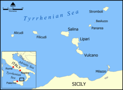
This is a map of the Aeolian Islands off the coast of Sicily, Italy in the Tyrrhenian Sea. The map shows the location of the islands of Salina, Lipari, Vulcano, Alicudi, Filicudi, Panarea, Basiluzzo, and Stromboli. Blank version available at Image:Aeolian Islands blank map.png.
Created by NormanEinstein.Autor:
Ellis, Edward Sylvester, 1840-1916;
Horne, Charles F. (Charles Francis), 1870-1942, Licence: No restrictionsIdentifier: storyofgreatestn02elli (find matches)
Title: The story of the greatest nations, from the dawn of history to the twentieth century : a comprehensive history, founded upon the leading authorities, including a complete chronology of the world, and a pronouncing vocabulary of each nation
Year: 1900 (1900s)
Authors: Ellis, Edward Sylvester, 1840-1916 Horne, Charles F. (Charles Francis), 1870-1942
Subjects: World history
Publisher: New York : F.R. Niglutsch
Contributing Library: University of California Libraries
Digitizing Sponsor: Internet Archive
View Book Page: Book Viewer
About This Book: Catalog Entry
View All Images: All Images From Book
Click here to view book online to see this illustration in context in a browseable online version of this book.
Text Appearing Before Image:
method used is said to have been thatof placing him in a barrel filled with nails projecting inward, and rolling himabout until he died. The best authorities believe this horrible story was aninvention of the Romans to excuse their own atrocities to Carthaginian prison-ers, though it is hardly to be doubted that Regulus actually suffered deathfor his patriotic fortitude. The final victory of the Romans at the ^^gates Islands made them mastersof the situation, and led the Carthaginians to seek peace in B.C. 241. By theterms which closed the first Punic War, the Carthaginians were required toevacuate Sicily and the adjacent islands, to pay a large indemnity, and to recog-nize the independence of Hiero, king of Syracuse. The war had lasted twenty-four years, and, according to Polybius the historian, cost Carthage five hundredand Rome seven hundred galleys; but Rome had gained an immense prestigeand had taken the first step that was to win for her the proud title of Mistressof the World.
Text Appearing After Image:
Rome—Conquest of the Islands 327 It should be noted that that part of Sicily which was wrested from the Car-thaginians was now organized into 2iprovince, this being the commencementof the new system which Rome adopted, of the institution of provincial govern-ment in her possessions outside of Italy. An immense advantage was held byRome over Carthage from the first: <:his lay in the difference of their system orpolicy toward their conquered subjects. The Romans associated them in theirown enterprises on equal terms, not only paying for their services, but sharingthe booty obtained, and allowing them to retain their own laws, customs, andnational identity. The system, in brief, was similar in the main to that whichhas made England the greatest colonizing Power of modern times. But whilethose who fought beside the Romans were her allies, the soldiers of the Car-thaginians were simply servants who risked their lives for wages. As a con-sequence, Carthage soon became involvea in a des
Note About Images
Autor: Chewie, Licence: CC BY-SA 2.5
Schéma de fonctionnement du corbeau ou corvus en latin.


