Chárga
| Chárga الخارجة | |
|---|---|
 Pohled na město Chárga | |
| Poloha | |
| Souřadnice | 25°26′8″ s. š., 30°33′ v. d. |
| Nadmořská výška | 32 m n. m. |
| Časové pásmo | UTC + 2 |
| Stát | |
| Guvernorát | al-Vádí al-Gadíd |
| Rozloha a obyvatelstvo | |
| Rozloha | 440 098 km² |
| Počet obyvatel | 67 700 (2012) |
| Hustota zalidnění | 0,2 obyv./km² |
| Některá data mohou pocházet z datové položky. | |
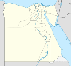
Charga je hlavním městem guvernorátu al-Vádí al-Gadíd. Leží asi 250 km západně od Luxoru. K roku 2012 zde žilo 67 700 obyvatel na celkové ploše 440 098 km².
Externí odkazy
 Obrázky, zvuky či videa k tématu Chárga na Wikimedia Commons
Média použitá na této stránce
Autor: kairoinfo4u (Hanne Siegmeier), Licence: CC BY 2.0
Kharga Oasis in the Libyan desert is the largest oasis known to exist in Western Egypt.
- It is located about 200 kilometres west of the Nile Valley.
- Kharga Oasis is also well known for featuring the well preserved Temple of Hibis--which was first built by pharaoh Psamtik II of the 26th Saite dynasty and subsequently decorated by the Persian king Darius I--as well as the 3rd to 7th century AD Christian cemetary of El-Bagawat. El-Bagawat is one of the earliest known Christian cemetaries in the world.
Coat of arms of Egypt -- standard pan-Arab "Eagle of Saladin" with shield of vertical tricolor of the national flag, holding a scroll with the words جمهورية مصر العربية (Jumhuriyat Misr al-`Arabiya or "Arab Republic of Egypt").


