Chorásán Razaví
| Chorásán-e Razaví | |
|---|---|
| Geografie | |
| Hlavní město | Mašhad |
| Souřadnice | 36°17′53″ s. š., 59°36′21″ v. d. |
| Rozloha | 118 884 km² |
| Časové pásmo | +3:30 |
| Geodata (OSM) | OSM, WMF |
| Obyvatelstvo | |
| Počet obyvatel | 6 434 501[1] (2016) |
| Jazyk | Perština |
| Náboženství | Islám |
| Správa regionu | |
| Stát | |
| Nadřazený celek | Írán |
| Druh celku | provincie |
| Podřízené celky | 33 krajů |
| guvernér | Yaghob-Ali Nazari |
| Mezinárodní identifikace | |
| ISO 3166-2 | IR-09 |
| Některá data mohou pocházet z datové položky. | |
Chorásán Razaví ( persky استان خراسان رضوی ) je provincie na severovýchodě Íránu. Jejím centrem je druhé největší město Íránu Mašhad. Rozloha je 144 681 km² a v roce 2006 zde žilo 5 593 079 obyvatel. Provincie vznikla v roce 2004 administrativním rozdělením provincie Chorásán na Chorásán Razaví, Severní Chorásán a Jižní Chorásán.
Reference
- ↑ Statistical Centre of Iran, 2016 [cit. 2022-12-23]. Dostupné online. (anglicky)
Související články
Externí odkazy
 Obrázky, zvuky či videa k tématu Chorásán Razaví na Wikimedia Commons
Média použitá na této stránce
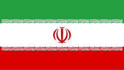
Flag of Iran. The tricolor flag was introduced in 1906, but after the Islamic Revolution of 1979 the Arabic words 'Allahu akbar' ('God is great'), written in the Kufic script of the Qur'an and repeated 22 times, were added to the red and green strips where they border the white central strip and in the middle is the emblem of Iran (which is a stylized Persian alphabet of the Arabic word Allah ("God")).
The official ISIRI standard (translation at FotW) gives two slightly different methods of construction for the flag: a compass-and-straightedge construction used for File:Flag of Iran (official).svg, and a "simplified" construction sheet with rational numbers used for this file.
(c) Iahsan from en.wikipedia.org, CC BY-SA 3.0
Author: IA Source: Taken at the shrine of Imam Ali Reda in Mashad, Iran, in August, 2005.
Autor: Дмитрий-5-Аверин, Licence: CC BY-SA 3.0
Flag-map of Iran (tricolour)


