Dálnice v Nizozemsku
Celková délka dálnic v Nizozemsku je 3 530 km, síť dálnic je tedy velmi rozvinutá a jedna z nejhustších na světě. Nejvyšší povolená rychlost na dálnicích je pro osobní automobily 130 km/h. Dálniční poplatky v Nizozemsku neexistují, zpoplatněn je pouze tunel Westerscheldetunnel a to prostřednictvím mýta.
Historie výstavby dálnic
Historicky první holandský dálniční úsek byl otevřen v roce 1936 nedaleko Haagu. (Dnes se jedná o dálnici A12). V 60. a 70. letech minulého století rychlost výstavby dalších dálnic raketově stoupla, později, v 80. letech však zpomalila. Dnes má Nizozemí jednu z nejhustších dálničních sítí na světě.
Seznam dálnic
Dálnice jsou v Nizozemsku označovány písmenem A (autosnelwegen – nizozemsky dálnice).
| Číslo dálnice | Mapa | Trasa | Konečná délka | V provozu |
|---|---|---|---|---|
 |  | Amsterdam – Hilversum – Amersfoort – Apeldoorn – Deventer – Hengelo – | 98 km | 98 km |
 |  | Amsterdam – Utrecht – 's-Hertogenbosch – Eindhoven – Weert – Geleen – Maastricht – | 135 km | 135 km |
 |  | Amsterdam – Schiphol Heijningen – Bergen op Zoom – | 130 km | 130 km |
 | 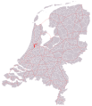 | Amsterdam – Hoofddorp | 17 km | 17 km |
 |  | (A1) – Almere – Lelystad – Emmeloord – Joure | 101 km | 101 km |
 |  | Zaanstad – Purmerend – Hoorn – Afsluitdijk – Sneek – Heerenveen – Drachten – Groningen – Hoogezand – Winschoten – Bad Nieuweschans – | 242 km | 242 km |
 |  | Amsterdam – Zaanstad | 10 km | 10 km |
 |  | (A1) – Amsterdam – Amstelveen – Badhoeverdorp – Haarlem – Baverwijk – Alkmaar | 96 km | 96 km |
 |  | Amsterdamský okruh | 32 km | 32 km |
 | 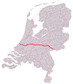 | Den Haag – Zoetermeer – Gouda – Utrecht – Ede – Arnhem – Zavenaar – | 137 km | 137 km |
 |  | Den Haag – Rotterdam | 17 km | 17 km |
  |  | Rotterdam – Dordrecht – Gorinchem – Tiel – Nijmegen | 204 km | 204 km |
 | 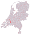 | Rotterdam – Dordrecht – Breda – | 58 km | 58 km |
 | 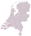 | Moerdijk – Roosendaal | 27 km | 27 km |
 |  | Gouda – Rotterdam – Vlaardingen – Maassluis | 39 km | 39 km |
 |  | Velsen – Baverwijk | 8 km | 8 km |
 |  | Breda – Gorinchem – Utrecht – Hilversum – Huizen – Almere | 109 km | 109 km |
 |  | Utrecht – Amersfoort – Harderwijk – Zwolle – Meppel – Hoogeveen – Assen – Groningen | 187 km | 187 km |
 |  | Rotterdam – Dinteloord | 26 km | 26 km |
 | 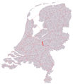 | Barneveld – Ede | 18 km | 18 km |
 | 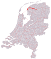 | Harlingen – Leeuwarden | 67 km | 67 km |
 |  | Meppel – Steenwijk – Heerenveen – Akkrum – Leeuwarden | 66 km | 66 km |
 |  | Wierden – Almelo – Hengelo – Enschede – | 76 km | 76 km |
 |  | Zwartemeer – Emmen – Hoogeveen – | 42 km | 42 km |
 | Spojka dálnic A15 a A16 v Ridderkerku | 1,5 km | 1,5 km | |
 |  | Wassenaar – Leiden – Nieuw Vennep | 28 km | 28 km |
 |  | Eindhoven – Oss – Wijchen – Arnhem – Apeldoorn – Zwolle | 160 km | 160 km |
 |  | Eindhoven – Tilburg – Breda – Roosendaal – Bergen op Zoom – Goes – Middelburg – Vlissingen | 140 km | 140 km |
 | 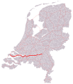 | Willemstad – Moerdijk – Waalwijk – 's-Hertogenbosch – Oss | 121 km | 121 km |
 |  | Tilburg – Berkel-Enschot | 22 km | 22 km |
 | 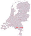 | 78 km | 78 km | |
 |  | (A50) Nijmegen – Venlo – Roermond – (A2) | 106 km | 106 km |
 | 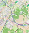 | Venlo – | 2 km | 2 km |
 | 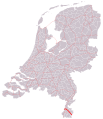 | 27 km | 27 km | |
 |  | Boxmeer – | 10 km | 10 km |
 |  | Maastricht – Heerlen | 19 km | 19 km |
 |  | Zwanenburg – Haarlem | 12 km | 12 km |
 |  | Haarlemská spojka | 1,5 km | 1,5 km |
 |  | Goeská spojka | ||
 |  | Eindhoven – Helmond | ||
 |  | Arnhem – Nijmegen | ||
 |  | Wijchen – Nijmegen | ||
 |  | Arnhem – Dieren |
Zajímavosti
- Nizozemsko se chce do roku 2025 zbavit všech benzinových a dieselových vozidel. Už teď provozuje stát hustou síť dobíjecích stanic pro elektrická auta po celé zemi. Do roku 2018 by mělo být těchto stanic celkem 4 000.[zdroj?]
- Nizozemsko má velmi hustou síť ekoduktů, tedy přírodních přechodů pro zvířata nad silnicemi či dálnicemi. V roce 2014 byl např. otevřen v Haagu most pro veverky nad rušnou silnicí, který stál v přepočtu 4 miliony korun. Stal se ale předmětem kritiky, protože ho za 4 roky svého fungování použilo pouze pět veverek.[zdroj?]
Externí odkazy
 Obrázky, zvuky či videa k tématu Dálnice v Nizozemsku na Wikimedia Commons
Média použitá na této stránce
This is the national flag of Belgium, according to the Official Guide to Belgian Protocol. It has a 13:15 aspect ratio, though it is rarely seen in this ratio.
Its colours are defined as Pantone black, Pantone yellow 115, and Pantone red 032; also given as CMYK 0,0,0,100; 0,8.5,79,0; and 0,94,87,0.Sign of A9 in the Netherlands
Sign of A44 in the Netherlands
Sign of A20 in the Netherlands
Sign of A208 in the Netherlands
Sign of A5 in the Netherlands
Sign of A38 in the Netherlands
Sign of A50 in the Netherlands
Sign of A7 in the Netherlands
Sign of A18 in the Netherlands
Sign of A59 in the Netherlands
Sign of A15 in the Netherlands
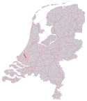
Autor: Dre Odz, based on File:Nederland gemeenten 2009.svg by Mtcv and File:Rijkswegen.svg by Erwin85, Licence: CC BY-SA 3.0
Map of Gelderland with Dutch provincial road no. 326
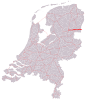
Autor: Dre Odz, based on File:Nederland gemeenten 2009.svg by Mtcv and File:Rijkswegen.svg by Erwin85, Licence: CC BY-SA 3.0
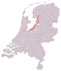
Map of Overijssel and Gelderland with Dutch provincial road no. 348
Sign of A4 in the Netherlands
Autor: Antoine , Licence: CC BY-SA 3.0
Concrete supports for mega bridge over the A27 motorway to Utrecht in the Netherlands
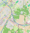
Autor: TheM_NL, and contributers http://www.openstreetmap.org/, Licence: CC BY-SA 3.0
Kaart Rijksweg 74
Sign of A22 in the Netherlands
Sign of A348 in the Netherlands
Sign of A270 in the Netherlands
Netherlands road sign K1 - Low level motorway information sign showing both main and intermediary destinations and the motorway number
Sign of A67 in the Netherlands
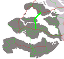
Autor: Dre Odz, based on File:Nederland gemeenten 2009.svg by Mtcv and File:Rijkswegen.svg by Erwin85, Licence: CC BY-SA 3.0
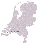
Map of Zeeland with Dutch provincial road no. 256
Sign of A256 in the Netherlands
Sign of A13 in the Netherlands
Sign of A2 in the Netherlands
Sign of A35 in the Netherlands
Sign of A8 in the Netherlands
Sign of A10 in the Netherlands
Sign of A74 in the Netherlands
Sign of A1 in the Netherlands
Sign of A326 in the Netherlands
Sign of A79 in the Netherlands
Sign of A12 in the Netherlands
Sign of A73 in the Netherlands
Sign of A6 in the Netherlands
Autor: Dre Odz, based on File:Nederland gemeenten 2009.svg by Mtcv and File:Rijkswegen.svg by Erwin85, Licence: CC BY-SA 3.0
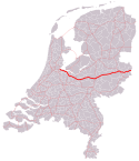
Map of Gelderland with Dutch provincial road no. 325
Autor: Michiel1972, Licence: CC BY-SA 3.0
A38, shortest motorway of the Netherlands
Sign of A58 in the Netherlands
Sign of A32 in the Netherlands
Autor: Dre Odz, based on File:Nederland gemeenten 2009.svg by Mtcv and File:Rijkswegen.svg by Erwin85, Licence: CC BY-SA 3.0
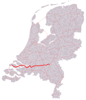
Map of Limburg and Noord-Brabant with Dutch provincial road no. 270
Air Transportation Symbol (schwarz auf weiß)
Sign of A31 in the Netherlands
Sign of A200 in the Netherlands
Autor: T Houdijk, Licence: CC-BY-SA-3.0
Map of highways in the Netherlands
Sign of A65 in the Netherlands
Sign of A27 in the Netherlands
Sign of A29 in the Netherlands
Sign of A325 in the Netherlands
Sign of A37 in the Netherlands
Sign of A76 in the Netherlands
Sign of A77 in the Netherlands
Sign of A30 in the Netherlands
Sign of A17 in the Netherlands
Sign of A28 in the Netherlands
Sign of A16 in the Netherlands


