Dálnice ve Spojeném království
Celková délka dálnic ve Spojeném království činí 3 218 km. Nejvyšší povolená rychlost na dálnicích je pro osobní automobily 112 km/h. Většina dálnic není zpoplatněna, zpoplatněny jsou pouze některé úseky, mosty, tunely, či vjezdy do velkých měst, kde funguje mýtný systém.
Historie výstavby dálnic

První dálniční úsek na území Spojeného království byl zprovozněn v roce 1958 (nyní je součástí dálnice M6). Následovala výstavba dnešní dálnice M1. V roce 1979 byl Konzervativní vládou Margaret Thatcherové přijat rozsáhlý program, který počítal s výstavbou 500 dalších úseků a zefektivnění dopravy do roku 2025 o 142%. V roce 1996 dosáhla síť dálnic 2000 km. Po nástupu nové vlády byla v roce 1997 většina zbývajících plánů předložené vládou Margaret Thatcherové zrušena. Roku 2002 byl přijat nový návrh který počítal s výstavbou 580 km dalších dálnic a více než 100 silničních obchvatů měst. V roce 2007 byl parlamentu předložen Zákon o plánování, který měl urychlit schvalování a výstavbu dalších dálnic, objevily se však obavy o narušení demokracie. V současnosti dálniční síť dosahuje délky více než 3200 km.
Seznam dálnic
Dálnice jsou ve Spojeném království označovány písmenem M (motorway - anglicky dálnice)


Velká Británie
| Číslo dálnice | Mapa | Trasa | Konečná délka | V provozu |
|---|---|---|---|---|
_map.svg) Nilfanion and Dr Greg. © OpenStreetMap contributors. Contains Ordnance Survey data © Crown copyright and database right 2010., CC BY-SA 4.0 | Londýn - Leicester - Nottingham - Chesterfield - Sheffield - Leeds | 311,5 km | 311,5 km | |
_map.svg) Nilfanion and Dr Greg. © OpenStreetMap contributors. Contains Ordnance Survey data © Crown copyright and database right 2010., CC BY-SA 4.0 | Strood - Rochester - Faversham | 41,5 km | 41,5 km | |
_map.svg) Nilfanion and Dr Greg. © OpenStreetMap contributors. Contains Ordnance Survey data © Crown copyright and database right 2010., CC BY-SA 4.0 | Londýn - Winchester - Southampton | 94 km | 94 km | |
_map.svg) Nilfanion and Dr Greg. © OpenStreetMap contributors. Contains Ordnance Survey data © Crown copyright and database right 2010., CC BY-SA 4.0 | Londýn - Heathrow | 304 km | 304 km | |
_map.svg) Nilfanion and Dr Greg. © OpenStreetMap contributors. Contains Ordnance Survey data © Crown copyright and database right 2010., CC BY-SA 4.0 | West Bromwich - Birmingham - Worchester - Bristol - Exeter | 262 km | 262 km | |
_map.svg) Nilfanion and Dr Greg. © OpenStreetMap contributors. Contains Ordnance Survey data © Crown copyright and database right 2010., CC BY-SA 4.0 | Rugby (M1) - Birmingham - Stafford - Carlisle (M74) | 373,5 km | 373,5 km | |
_map.svg) Nilfanion and Dr Greg. © OpenStreetMap contributors. Contains Ordnance Survey data © Crown copyright and database right 2010., CC BY-SA 4.0 | Cannock (M6) - Burntwood | 43 km | 43 km | |
_map.svg) Nilfanion and Dr Greg. © OpenStreetMap contributors. Contains Ordnance Survey data © Crown copyright and database right 2010., CC BY-SA 4.0 | Edinburgh - Livingston - Glasgow - Greenock | 97 km | 97 km | |
_map.svg) Nilfanion and Dr Greg. © OpenStreetMap contributors. Contains Ordnance Survey data © Crown copyright and database right 2010., CC BY-SA 4.0 | Edinburgh (M8) - Stirling | 53 km | 53 km | |
_map.svg) Nilfanion and Dr Greg. © OpenStreetMap contributors. Contains Ordnance Survey data © Crown copyright and database right 2010., CC BY-SA 4.0 | Londýn - Cambridge - Harlow - Loughton | 88,5 km | 88,5 km | |
_map.svg) Nilfanion and Dr Greg. © OpenStreetMap contributors. Contains Ordnance Survey data © Crown copyright and database right 2010., CC BY-SA 4.0 | Sheffield (M1) - Leeds (M62) | 42,5 km | 42,5 km | |
_map.svg) Nilfanion and Dr Greg. © OpenStreetMap contributors. Contains Ordnance Survey data © Crown copyright and database right 2010., CC BY-SA 4.0 | (M25) Maidstone - Ashford - Eurotunel | 81,5 km | 81,5 km | |
_map.svg) Nilfanion and Dr Greg. © OpenStreetMap contributors. Contains Ordnance Survey data © Crown copyright and database right 2010., CC BY-SA 4.0 | (M25) Londýn - Crawley | 25,5 km | 25,5 km | |
_map.svg) Nilfanion and Dr Greg. © OpenStreetMap contributors. Contains Ordnance Survey data © Crown copyright and database right 2010., CC BY-SA 4.0 | Londýnský okruh | 188 km | 188 km | |
 | Severnoaks - Maidstone | 16 km | 16 km | |
_map.svg) Nilfanion and Dr Greg. © OpenStreetMap contributors. Contains Ordnance Survey data © Crown copyright and database right 2010., CC BY-SA 4.0 | Southampton - Portsmouth | 40 km | 40 km | |
 | Bristolská spojka | 7 km | 7 km | |
_map.svg) Nilfanion and Dr Greg. © OpenStreetMap contributors. Contains Ordnance Survey data © Crown copyright and database right 2010., CC BY-SA 4.0 | Londýn - Oxford- Warwick - Birmingham | 143 km | 143 km | |
_map.svg) Nilfanion and Dr Greg. © OpenStreetMap contributors. Contains Ordnance Survey data © Crown copyright and database right 2010., CC BY-SA 4.0 | Birmingham - Appleby Magna | 64,5 km | 64,5 km | |
| Rugby - Coventry | 12,5 km | 12,5 km | ||
| Awkley - Undy (Přípojka M4) | 19 km | 19 km | ||
| Spojka dálnic M4 a M5 v Bristolu | 8 km | 8 km | ||
_map.svg) Nilfanion and Dr Greg. © OpenStreetMap contributors. Contains Ordnance Survey data © Crown copyright and database right 2010., CC BY-SA 4.0 | Tawkesbury (M5) - Ross-on-Wye | 35 km | 35 km | |
_map.svg) Nilfanion and Dr Greg. © OpenStreetMap contributors. Contains Ordnance Survey data © Crown copyright and database right 2010., CC BY-SA 4.0 | Wallasey - Chester | 30,5 km | 30,5 km | |
_map.svg) Nilfanion and Dr Greg. © OpenStreetMap contributors. Contains Ordnance Survey data © Crown copyright and database right 2010., CC BY-SA 4.0 | Wolverhampton (M6) - Telford | 37 km | 37 km | |
_map.svg) Nilfanion and Dr Greg. © OpenStreetMap contributors. Contains Ordnance Survey data © Crown copyright and database right 2010., CC BY-SA 4.0 | Preston (M6) - Blackpool | 19,5 km | 19,5 km | |
_map.svg) Nilfanion and Dr Greg. © OpenStreetMap contributors. Contains Ordnance Survey data © Crown copyright and database right 2010., CC BY-SA 4.0 | Manchester - Chester | 53,5 km | 53,5 km | |
| Liverpool (M62) - Switch Island | 16 km | 16 km | ||
| Switch Island - Orrell | 19 km | 19 km | ||
_map.svg) Nilfanion and Dr Greg. © OpenStreetMap contributors. Contains Ordnance Survey data © Crown copyright and database right 2010., CC BY-SA 4.0 | Manchesterský okruh | 58 km | 58 km | |
_map.svg) Nilfanion and Dr Greg. © OpenStreetMap contributors. Contains Ordnance Survey data © Crown copyright and database right 2010., CC BY-SA 4.0 | Manchester - Bamber Bridge | 32 km | 32 km | |
Nilfanion and Dr Greg. © OpenStreetMap contributors. Contains Ordnance Survey data © Crown copyright and database right 2010., CC BY-SA 4.0 | Liverpool - Manchester - Oldham - Leeds - Kingston upon Hull | 172 km | 172 km | |
_map.svg) Nilfanion and Dr Greg. © OpenStreetMap contributors. Contains Ordnance Survey data © Crown copyright and database right 2010., CC BY-SA 4.0 | Bamber Bridge - Preston | 41,5 km | 41,5 km | |
| Ramsbottom - Whitefield (M60) | 13 km | 13 km | ||
 | Manchester (M60) - Hattersley | 8 km | 8 km | |
_map.svg) Nilfanion and Dr Greg. © OpenStreetMap contributors. Contains Ordnance Survey data © Crown copyright and database right 2010., CC BY-SA 4.0 | Coventry - Leicester | 25 km | 25 km | |
| Uddingston (M74) - Cumbernauld (M80) | 11 km | 11 km | ||
_map.svg) Nilfanion and Dr Greg. © OpenStreetMap contributors. Contains Ordnance Survey data © Crown copyright and database right 2010., CC BY-SA 4.0 | Glasgow - Abington | 60 km | 60 km | |
_map.svg) Nilfanion and Dr Greg. © OpenStreetMap contributors. Contains Ordnance Survey data © Crown copyright and database right 2010., CC BY-SA 4.0 | Glasgow (M8) - Fenwick | 32 km | 32 km | |
_map.svg) Nilfanion and Dr Greg. © OpenStreetMap contributors. Contains Ordnance Survey data © Crown copyright and database right 2010., CC BY-SA 4.0 | Glasgow (M8) - Stirling (M9) | 40 km | 40 km | |
_map.svg) Nilfanion and Dr Greg. © OpenStreetMap contributors. Contains Ordnance Survey data © Crown copyright and database right 2010., CC BY-SA 4.0 | Inverkeithing - Perth | 48 km | 48 km | |
_map.svg) Nilfanion and Dr Greg. © OpenStreetMap contributors. Contains Ordnance Survey data © Crown copyright and database right 2010., CC BY-SA 4.0 | Thorne (M18) - Humber Bridge (M15) | 40 km | 40 km | |
| M180 - Scunthorpe | 3 km | 3 km | ||
| Romsey (M27) - Southampton | 5 km | 5 km | ||
| Horsea Island (M27) - Portsmouth | 3 km | 3 km | ||
| Winton (M62) - Manchester | 6,5 km | 6,5 km | ||
| Cleckheaton, přípojka z dálnice M62 | 5 km | 5 km | ||
| Gildersome (M62) - Leeds - Rothwell (M1) | 12,5 km | 12,5 km | ||
| Denny (M80) - Kincardine Bridge | 13 km | 13 km | ||
| Rosyth, spojka dálnic M90 a M823 | 1 km | 1 km |
Severní Irsko

| Číslo dálnice | Obrázek | Trasa | Konečná délka | V provozu |
|---|---|---|---|---|
_map.svg) Nilfanion and Dr Greg. © OpenStreetMap contributors. Contains Ordnance Survey data © Crown copyright and database right 2010., CC BY-SA 4.0 | Belfast - Dungannon | 61 km | 61 km | |
_map.svg) Nilfanion and Dr Greg. © OpenStreetMap contributors. Contains Ordnance Survey data © Crown copyright and database right 2010., CC BY-SA 4.0 | Dva úseky: Belfast - Antrim a obchvat města Ballymena. Úsek mezi nimi (? km) plánovaný | ? km | 35,5 km | |
| Přípojka M2 v Belfastu | 1 km | 1 km | ||
| Belfast (M2) - Newtownabbey | 2 km | 2 km | ||
| Derrymacash (M1) - Portadown | 2,5 km | 2,5 km | ||
| Atrim (M2) - Randalstown | 9 km | 9 km |
Externí odkazy
 Obrázky, zvuky či videa k tématu Dálnice ve Spojeném království na Wikimedia Commons
Média použitá na této stránce


Motorway badge for the M90 motorway
Autor:

Motorway badge for the M621 motorway

Motorway badge for the M3 motorway
Nilfanion and Dr Greg. © OpenStreetMap contributors. Contains Ordnance Survey data © Crown copyright and database right 2010., CC BY-SA 4.0
The M2 motorway of Northern Ireland highlighted against the motorways of the United Kingdom in 2016. Equirectangular map projection on WGS 84 datum.

Motorway badge for the M62 motorway

Motorway badge for the M25 motorway
Nilfanion and Dr Greg. © OpenStreetMap contributors. Contains Ordnance Survey data © Crown copyright and database right 2010., CC BY-SA 4.0
The M60 motorway of Great Britain highlighted against the motorways of the United Kingdom in 2016. Equirectangular map projection on WGS 84 datum.
Nilfanion and Dr Greg. © OpenStreetMap contributors. Contains Ordnance Survey data © Crown copyright and database right 2010., CC BY-SA 4.0
The M8 motorway of Great Britain highlighted against the motorways of the United Kingdom in 2016. Equirectangular map projection on WGS 84 datum.

Motorway badge for the M54 motorway
(c) Chris Shaw, CC BY-SA 2.0
M4 River Neath Crossing (left) and the previous A48(M) motorway, now the A48 road (right)
Nilfanion and Dr Greg. © OpenStreetMap contributors. Contains Ordnance Survey data © Crown copyright and database right 2010., CC BY-SA 4.0
The M80 motorway of Great Britain highlighted against the motorways of the United Kingdom in 2016. Equirectangular map projection on WGS 84 datum.
Nilfanion and Dr Greg. © OpenStreetMap contributors. Contains Ordnance Survey data © Crown copyright and database right 2010., CC BY-SA 4.0
The M18 motorway of Great Britain highlighted against the motorways of the United Kingdom in 2016. Equirectangular map projection on WGS 84 datum.
Autor: [British] Department forTransport, Licence: OGL v1.0
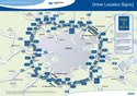
Map of the M25 showing driver location signs
Nilfanion and Dr Greg. © OpenStreetMap contributors. Contains Ordnance Survey data © Crown copyright and database right 2010., CC BY-SA 4.0
The M11 motorway of Great Britain highlighted against the motorways of the United Kingdom in 2016. Equirectangular map projection on WGS 84 datum.

Motorway badge for the M271 motorway
Nilfanion and Dr Greg. © OpenStreetMap contributors. Contains Ordnance Survey data © Crown copyright and database right 2010., CC BY-SA 4.0
Map of the M42 motorway of Great Britain highlighted against the motorways of the United Kingdom in 2016. Equirectangular map projection on WGS 84 datum.

Motorway badge for the M48 motorway
Nilfanion and Dr Greg. © OpenStreetMap contributors. Contains Ordnance Survey data © Crown copyright and database right 2010., CC BY-SA 4.0
The M4 motorway of Great Britain highlighted against the motorways of the United Kingdom in 2016. Equirectangular map projection on WGS 84 datum.

Motorway badge for the M69 motorway

Motorway badge for the M5 motorway

Motorway badge for the M180 motorway
Nilfanion and Dr Greg. © OpenStreetMap contributors. Contains Ordnance Survey data © Crown copyright and database right 2010., CC BY-SA 4.0
The M77 motorway of Great Britain highlighted against the motorways of the United Kingdom in 2016. Equirectangular map projection on WGS 84 datum.
Nilfanion and Dr Greg. © OpenStreetMap contributors. Contains Ordnance Survey data © Crown copyright and database right 2010., CC BY-SA 4.0
Map of the M55 motorway of Great Britain highlighted against the motorways of the United Kingdom in 2016. Equirectangular map projection on WGS 84 datum.

Motorway badge for the M67 motorway
Nilfanion and Dr Greg. © OpenStreetMap contributors. Contains Ordnance Survey data © Crown copyright and database right 2010., CC BY-SA 4.0
The M2 motorway of Great Britain highlighted against the motorways of the United Kingdom in 2016. Equirectangular map projection on WGS 84 datum.
Autor: Klaus with K, Licence: CC BY-SA 3.0
Motorway M1 in Yorkshire south of Leeds.
Nilfanion and Dr Greg. © OpenStreetMap contributors. Contains Ordnance Survey data © Crown copyright and database right 2010., CC BY-SA 4.0
Map of the M53 motorway of Great Britain highlighted against the motorways of the United Kingdom in 2016. Equirectangular map projection on WGS 84 datum.
Nilfanion and Dr Greg. © OpenStreetMap contributors. Contains Ordnance Survey data © Crown copyright and database right 2010., CC BY-SA 4.0
The M6 motorway of Great Britain highlighted against the motorways of the United Kingdom in 2016. Equirectangular map projection on WGS 84 datum.
Nilfanion and Dr Greg. © OpenStreetMap contributors. Contains Ordnance Survey data © Crown copyright and database right 2010., CC BY-SA 4.0
Map of the M61 motorway of Great Britain highlighted against the motorways of the United Kingdom in 2016. Equirectangular map projection on WGS 84 datum.

Motorway badge for the M4 motorway
Nilfanion and Dr Greg. © OpenStreetMap contributors. Contains Ordnance Survey data © Crown copyright and database right 2010., CC BY-SA 4.0
Map of the M40 motorway of Great Britain highlighted against the motorways of the United Kingdom in 2016. Equirectangular map projection on WGS 84 datum.
(c) Mat Fascione, CC BY-SA 2.0
M1 Motorway Looking south from the Stoney Lane Motorway Bridge.

Motorway badge for the M12 motorway
Nilfanion and Dr Greg. © OpenStreetMap contributors. Contains Ordnance Survey data © Crown copyright and database right 2010., CC BY-SA 4.0
The M180 motorway of Great Britain highlighted against the motorways of the United Kingdom in 2016. Equirectangular map projection on WGS 84 datum.
Nilfanion and Dr Greg. © OpenStreetMap contributors. Contains Ordnance Survey data © Crown copyright and database right 2010., CC BY-SA 4.0
Map of the M27 motorway of Great Britain highlighted against the motorways of the United Kingdom in 2016. Equirectangular map projection on WGS 84 datum.

Motorway badge for the M61 motorway

Motorway badge for the M32 motorway
Nilfanion and Dr Greg. © OpenStreetMap contributors. Contains Ordnance Survey data © Crown copyright and database right 2010., CC BY-SA 4.0
The M3 motorway of Great Britain highlighted against the motorways of the United Kingdom in 2016. Equirectangular map projection on WGS 84 datum.
Nilfanion and Dr Greg. © OpenStreetMap contributors. Contains Ordnance Survey data © Crown copyright and database right 2010., CC BY-SA 4.0
The M9 motorway of Great Britain highlighted against the motorways of the United Kingdom in 2016. Equirectangular map projection on WGS 84 datum.

Motorway badge for the M275 motorway
Nilfanion and Dr Greg. © OpenStreetMap contributors. Contains Ordnance Survey data © Crown copyright and database right 2010., CC BY-SA 4.0
Map of the motorways of the United Kingdom in 2016. The shortest motorways are not labelled. Motorways in Northern Ireland are numbered independently from motorways in Great Britain.
Equirectangular map projection on WGS 84 datum.
- Key
Nilfanion and Dr Greg. © OpenStreetMap contributors. Contains Ordnance Survey data © Crown copyright and database right 2010., CC BY-SA 4.0
The M90 motorway of Great Britain highlighted against the motorways of the United Kingdom in 2016. Equirectangular map projection on WGS 84 datum.

Motorway badge for the M55 motorway
Nilfanion and Dr Greg. © OpenStreetMap contributors. Contains Ordnance Survey data © Crown copyright and database right 2010., CC BY-SA 4.0
The M25 motorway of Great Britain highlighted against the motorways of the United Kingdom in 2016. Equirectangular map projection on WGS 84 datum.
Nilfanion and Dr Greg. © OpenStreetMap contributors. Contains Ordnance Survey data © Crown copyright and database right 2010., CC BY-SA 4.0
The M74 motorway of Great Britain highlighted against the motorways of the United Kingdom in 2016. Equirectangular map projection on WGS 84 datum.
Nilfanion and Dr Greg. © OpenStreetMap contributors. Contains Ordnance Survey data © Crown copyright and database right 2010., CC BY-SA 4.0
The M20 motorway of Great Britain highlighted against the motorways of the United Kingdom in 2016. Equirectangular map projection on WGS 84 datum.

Motorway badge for the M9 motorway

Motorway badge for the M60 motorway

Motorway badge for the M23 motorway

Motorway badge for the M2 motorway
Nilfanion and Dr Greg. © OpenStreetMap contributors. Contains Ordnance Survey data © Crown copyright and database right 2010., CC BY-SA 4.0
Map of the M65 motorway of Great Britain highlighted against the motorways of the United Kingdom in 2016. Equirectangular map projection on WGS 84 datum.
Nilfanion and Dr Greg. © OpenStreetMap contributors. Contains Ordnance Survey data © Crown copyright and database right 2010., CC BY-SA 4.0
The M6 Toll motorway of Great Britain highlighted against the motorways of the United Kingdom in 2016. Equirectangular map projection on WGS 84 datum.
(c) HENRY CLARK, CC BY-SA 2.0
M1 Motorway Taken from Charlestown Bridge looking east towards Belfast close to J11 M12
Nilfanion and Dr Greg. © OpenStreetMap contributors. Contains Ordnance Survey data © Crown copyright and database right 2010., CC BY-SA 4.0
Map of the M69 motorway of Great Britain highlighted against the motorways of the United Kingdom in 2016. Equirectangular map projection on WGS 84 datum.

Motorway badge for the M45 motorway

Motorway badge for the M49 motorway

Motorway badge for the M18 motorway

Motorway badge for the M8 motorway
Nilfanion and Dr Greg. © OpenStreetMap contributors. Contains Ordnance Survey data © Crown copyright and database right 2010., CC BY-SA 4.0
The M1 motorway of Great Britain highlighted against the motorways of the United Kingdom in 2016. Equirectangular map projection on WGS 84 datum.

Motorway badge for the M876 motorway

Motorway badge for the M56 motorway

Motorway badge for the M40 motorway

Motorway badge for the M1 motorway

Motorway badge for the M898 motorway

Motorway badge for the M50 motorway
Air Transportation Symbol (schwarz auf weiß)

Motorway badge for the M181 motorway

Motorway badge for the M66 motorway
Nilfanion and Dr Greg. © OpenStreetMap contributors. Contains Ordnance Survey data © Crown copyright and database right 2010., CC BY-SA 4.0
The M23 motorway of Great Britain highlighted against the motorways of the United Kingdom in 2016. Equirectangular map projection on WGS 84 datum.

Motorway badge for the M77 motorway
(c) Mat Fascione, CC BY-SA 2.0
The busy M1 motorway. In the distance is Leicester Forest East Services.

Motorway badge for the M42 motorway

Motorway badge for the M11 motorway

Motorway badge for the M74 motorway

Motorway badge for the M6 Toll motorway

Motorway badge for the M22 motorway

Motorway badge for the M53 motorway

Motorway badge for the M57 motorway

Motorway badge for the M20 motorway
Nilfanion and Dr Greg. © OpenStreetMap contributors. Contains Ordnance Survey data © Crown copyright and database right 2010., CC BY-SA 4.0
Map of the M54 motorway of Great Britain highlighted against the motorways of the United Kingdom in 2016. Equirectangular map projection on WGS 84 datum.
(c) DavidCane from en.wikipedia.org, CC-BY-SA-3.0
*London Ringways Plan from the late 1960s showing roads planned for Ringways 1, 2, 3 and 4 indicating those sections of roads that were built and those sections not built. --DavidCane 15:41, 4 February 2007 (UTC)
Nilfanion and Dr Greg. © OpenStreetMap contributors. Contains Ordnance Survey data © Crown copyright and database right 2010., CC BY-SA 4.0
The M5 motorway of Great Britain highlighted against the motorways of the United Kingdom in 2016. Equirectangular map projection on WGS 84 datum.

Motorway badge for the M606 motorway

Motorway badge for the M80 motorway
Nilfanion and Dr Greg. © OpenStreetMap contributors. Contains Ordnance Survey data © Crown copyright and database right 2010., CC BY-SA 4.0
The M1 motorway of Northern Ireland highlighted against the motorways of the United Kingdom in 2016. Equirectangular map projection on WGS 84 datum.

Motorway badge for the M27 motorway

Motorway badge for the M73 motorway

Motorway badge for the M65 motorway

Motorway badge for the M26 motorway
Nilfanion and Dr Greg. © OpenStreetMap contributors. Contains Ordnance Survey data © Crown copyright and database right 2010., CC BY-SA 4.0
Map of the M50 motorway of Great Britain highlighted against the motorways of the United Kingdom in 2016. Equirectangular map projection on WGS 84 datum.

Motorway badge for the M6 motorway

Motorway badge for the M58 motorway

Motorway badge for the M602 motorway
Nilfanion and Dr Greg. © OpenStreetMap contributors. Contains Ordnance Survey data © Crown copyright and database right 2010., CC BY-SA 4.0
Map of the M56 motorway of Great Britain highlighted against the motorways of the United Kingdom in 2016. Equirectangular map projection on WGS 84 datum.