Denderleeuw
| Denderleeuw | |
|---|---|
 | |
| Poloha | |
| Souřadnice | 50°53′ s. š., 4°5′ v. d. |
| Časové pásmo | SEČ/SELČ |
| Stát | |
| Region | Vlámsko |
| Provincie | Východní Flandry |
| Arrondissement | Aalst |
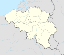
(c) Karte: NordNordWest, Lizenz: Creative Commons by-sa-3.0 de Denderleeuw | |
| Rozloha a obyvatelstvo | |
| Rozloha | 13,8 km² |
| Počet obyvatel | 20 086 (2018)[1] |
| Hustota zalidnění | 1 458,7 obyv./km² |
| Správa | |
| Oficiální web | www |
| lokaalbestuur | |
| Adresa obecního úřadu | Administratief Centrum A. De Cockstraat 1 9470 Denderleeuw |
| Telefonní předvolba | 053 |
| PSČ | 9470 (Denderleeuw) 9472 (Iddergem) 9473 (Welle) |
| Některá data mohou pocházet z datové položky. | |
Denderleeuw je město v Belgii na řece Dender asi 6 kilometrů jihovýchodně od Aalstu. Leží v provincii Východní Flandry ve Vlámském regionu. K 1. lednu 2008 měl Denderleeuw 17 937 obyvatel. Má i dvě místní části – Iddergem a Welle.
Místní fotbalový klub hraje 1. belgickou fotbalovou ligu.
Odkazy
Reference
- ↑ Wettelijke Bevolking per gemeente op 1 januari 2018. Statbel. Dostupné online. [cit. 2019-03-09].
Externí odkazy
 Obrázky, zvuky či videa k tématu Denderleeuw na Wikimedia Commons
 - Oficiální stránky
Média použitá na této stránce
This is the national flag of Belgium, according to the Official Guide to Belgian Protocol. It has a 13:15 aspect ratio, though it is rarely seen in this ratio.
Its colours are defined as Pantone black, Pantone yellow 115, and Pantone red 032; also given as CMYK 0,0,0,100; 0,8.5,79,0; and 0,94,87,0.Flag of the Belgian province of East-Flanderes
Flag of Denderleeuw munitipality in Belgium
Wapenschild van Denderleeuw
Autor: Henxter, Licence: CC BY-SA 4.0
This is a photo of onroerend erfgoed number
(c) Karte: NordNordWest, Lizenz: Creative Commons by-sa-3.0 de
Location map of Belgium


