Ejálet Rumélie
| Rumélijský ejálet Eyalet-i Rumeli ایالت روم ایلی
| |||||||||||||||||||||||||
geografie
| |||||||||||||||||||||||||
rozloha: | 124 630 km² (rok 1844) | ||||||||||||||||||||||||
| obyvatelstvo | |||||||||||||||||||||||||
počet obyvatel: | 2 700 000 (rok 1844) | ||||||||||||||||||||||||
národnostní složení: | |||||||||||||||||||||||||
| státní útvar | |||||||||||||||||||||||||
| státní útvary a území | |||||||||||||||||||||||||
| |||||||||||||||||||||||||
Ejálet Rumélie (turecky Eyalet-i Rumeli) byla provincie (ejálet) Osmanské říše. Existovala v letech 1365–1867. Rozkládala se téměř po celém Balkánu, tedy na území které Turci nazývali Rumélie (Rumeli). Šlo o největší provincii Osmanské říše vůbec, největší území zabírala v 17. století; s ústupem Osmanů z Evropy v 19. století se však postupně zmenšovala. V polovině 19. století měla rozlohu 124,630 km2 žilo v ní 2,7 milionu obyvatel.[1] Provincii založil sultán Murad I. V letech 1362–1530 bylo jejím hlavním městem thrácké Edirne (tehdy Adrianopolis), v letech 1530–1836 Sofie a v období 1836–1867 dnešní Bitola (tehdy Monastir).[2] Ejálet zasahoval na území dnešních států Bulharsko, Severní Makedonie, Bosna a Hercegovina, Albánie, Řecko, Srbsko a Turecko. Ke známým guvernérům patřil Mehmed Paša Sokolović (nástup okolo 1551) a Ali Paša Janinský (1793).
Reference
V tomto článku byl použit překlad textu z článku Rumelia Eyalet na anglické Wikipedii.
- ↑ The Encyclopædia Britannica, Or, Dictionary of Arts, Sciences, and General Literature. [s.l.]: Adam & Charles Black 914 s. Dostupné online. (anglicky) Google-Books-ID: TUEhAQAAMAAJ.
- ↑ DIMITROV, Nikola V.; MARKOSKI, Blagoja; RADEVSKI, Ivan. Bitola – from Eyalet capital to regional centre in the Republic of Macedonia. Urban Development Issues. 2018, roč. 55, čís. 3, s. 67. Dostupné online [cit. 2023-07-25]. ISSN 2544-6258.
Média použitá na této stránce
An Ottoman flag with an eight pointed star rather than the five pointed star which later became typical.
No official flag.
Autor: David Liuzzo, eagle by N3MO (re-uploaded by Dragovit), Licence: CC BY-SA 3.0
Banner of the Holy Roman Empire, double headed eagle without haloes (1400-1806)
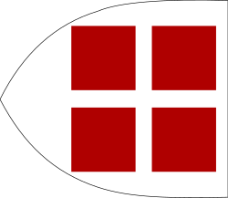
Flag of Vicina, Dobrudja, around 1350, according to the story of a Spanish Franciscan friar:
- I left Constantinople and entered the Mare Mayor (Black Sea), proceeding along the coast of the left hand to a great city called Vecina (Vicina¹). Here nine rivers unite and fall into the Mare Mayor². These nine rivers make a great commotion before this city of Vecina, which is the capital of the kingdom³. It has a white flag with four red squares.
² - The Danube Delta.
³ - Possible refference to principality of Dobrotici of Dobrudja.
This digital recreation of the Coat of arms of the House of Kastrioti is based on an illustration found in the book "Gli Albanesi e la Questione Balcanica" by prominent Albanian Arbëresh author and linguist Giuseppe Schirò from Piana degli Albanesi (PA).
Autor: Samhanin, Licence: CC0
Flag of the Second Bulgarian Empire (Ivan Shishman of Bulgaria Era, 1380). as shown in the Guillem Soler.
Autor: Santasa99, Licence: CC BY-SA 4.0
Bosnian Royal Flag of Tvrtko I of Bosnia
Autor: Tento vektorový obrázek byl vytvořen programem Inkscape ., Licence: CC BY-SA 3.0
Flag of Bulgaria (i.e Vidin), used in the 14th century.
Autor: Underlying lk, Licence: CC BY-SA 3.0
Rumelia Eyalet, Ottoman Empire (1609). Source: Encyclopedia of the Ottoman Empire at Google Books By Gábor Ágoston, Bruce Alan Masters
Autor: Old!!man1234561234, Licence: CC BY-SA 3.0
Flag of the Serbian Despotate, 1402-1459.
Flag of Serbia (1835-1882)
Autor: Samhanin, Licence: CC0
Royal banner of Mrnjavčević family
Flag of Genoa
Autor: Cplakidas, Licence: CC BY-SA 3.0
The Byzantine imperial ensign (βασιλικόν φλάμουλον), as depicted in the 14th-century Castilian Book of All Kingdoms, and described in the Treatise on Offices by the mid 14th-century Byzantine writer Pseudo-Kodinos as being hoisted on imperial naval vessels. It features the tetragrammic cross with the four "B"s that is attested in contemporary portolans, on coins and reliefs.


