El Vizcaíno
| velrybí útočiště El Vizcaíno | |
|---|---|
| Světové dědictví UNESCO | |
 | |
| Smluvní stát | |
| Souřadnice | 27°47′32″ s. š., 114°13′40″ z. d. |
| Typ | přírodní dědictví |
| Kritérium | x |
| Odkaz | 554 (anglicky) |
| Oblast | Latinská Amerika a Karibik |
| Zařazení do seznamu | |
| Zařazení | 1993 (17. zasedání) |
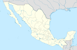
El Vizcaíno je rozlehlé chráněné území v centrální části Kalifornského poloostrova ve státě Baja California Sur.
V roce 1988 zde byla vyhlášena biosférická rezervace o rozloze větší než 25 000 km².[1][2] Svojí rozlohou patří El Vizcaíno k největším chráněným územím nejen v Mexiku, ale i na celém americkém kontinentu. Panuje zde velmi suché klima (průměrný roční srážkový úhrn pouze 80 mm), nacházejí se zde ekosystémy pouště, teplomilných rostlinných společenstev, dubových lesů či pobřežních mangrovových porostů.
Světové dědictví UNESCO
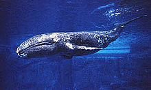
V roce 1993 byla část (370 950 ha) biosférické rezervace vyhlášena za lokalitu přírodního dědictví UNESCO pod názvem „velrybí útočiště El Vizcaíno“. Jedná se o dvě laguny na západním pobřeží poloostrova – Laguna de Ojo de Liebre (227 994 ha) a Laguna San Ignacio (142 956 ha).[3] V těchto lagunách jsou ideální podmínky pro reprodukci plejtvákovce šedého. V zimním období se zde vyskytuje 300 až 400 jedinců. Kromě této velryby se zde vyskytují i populace lachtana kalifornského, tuleně obecného či rypouše severního. Místo zároveň domovem několika druhů mořských želv (kareta pravá, kareta obecná, kareta obrovská, kareta zelenavá)[3] a velkého množství mořských ptáků. Zároveň je využíváno jako místo přezimování některými migrujícími ptáky.
Reference
- ↑ (španělsky) přehled chráněných území v Mexiku – CONANP
- ↑ (anglicky) informace o biosférické rezervaci – MAB biosphere reserves directory UNESCO
- ↑ a b Whale Sanctuary of El Vizcaino [online]. United Nations Environment Programme [cit. 2020-06-08]. Dostupné online. (anglicky)
Externí odkazy
 Obrázky, zvuky či videa k tématu El Vizcaíno na Wikimedia Commons
Média použitá na této stránce
Shiny green button/marker widget.
El Vizcaíno Biosphere Reserve — located midway down the Baja California Peninsula, in the Mulegé Municipality, northern Baja California Sur state, northwestern México.
- The Biosphere reserve, the largest wildlife refuge in all of Latin America, was declared a World Heritage Site by the United Nations Educational, Scientific, and Cultural Organization (UNESCO).
- Encompassing two lagoons on the Pacific Ocean and a large stretch of land between them, El Vizcaíno Biosphere Reserve provides a winter home for gray whales and other marine mammals, and habitat for thousands of migratory waterfowl. Plant life in the reserve includes Sonoran Desert vegetation and, at the water’s edge, Mangroves.
- On December 5, 2002, the Enhanced Thematic Mapper Plus on the Landsat 7 satellite captured this image of the western part of the Biosphere reserve, including Laguna Ojo de Liebre ("Scammon's Lagoon").
- In the western reaches of the El Vizcaíno Biosphere Reserve, elevations are low and land conditions are dry. Annual precipitation is generally less than 80 millimeters (3 inches) per year, and water evaporates so quickly here that rivers rarely reach the ocean. Meanwhile, constant winds organize loose sands into dunes. But the land is not completely barren: More than 400 plant species have been identified in the reserve, many of them shrubs or herbaceous plants.
- The rocks in this region are mostly sedimentary—made from material that was eroded by wind or water, and later deposited in new places. Volcanic rocks protrude through the sedimentary layers and can be distinguished by their darker colors and rugged surfaces. An assemblage of volcanic rocks appears southeast of Lago Ojo de Liebre
- This image also shows evidence of human activity. So some of the clearest green areas in this image result not from lush vegetation but from salt extraction. Along the edges of Lago Ojo de Liebre and near the town of Guerrero Negro, a massive salt mine produces roughly 7 million tons of salt each year. The salt works contrast with their surroundings thanks to their rectangular outlines and green hues.
Gray Whale (Eschrichtius robustus)


