Evropská silnice E17
| Evropská silnice E17 | |
|---|---|
 | |
| Mapa | |
 | |
| Základní údaje | |
| Začátek | Antverpy (Belgie) |
| Konec | Beaune (Francie) |
| Celková délka | 696 km |
| Stát | |
| Geodata (OSM) | OSM, WMF |
 | |
| Některá data mohou pocházet z datové položky. | |
Evropská silnice E17 je evropskou silnicí 1. třídy. Začíná v belgických Antverpách a končí ve francouzském Beaune. Celá trasa měří 696 kilometrů.
Trasa
Galerie
- (c) LimoWreck, CC-BY-SA-3.0
Trasa E17 v Belgii
Odkazy
Reference
V tomto článku byl použit překlad textu z článku European route E17 na anglické Wikipedii.
Související články
Externí odkazy
 Obrázky, zvuky či videa k tématu Evropská silnice E17 na Wikimedia Commons
Média použitá na této stránce
This is the national flag of Belgium, according to the Official Guide to Belgian Protocol. It has a 13:15 aspect ratio, though it is rarely seen in this ratio.
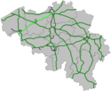
Its colours are defined as Pantone black, Pantone yellow 115, and Pantone red 032; also given as CMYK 0,0,0,100; 0,8.5,79,0; and 0,94,87,0.Map generated using coastline/boundary data from World Data Bank, and locations from http://www.world-gazetteer.com/. Straight lines connect control cities, no attempt to follow the real road. Roads color has been changed to green.
E17 near Lokeren, Belgium
(c) I, LimoWreck, CC BY 2.5
Border crossing on the E17 in Rekkem. Border between France (highway A22/E17) and Belgium (highway A14/E17). Border post has completely disappeared. On the left, on the horizon, the monument "De Sjouwer". Rekkem, Menen, West Flanders, Belgium.
A4 French motorway through Reims.
Autor: nl:User:LimoWreck, Licence: CC BY 2.5
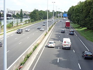
Beginning of B401 link road. B401 splits of from A14/E17 at interchange Gent-Centrum. The main axis of the E17 is just visible on the left (the road with the white van). Central in the picture is the en:Collector/distributor road used for the exit Gent-UZ, the junction with the B401 and access to the B401 and E17. The bridge in the distance at the left is the B401 entering Gent. (The church of Ledeberg can be seen). Image taken from the bridge with the Corneel Heymanslaan.


