Gandakí
| Gandakí | |
|---|---|
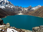
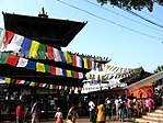
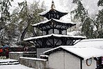
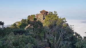
Shora zleva doprava Annapurna, jezero Phewa, království Mustang, jezero Tilicho, chrám Manakamana, chrám Muktinath, Mačapučare a Gorkha Durbar | |
| Geografie | |
| Hlavní město | Pókhara |
| Souřadnice | 28°12′34″ s. š., 83°59′29″ v. d. |
| Rozloha | 21 733 km² |
| Geodata (OSM) | OSM, WMF |
| Obyvatelstvo | |
| Počet obyvatel | 2 466 427 (2021) |
| Hustota zalidnění | 113,5 obyv./km² |
| Správa regionu | |
| Stát | |
| Vznik | 2015 |
| Oficiální web | gandaki |
| Některá data mohou pocházet z datové položky. | |
Provincie Gandakí (nepálsky गण्डकी प्रदेश) je jednou ze sedmi federálních provincií zřízených současnou ústavou Nepálu, která byla vyhlášena 20. září 2015.[1] Hlavním městem provincie je Pókhara. Na severu hraničí s Tibetskou autonomní oblastí, na východě s provincií Bágmatí, na západě s provincií Karnali a na jihu s provincií Lumbiní a indickým Bihárem. Celková plocha provincie je 21 500 km2 - asi 15 % celkové rozlohy země. Podle posledního sčítání lidu tu žije 2,4 mil. obyvatel.[2] Krišna Čandra Nepálí je současným hlavním ministrem provincie Gandakí.
Geografie
Provincie má rozlohu 21 773 km2 což je asi 14,66 % celkové rozlohy Nepálu. Stát se rozprostírá mezi 27°-20' severní šířky ~ 29°-20' severní šířky a 82° 52' východní délky ~ 85°-12' východní délky. Z hlediska terénu se provincie rozprostírá v himálajské, kopcovité a nížinné oblasti Teraj; 5 919 km2 (26,8 %) rozlohy spadá pod oblast Himálaje, 14 604 km2 (67,2 %) rozlohy spadá pod oblast pahorkatin (kopců) a 1310 km2 (6 %) rozlohy spadá pod region Teraj.[3]
Odkazy
Reference
V tomto článku byl použit překlad textu z článku Gandaki Province na anglické Wikipedii.
- ↑ Nepal Provinces [online]. statoids.com [cit. 2016-03-21]. Dostupné online. (anglicky)
- ↑ Gandaki Province in Nepal population [online]. [cit. 2018-06-04]. Dostupné online. (anglicky)
- ↑ Archivovaná kopie [online]. [cit. 2023-02-05]. Dostupné v archivu pořízeném dne 2018-04-28.
Externí odkazy
 Obrázky, zvuky či videa k tématu Gandakí na Wikimedia Commons
Média použitá na této stránce
Autor: Jean-Marie Hullot from France, Licence: CC BY 2.0
After a night in Kathmandu, our next stop towards Upper Mustang is Pokhara, just an half-hour flight from Katmandu with gorgeous views on the Himalayas all along (sit on the right of the aircraft). Pokhara is the second largest city of Nepal but, unlike the capital Kathmandu, it is quite loosely built up and still has much green space. The tourist district is along the north shore of Phewa lake. The Annapurna range on the north is only about 28 km away from the lake, and the lake is famous for the reflection of mount Machhapuchhre and other mountain peaks of the Annapurna and Dhaulagiri ranges on its surface. I still remember spending all the day there, back in the early eighties, just enjoying the fantastic view and feeling I was flying in the sky with the eagles after having picked the "magic mushroom omelet" on the breakfast menu Well this time has gone, but Pokhara is still one of the most enchanting place in the world and the new way to fly with the eagles is to have a tandem paraglider flight, a very popular activity these days.
Autor: Bijaya2043, Licence: CC BY-SA 3.0
This is a photo of a natural site in Nepal identified by the ID
Autor: Anuppanthi, Licence: CC BY-SA 4.0
Tilicho lake in the mid day during april- march season.
Autor: Anuj Devkota, Licence: CC BY-SA 4.0
I took this photo few months before the Gorkha Earthquake happened.
Autor: Ammit Shrestha, Licence: CC BY-SA 4.0
Muktinath is a sacred place both for Hindus and Buddhists located in Muktinath Valley at an altitude of 3,710 meters at the foot of the Thorong La mountain pass (part of the Himalayas), Mustang, Nepal. The site is close to the village of Ranipauwa, which sometimes mistakenly is called Muktinath as well.
(c) Sergey Ashmarin, CC BY-SA 3.0
Aerial view of the Annapurna massif / Nepal
Autor: Patricia Sauer, Licence: CC BY-SA 4.0
This is a photo of a natural site in Nepal identified by the ID


