Geel
| Geel | |
|---|---|
 | |
| Poloha | |
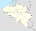
| Souřadnice | 51°9′40″ s. š., 4°59′25″ v. d. |
| Stát | |
| Rozloha a obyvatelstvo | |
| Rozloha | 110,3 km² |
| Počet obyvatel | 40 709 (2020)[1] |
| Hustota zalidnění | 369,2 obyv./km² |
| Správa | |
| Starosta | Vera Celis (od 2013) |
| Oficiální web | www |
| Telefonní předvolba | 014 |
| PSČ | 2440 |
| Některá data mohou pocházet z datové položky. | |
Geel je město v Belgii. Administrativně náleží do arrondissementu Turnhout v provincii Antverpy ve Vlámském společenství. Status města má od 80. let 20. století. Zahrnuje centrum, které sestává ze čtyř historických čtvrtí a měst (Sint-Amand, Sint-Dimpna, Holven a Elsum a nových čtvrtí vzniklých okolo něj (Ten Aard na severu, Sas 7 na severovýchodě, Bel na východě, Winkelomheide na jihovýchodě, Stelen, Oosterlo a Zammel na jihu, Punt na jihozápadě a Larum na západě. V roce 2006 v něm žilo 35 189 obyvatel. Rozloha města činí 109,85 km² a hustota obyvatel 320 na km².
Reference
V tomto článku byl použit překlad textu z článku Geel na anglické Wikipedii.
- ↑ Bevolking per gemeente op 1 januari 2020. Dostupné online.
Externí odkazy
 Obrázky, zvuky či videa k tématu Geel na Wikimedia Commons
Média použitá na této stránce
This is the national flag of Belgium, according to the Official Guide to Belgian Protocol. It has a 13:15 aspect ratio, though it is rarely seen in this ratio.
Its colours are defined as Pantone black, Pantone yellow 115, and Pantone red 032; also given as CMYK 0,0,0,100; 0,8.5,79,0; and 0,94,87,0.Wapen van de Belgische stad Geel.
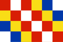
Flag of the Belgian commune of Geel.
The municipal flag of Geel is vertically divided in seven vertical stripes in turn yellow and red, with a white canton charged with three rows of three black ermine spots each.Autor: Sally V, Licence: CC BY-SA 4.0
This is a photo of onroerend erfgoed number


