Jazd (provincie)
| Provincie Jazd استان یزد | |
|---|---|
 | |
| Geografie | |
| Hlavní město | Jazd |
| Souřadnice | 31°53′41″ s. š., 54°21′25″ v. d. |
| Rozloha | 76 469 km² |
| Geodata (OSM) | OSM, WMF |
| Obyvatelstvo | |
| Počet obyvatel | 958 318 |
| Hustota zalidnění | |
| Jazyk | Perština |
| Náboženství | Islám |
| Správa regionu | |
| Nadřazený celek | Írán |
| Druh celku | Provincie |
| Podřízené celky | 11 krajů |
| Některá data mohou pocházet z datové položky. | |
Jazd (persky استان یزد) je provincie Íránu, která leží v jeho centrální části. Má rozlohu 76 469 km² a je rozdělena do jedenácti krajů Maybod, Mehríz, Taft, Ardakan, Behabád, Chatam, Sadogh, Bafq, Abar Kúh, Tabas a hlavní město Jazd.
Obyvatelstvo
Obyvatelstvo jsou převážně muslimové šíitského vyznání. Existuje zde ovšem nezanedbatelná komunita lidí vyznávající původní náboženství Zoroastrismus.
Externí odkazy
 Obrázky, zvuky či videa k tématu Jazd na Wikimedia Commons
Média použitá na této stránce
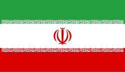
Flag of Iran. The tricolor flag was introduced in 1906, but after the Islamic Revolution of 1979 the Arabic words 'Allahu akbar' ('God is great'), written in the Kufic script of the Qur'an and repeated 22 times, were added to the red and green strips where they border the white central strip and in the middle is the emblem of Iran (which is a stylized Persian alphabet of the Arabic word Allah ("God")).
The official ISIRI standard (translation at FotW) gives two slightly different methods of construction for the flag: a compass-and-straightedge construction used for File:Flag of Iran (official).svg, and a "simplified" construction sheet with rational numbers used for this file.
Autor: Everaldo Coelho and YellowIcon;, Licence: LGPL
Ikonka z ikonkové sady Crystal Clear
Autor: Montage by Dr. Blofeld using files made by 1.Phillip Maiwald 2.Betta27 3. Betta27 4.Maziart, Licence: CC BY-SA 3.0
Locator map of Iran
Autor: Дмитрий-5-Аверин, Licence: CC BY-SA 3.0
Flag-map of Iran (tricolour)


