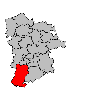
Kanton Broglie
| Kanton Broglie | |
|---|---|
| Geografie | |
| Hlavní město | Broglie |
| Souřadnice | 48°58′4″ s. š., 0°30′5″ v. d. |
| Rozloha | 217,57 km² |
| Obyvatelstvo | |
| Počet obyvatel | 6 275 (2009) |
| Hustota zalidnění | 28,8 obyv./km² |
| Správa regionu | |
| Stát | |
| Region | Horní Normandie |
| Departement | Eure |
| Arrondissement | Bernay |
| Druh celku | Kanton |
| Podřízené celky | Obce (počet: 20) |
| Některá data mohou pocházet z datové položky. | |
Kanton Broglie (fr. Canton de Broglie) je francouzský kanton v departementu Eure v regionu Horní Normandie. Skládá se z 20 obcí.
Obce kantonu
- Broglie
- Capelle-les-Grands
- Chamblac
- La Chapelle-Gauthier
- Ferrières-Saint-Hilaire
- La Goulafrière
- Grand-Camp
- Mélicourt
- Mesnil-Rousset
- Montreuil-l'Argillé
- Notre-Dame-du-Hamel
- Saint-Agnan-de-Cernières
- Saint-Aubin-du-Thenney
- Saint-Denis-d'Augerons
- Saint-Jean-du-Thenney
- Saint-Laurent-du-Tencement
- Saint-Pierre-de-Cernières
- Saint-Quentin-des-Isles
- La Trinité-de-Réville
- Verneusses
Média použitá na této stránce
Autor: Michiel1972, Licence: CC BY-SA 3.0
Location of the canton within its arrondissement.


