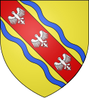
Kanton Colombey-les-Belles
| Kanton Colombey-les-Belles | |
|---|---|
| Geografie | |
| Hlavní město | Colombey-les-Belles |
| Souřadnice | 48°28′40″ s. š., 5°55′11″ v. d. |
| Rozloha | 298,89 km² |
| Obyvatelstvo | |
| Počet obyvatel | 7 900 (2010) |
| Hustota zalidnění | 26,4 obyv./km² |
| Správa regionu | |
| Stát | |
| Region | Lotrinsko |
| Departement | Meurthe-et-Moselle |
| Arrondissement | Toul |
| Druh celku | Kanton |
| Podřízené celky | Obce (počet: 31) |
| Některá data mohou pocházet z datové položky. | |
Kanton Colombey-les-Belles (fr. Canton de Colombey-les-Belles) byl francouzský kanton v departementu Meurthe-et-Moselle v regionu Lotrinsko. Tvořilo ho 31 obcí. Zrušen byl po reformě kantonů 2014.
Obce kantonu
- Aboncourt
- Allain
- Allamps
- Bagneux
- Barisey-au-Plain
- Barisey-la-Côte
- Battigny
- Beuvezin
- Colombey-les-Belles
- Courcelles
- Crépey
- Dolcourt
- Favières
- Fécocourt
- Gélaucourt
- Gémonville
- Germiny
- Gibeaumeix
- Grimonviller
- Mont-l'Étroit
- Pulney
- Saulxerotte
- Saulxures-lès-Vannes
- Selaincourt
- Thuilley-aux-Groseilles
- Tramont-Émy
- Tramont-Lassus
- Tramont-Saint-André
- Uruffe
- Vandeléville
- Vannes-le-Châtel
Média použitá na této stránce
Autor: Michiel1972, Licence: CC BY-SA 3.0
Location of the canton within its arrondissement.


