Kanton Mont-Louis
| Kanton Mont-Louis | |
|---|---|
| Geografie | |
| Hlavní město | Mont-Louis |
| Souřadnice | 42°30′ s. š., 2°8′ v. d. |
| Rozloha | 305,12 km² |
| Geodata (OSM) | OSM, WMF |
| Obyvatelstvo | |
| Počet obyvatel | 4 066 (2009) |
| Hustota zalidnění | 13,3 obyv./km² |
| Správa regionu | |
| Stát | |
| Region | Languedoc-Roussillon |
| Departement | Pyrénées-Orientales |
| Arrondissement | Prades |
| Druh celku | Kanton |
| Podřízené celky | Obce (počet: 15) |
| Některá data mohou pocházet z datové položky. | |
Kanton Mont-Louis (fr. Canton de Mont-Louis) je francouzský kanton v departementu Pyrénées-Orientales v regionu Languedoc-Roussillon. Skládá se z 15 obcí.
Obce kantonu
- Bolquère
- La Cabanasse
- Les Angles
- Formiguères
- Mont-Louis
- La Llagonne
- Matemale
- Saint-Pierre-dels-Forcats
- Fontpédrouse
- Sauto
- Puyvalador
- Fontrabiouse
- Réal
- Planès
- Caudiès-de-Conflent
Externí odkazy
 Obrázky, zvuky či videa k tématu Kanton Mont-Louis na Wikimedia Commons
Média použitá na této stránce
Autor: Tallaferro, Licence: CC BY 2.5
Canton of Mont-Louis in the french Pyrénées-Orientales department.
Autor: WikiMeGa****, Licence: CC BY-SA 3.0
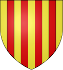
Arms of Pyrénées-Orientale department: Or, four pallets gules


