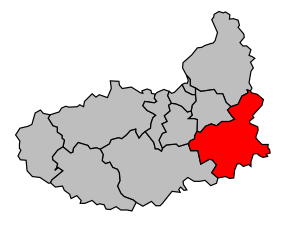
Kanton Nogent-le-Roi
| Kanton Nogent-le-Roi | |
|---|---|
| Geografie | |
| Hlavní město | Nogent-le-Roi |
| Souřadnice | 48°40′12″ s. š., 1°31′10″ v. d. |
| Rozloha | 199,94 km² |
| Obyvatelstvo | |
| Počet obyvatel | 17 666 (2010) |
| Hustota zalidnění | 88,4 obyv./km² |
| Správa regionu | |
| Stát | |
| Region | Centre-Val de Loire |
| Departement | Eure-et-Loir |
| Arrondissement | Dreux |
| Druh celku | Kanton |
| Podřízené celky | Obce (počet: 18) |
| Některá data mohou pocházet z datové položky. | |
Kanton Nogent-le-Roi (francouzsky Canton de Nogent-le-Roi) je francouzský kanton v departementu Eure-et-Loir v regionu Centre-Val de Loire. Tvoří ho 18 obcí.
Obce kantonu
- Le Boullay-Mivoye
- Le Boullay-Thierry
- Boutigny-Prouais
- Bréchamps
- Chaudon
- Coulombs
- Croisilles
- Faverolles
- Lormaye
- Néron
- Nogent-le-Roi
- Ormoy
- Les Pinthières
- Saint-Laurent-la-Gâtine
- Saint-Lucien
- Senantes
- Villemeux-sur-Eure
- Villiers-le-Morhier
Média použitá na této stránce
Autor: Michiel1972, Licence: CC BY-SA 3.0
Location of the canton within its arrondissement. Map canton code 28 19.svg


