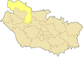
Kanton Rue
| Kanton Rue | |
|---|---|
| Geografie | |
| Hlavní město | Rue |
| Souřadnice | 50°16′19″ s. š., 1°40′4″ v. d. |
| Rozloha | 620,75 km² |
| Geodata (OSM) | 4451926 OSM, WMF |
| Obyvatelstvo | |
| Počet obyvatel | 25 116 (2012) |
| Hustota zalidnění | 40,5 obyv./km² |
| Správa regionu | |
| Stát | |
| Region | Hauts-de-France |
| Departement | Somme |
| Arrondissement | Abbeville |
| Druh celku | Kanton |
| Podřízené celky | Obce (počet: 55) |
| Vznik | 2015 |
| Některá data mohou pocházet z datové položky. | |
Kanton Rue (fr. Canton de Rue) je francouzský kanton v departementu Somme v regionu Hauts-de-France. Skládá se z 55 obcí. Před reformou kantonů 2014 ho tvořilo 17 obcí.
Obce kantonu
od roku 2015:
|
|
|
před rokem 2015:
- Argoules
- Arry
- Bernay-en-Ponthieu
- Le Crotoy
- Favières
- Fort-Mahon-Plage
- Machiel
- Machy
- Nampont
- Quend
- Regnière-Écluse
- Rue
- Saint-Quentin-en-Tourmont
- Vercourt
- Villers-sur-Authie
- Vironchaux
- Vron
Externí odkazy
- Kanton Rue na stránkách INSEE
Média použitá na této stránce
Autor: Mikhail-Vlad-P, Licence: CC BY-SA 4.0
Canton de Rue dans le département de la Somme


