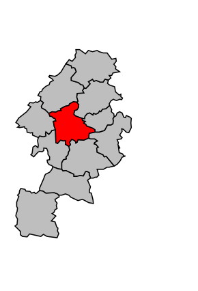
Kanton Saint-Gaudens
| Kanton Saint-Gaudens | |
|---|---|
| Geografie | |
| Hlavní město | Saint-Gaudens |
| Souřadnice | 43°6′29″ s. š., 0°43′24″ v. d. |
| Rozloha | 189,40 km² |
| Obyvatelstvo | |
| Počet obyvatel | 21 382 (2010) |
| Hustota zalidnění | 112,9 obyv./km² |
| Správa regionu | |
| Stát | |
| Region | Midi-Pyrénées |
| Departement | Haute-Garonne |
| Arrondissement | Saint-Gaudens |
| Druh celku | Kanton |
| Podřízené celky | Obce (počet: 21) |
| Vznik | 2015 |
| Některá data mohou pocházet z datové položky. | |
Kanton Saint-Gaudens (francouzsky Canton de Saint-Gaudens) je francouzský kanton v departementu Haute-Garonne v regionu Midi-Pyrénées. Tvoří ho 21 obcí.
Obce kantonu
- Aspret-Sarrat
- Estancarbon
- Labarthe-Inard
- Labarthe-Rivière
- Lalouret-Laffiteau
- Landorthe
- Larcan
- Lespiteau
- Lieoux
- Lodes
- Miramont-de-Comminges
- Pointis-Inard
- Régades
- Rieucazé
- Saint-Gaudens
- Saint-Ignan
- Saint-Marcet
- Saux-et-Pomarède
- Savarthès
- Valentine
- Villeneuve-de-Rivière
Média použitá na této stránce
Autor: Michiel1972, Licence: CC BY-SA 3.0
Location of the canton within its arrondissement.


