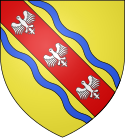
Kanton Villerupt
| Kanton Villerupt | |
|---|---|
| Geografie | |
| Hlavní město | Villerupt |
| Souřadnice | 49°26′20″ s. š., 5°49′26″ v. d. |
| Rozloha | 128,28 km² |
| Obyvatelstvo | |
| Počet obyvatel | 26 876 (2013) |
| Hustota zalidnění | 209,5 obyv./km² |
| Správa regionu | |
| Stát | |
| Region | Grand Est |
| Departement | Meurthe-et-Moselle |
| Arrondissement | Briey |
| Druh celku | Kanton |
| Podřízené celky | Obce (počet: 14) |
| Vznik | 2015 |
| Některá data mohou pocházet z datové položky. | |
Kanton Villerupt (fr. Canton de Villerupt) je francouzský kanton v departementu Meurthe-et-Moselle v regionu Lotrinsko. Tvoří ho 14 obcí. Před reformou kantonů 2014 ho tvořilo 12 obcí.
Obce kantonu
od roku 2015:
- Bréhain-la-Ville
- Crusnes
- Errouville
- Fillières
- Hussigny-Godbrange
- Laix
- Longlaville
- Morfontaine
- Saulnes
- Serrouville
- Thil
- Tiercelet
- Villers-la-Montagne
- Villerupt
před rokem 2015:
- Baslieux
- Bazailles
- Boismont
- Bréhain-la-Ville
- Fillières
- Laix
- Morfontaine
- Thil
- Tiercelet
- Ville-au-Montois
- Villers-la-Montagne
- Villerupt
Externí odkazy
- Kanton Villerupt na stránkách INSEE
Média použitá na této stránce
Autor: Pymouss, Licence: CC BY-SA 4.0
Carte de localisation du canton de Villerupt dans le département de Meurthe-et-Moselle, redécoupage de 2014.


