Karadž
| Karadž شهر کرج | |
|---|---|
 | |
| Poloha | |
| Souřadnice | 35°48′ s. š., 50°58′ v. d. |
| Nadmořská výška | 1 300 m n. m. |
| Časové pásmo | UTC+3:30 |
| Stát | |
| provincie | Alborz (provincie) |
| Rozloha a obyvatelstvo | |
| Rozloha | 162 km² |
| Počet obyvatel | 1 377 450 (2006) |
| Hustota zalidnění | 8 502,8 obyv./km² |
| Správa | |
| Starosta | Sajíd Alí Aqázáde |
| Telefonní předvolba | 0261 |
| Některá data mohou pocházet z datové položky. | |
Karadž (persky شهر کرج) je páté nejlidnatější město v Íránu a hlavní město provincie Alborz. Leží 20 km západně od Teheránu v podhůří Alborzu. Karadž je spojen silnicí a železnicí s Teheránem a Kazvínem.
Vývoj počtu obyvatel
| Rok | Počet obyvatel |
|---|---|
| 1986 | 275 100 |
| 1991 | 442 387 |
| 1996 | 940 968 |
| 2006 | 1 386 030 |
| 2016 | 1 592 492 |
Externí odkazy
 Obrázky, zvuky či videa k tématu Karadž na Wikimedia Commons
Média použitá na této stránce
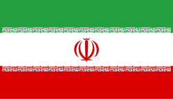
Flag of Iran. The tricolor flag was introduced in 1906, but after the Islamic Revolution of 1979 the Arabic words 'Allahu akbar' ('God is great'), written in the Kufic script of the Qur'an and repeated 22 times, were added to the red and green strips where they border the white central strip and in the middle is the emblem of Iran (which is a stylized Persian alphabet of the Arabic word Allah ("God")).
The official ISIRI standard (translation at FotW) gives two slightly different methods of construction for the flag: a compass-and-straightedge construction used for File:Flag of Iran (official).svg, and a "simplified" construction sheet with rational numbers used for this file.
Autor: Uwe Dedering, Licence: CC BY-SA 3.0
Location map of Iran.
Equirectangular projection. Stretched by 118.0%. Geographic limits of the map:
* N: 40.0° N
* S: 24.5° N
* W: 43.5° E
* E: 64.0° E
Made with Natural Earth. Free vector and raster map data @ naturalearthdata.com.


