Karibské moře
| Karibské moře | |
|---|---|
 Mapa Karibského moře | |
| Maximální hloubka | 7686 m |
| Rozloha | 2 754 000 km² |
| Zeměpisné souřadnice | 15°0′0″ s. š., 75°0′0″ z. d. |
| Nadřazený celek | Atlantský oceán |
| Sousední celky | Mexický záliv |
| Světadíl | Severní Amerika, Jižní Amerika |
| Stát |
|
| Přítoky | Orinoko, Magdalena |
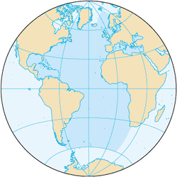
Karibské moře (anglicky Caribbean Sea, španělsky Mar Caribe, francouzsky Mer des Caraïbes, portugalsky Mar do Caribe (Mar das Caraíbas), nizozemsky Caraïbische Zee) je část Atlantského oceánu ležící v tropické části Ameriky jihovýchodně od Mexického zálivu. Zabírá většinu Karibské desky a je ohraničeno státy Venezuela, Kolumbie a Panama na jihu, státy Kostarika, Nikaragua, Honduras, Guatemala, Belize a poloostrovem Yucatán (patřícím Mexiku) na západě, Velkými Antilami, tj. ostrovy Kuba, Hispaniola, Jamajka a Portoriko na severu a na východě Malými Antilami.
Karibské moře zabírá plochu přibližně 2 754 000 km². Jeho nejhlubším místem je Kajmanský příkop mezi Kubou a Jamajkou s hloubkou 7686 m. Při pobřeží Mexika, Hondurasu a Belize se nachází Chetumalský záliv, Honduraský záliv a Mezoamerický korálový útes.
Oblast Karibského moře je sužována zemětřeseními, sopečnými výbuchy a sezónními hurikány.
Povrchová teplota moře se pohybuje mezi 24-29°C.
Ostrovy v Karibiku
- Velké Antily
- Grand Cayman (největší Kajmanský ostrov)
- Hispaniola (na ostrově leží Haiti a Dominikánská republika)
- Jamajka (nezávislý stát)
- Kuba (nezávislá republika)
- Portoriko (přidružený stát USA)
- Malé Antily
- Závětrné ostrovy
- Anguilla (zámořské území Spojeného království)
- Antigua (součást státu Antigua a Barbuda)
- Barbuda (součást státu Antigua a Barbuda)
- Dominika (nezávislá republika)
- Guadeloupe (zámořský region Francie)
- Montserrat (zámořské území Spojeného království)
- Nevis (součást republiky Svatý Kryštof a Nevis)
- Panenské ostrovy (rozděleny na Britské Pan. ostrovy a Americké Pan. ostrovy)
- Saba (součást Nizozemského království)
- Svatý Bartoloměj (francouzské zámořské společenství)
- Svatý Eustach (součást Nizozemského království)
- Svatý Kryštof (republika Svatý Kryštof a Nevis)
- Svatý Martin (rozdělený mezi francouzské zámořské společenství a autonomní zemi Nizozemského království)
- Návětrné ostrovy
- Barbados (člen Commonwealthu)
- Grenada (člen Commonwealthu)
- Grenadiny (mezi ostrovy Grenada a Svatý Vincenc)
- Martinik (zámořský region Francie)
- Svatá Lucie (nezávislá republika)
- Svatý Vincenc (součást státu Svatý Vincenc a Grenadiny)
- Tobago (součást republiky Trinidad a Tobago)
- Trinidad (součást republiky Trinidad a Tobago)
- Závětrné Antily
- Aruba (součást Nizozemského království)
- Bonaire (součást Nizozemského království)
- Curaçao (součást Nizozemského království)
- Isla de Margarita (součást Venezuely)
- Závětrné ostrovy
- ostrovy při pobřeží Střední Ameriky
- Islas de la Bahía (Honduras)
- Corn Islands, Cayos Miskitos (Nikaragua)
- atolové ostrůvky při pobřeží Belize
- San Andrés a Providencia (Kolumbie)
- Cozumel (Mexiko)
Externí odkazy
 Slovníkové heslo Karibské moře ve Wikislovníku
 Obrázky, zvuky či videa k tématu Karibské moře na Wikimedia Commons
Média použitá na této stránce
Note: The color selected is «turquoise blue» (the color mentioned in the decree), as defined by Pantone.
Flag of Jamaica. “The sunshine, the land is green, and the people are strong and bold” is the symbolism of the colours of the flag. GOLD represents the natural wealth and beauty of sunlight; GREEN represents hope and agricultural resources; BLACK represents the strength and creativity of the people. The original symbolism, however, was "Hardships there are, but the land is green, and the sun shineth", where BLACK represented the hardships being faced.
The national and official state flag of Haiti; arms obtained from File:Coat of arms of Haiti.svg. The civil flag can be found at here.
The flag of the Dominican Republic has a centered white cross that extends to the edges. This emblem is similar to the flag design and shows a bible, a cross of gold and 6 Dominican flags. There are branches of olive and palm around the shield and above on the ribbon is the motto "Dios,Patria!, Libertad" ("God, Country, Freedom") and to amiable freedom. The blue is said to stand for liberty, red for the fire and blood of the independence struggle and the white cross symbolized that God has not forgotten his people. "Republica Dominicana". The Dominican flag was designed by Juan Pablo Duarte, father of the national Independence of Dominican Republic. The first dominican flag was sewn by a young lady named Concepción Bona, who lived across the street of El Baluarte, monument where the patriots gathered to fight for the independence, the night of February 27th, 1844. Concepción Bona was helped by her first cousin María de Jesús Pina.
The flag of the Dominican Republic has a centered white cross that extends to the edges. This emblem is similar to the flag design and shows a bible, a cross of gold and 6 Dominican flags. There are branches of olive and palm around the shield and above on the ribbon is the motto "Dios,Patria!, Libertad" ("God, Country, Freedom") and to amiable freedom. The blue is said to stand for liberty, red for the fire and blood of the independence struggle and the white cross symbolized that God has not forgotten his people. "Republica Dominicana". The Dominican flag was designed by Juan Pablo Duarte, father of the national Independence of Dominican Republic. The first dominican flag was sewn by a young lady named Concepción Bona, who lived across the street of El Baluarte, monument where the patriots gathered to fight for the independence, the night of February 27th, 1844. Concepción Bona was helped by her first cousin María de Jesús Pina.
The flag of Aruba
The flag of Curaçao is a blue field with a horizontal yellow stripe slightly below the midline and two white, five-pointed stars in the canton. The geometry and colors are according to the description at Flags of the World.
Flag of Anguilla, adopted on 30 May 1990 and modified slightly on 25 January 1999.


