Keren
| Keren كيرين | |
|---|---|
 | |
| Poloha | |
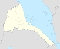
| Souřadnice | 15°47′ s. š., 38°27′ v. d. |
| Nadmořská výška | 1 590 m n. m. |
| Stát | |
| region | Anseba |
| distrikt | Keren |
| Rozloha a obyvatelstvo | |
| Počet obyvatel | 82 198 (2012) |
| Některá data mohou pocházet z datové položky. | |
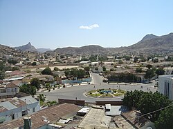
Keren je druhé největší město v Eritreji a zároveň hlavní město regionu Anseba. Město, dříve zvané Cheren nebo Sanhit, leží asi 91 kilometrů od Asmary. Rozprostírá se v široké kotlině, obklopené granitovými horami.
Historie
Město vyrostlo kolem eritrejské železnice vedoucí do Asmary, která byla později demontována kvůli válce. Keren je důležité obchodní centrum, které bylo během 2. světové války a Eritrejské války za nezávislost dějištěm pravidelných bitev.
Zajímavosti
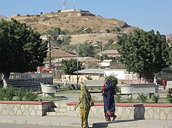
Mezi atrakce města patří egyptská pevnost z 19. století, kaple zabudovaná v baobabu, bývalá železniční stanice, stará mešita, mauzoleum, britské a italské vojenské hřbitovy a místní tržiště. Blízký klášter Debre Sina je známý pro své jeskynní příbytky.
Partnerská města
Galerie
Reference
V tomto článku byl použit překlad textu z článku Keren, Eritrea na anglické Wikipedii.
Externí odkazy
 Obrázky, zvuky či videa k tématu Keren na Wikimedia Commons
  Keren na wikivoyage.org
Média použitá na této stránce
Autor: David Stanley from Nanaimo, Canada, Licence: CC BY 2.0
A camel train passes the new Church of San Antonio in the center of Keren, Eritrea.
Autor: David Stanley from Nanaimo, Canada, Licence: CC BY 2.0
A fertility cult is associated with this ancient baobab tree at the Catholic shrine of St Maryam Dearit near Keren, Eritrea.
Autor: David Stanley from Nanaimo, Canada, Licence: CC BY 2.0
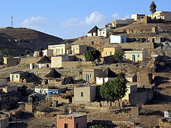
Village houses on the east side of Keren, Eritrea.
Autor: David Stanley from Nanaimo, Canada, Licence: CC BY 2.0
Tigu Fort on a hilltop overlooking Keren, Eritrea, was built during a period of Egyptian rule in the 19th century.
Autor: David Stanley from Nanaimo, Canada, Licence: CC BY 2.0
The Italian-era train station in Keren, Eritrea, now serves as a bus station. Plans to connect the Eritrean railway network to that of Sudan were interrupted by Mussolini's invasion of Ethiopia.
Autor: David Stanley from Nanaimo, Canada, Licence: CC BY 2.0
Hotel Keren is diagonally opposite the post office just off Giro Fiori in Keren, Eritrea. The rooms are rather basic but the rooftop terrace is nice.
Autor: David Stanley from Nanaimo, Canada, Licence: CC BY 2.0
Cactus and citrus trees next to St Maryam Dearit near Keren, Eritrea.
Autor: David Stanley, Licence: CC BY 2.0
A former railway bridge in Keren, Eritrea.
Autor: David Stanley from Nanaimo, Canada, Licence: CC BY 2.0
A Bilen house east of Keren, Eritrea.
Autor: David Stanley from Nanaimo, Canada, Licence: CC BY 2.0
The grain market in Keren, Eritrea.
Keren, Eritrea


