Kermán
| Kermán | |
|---|---|
 | |
| Poloha | |
| Souřadnice | 30°17′ s. š., 57°4′ v. d. |
| Nadmořská výška | 1 755 m n. m. |
| Stát | |
| Rozloha a obyvatelstvo | |
| Rozloha | 180,7 km² |
| Počet obyvatel | 573 449 (2012) |
| Hustota zalidnění | 3 173,5 obyv./km² |
| Správa | |
| Oficiální web | kermancity |
| Telefonní předvolba | 34 |
| PSČ | 761 |
| Některá data mohou pocházet z datové položky. | |
Kermán (persky کرمان) je město na jihu Íránu a centrum Kermánské provincie. Leží 1,076 km jižně od Teheránu. V roce 2006 mělo 636.242 obyvatel.
Asi 35 km východně od Kermánu je město Mahan s hrobkou velkého sufiského derviše – Shah Ne'emat Ollah-e-Vali, a nedaleko městečka se nachází Shazdeh Garden (Prince Garden).
Historie

Předpokládá se, že Kermán založil počátkem 3. století Ardašír I. zakladatel sásánovské dynastie.[1]
Geografie
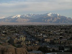
Kermán leží v hornaté krajině (1,755m) v poušti Dašt-e Kavír.
Obrázky
Reference
- ↑ http://www.mideasttravelling.net/iran/kerman/kerman_history.htm Archivováno 22. 3. 2012 na Wayback Machine Kerman - history
Externí odkazy
 Obrázky, zvuky či videa k tématu Kermán na Wikimedia Commons
 - (anglicky) Kerman Cultural Heritage Organization
- (anglicky) Photos of historic sites in Kerman
- Edareh Kar Kerman
Média použitá na této stránce
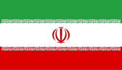
Flag of Iran. The tricolor flag was introduced in 1906, but after the Islamic Revolution of 1979 the Arabic words 'Allahu akbar' ('God is great'), written in the Kufic script of the Qur'an and repeated 22 times, were added to the red and green strips where they border the white central strip and in the middle is the emblem of Iran (which is a stylized Persian alphabet of the Arabic word Allah ("God")).
The official ISIRI standard (translation at FotW) gives two slightly different methods of construction for the flag: a compass-and-straightedge construction used for File:Flag of Iran (official).svg, and a "simplified" construction sheet with rational numbers used for this file.
Autor: Jan Koláček, Licence: CC BY-SA 3.0
Kermán - Staré hradby nedaleko univerzitní knihovny
The Masjid gate in Kerman
City of Kerman, Iran
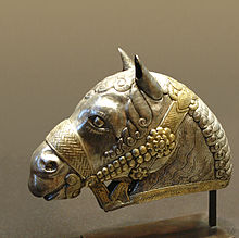
Horse head, gilded silver, 4th century, Sasanian art, found in Kerman, Iran
Autor: Uwe Dedering, Licence: CC BY-SA 3.0
Location map of Iran.
Equirectangular projection. Stretched by 118.0%. Geographic limits of the map:
* N: 40.0° N
* S: 24.5° N
* W: 43.5° E
* E: 64.0° E
Made with Natural Earth. Free vector and raster map data @ naturalearthdata.com.


