Kurnat as-Saudá
| Kurnat as-Saudá القرنة السوداء | |
|---|---|
 Kurnat as-Saudá z jihu (červenec 1985) | |
| Vrchol | 3088 m n. m. |
| Prominence | 2393 m |
| Izolace | 363,0 km |
| Seznamy | Ultraprominentní hory Nejvyšší hory asijských zemí |
| Poznámka | nejvyšší hora Libanonu |
| Poloha | |
| Světadíl | Asie |
| Stát | |
| Pohoří | Libanon |
| Souřadnice | 34°18′ s. š., 36°7′ v. d. |
| Některá data mohou pocházet z datové položky. | |
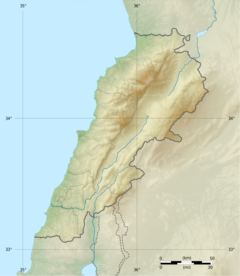
Kurnat as-Saudá (arabsky القرنة السوداء, 3088 m n. m.) je hora v pohoří Libanon. Leží na území Libanonu v guvernorátu Severní Libanon na hranici okresů Minja-Danja a Baszarri. Jedná se o nejvyšší horu státu i celého pohoří. Vrchol hory je 6 měsíců v roce pokryt sněhem.
Reference
V tomto článku byl použit překlad textu z článku Kurnat as-Sauda na polské Wikipedii.
Externí odkazy
Média použitá na této stránce
This is a solid red equilateral triangle, which can symbolize or indicate many things, including the the symbol for fire in the books by Franz Bardon.
Autor: Addicted04, Licence: CC BY-SA 3.0
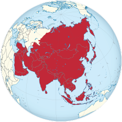
A map of the hemisphere centred on 95, 40, using an orthographic projection, created using gringer's Perl script with Natural Earth Data (1:50000 resolution, simplified to 0.25px). Asia is highlighted in red.
Autor: Vivepat and NordNordWest, Licence: CC BY-SA 3.0
Location map of Lebanon
View from the south of the Qurnat As Sawda, Lebanon's highest peak at 3,088 meters, taken on 9 June 1985 during the Lebanese civil war.


