Lautaro (sopka)
| Lautaro | |
|---|---|
 | |
| Vrchol | 3 580 m n. m. |
| Prominence | 3 302 m |
| Izolace | 181,8 km |
| Poloha | |
| Světadíl | Jižní Amerika |
| Stát | |
| Pohoří | Andy |
| Souřadnice | 49°1′11″ j. š., 73°30′12″ z. d. |
| Hornina | dacit, andezit, bazaltandezit |
| Některá data mohou pocházet z datové položky. | |
Lautaro je stratovulkán na jihu Chile, v Patagonských Andách. Nachází se v regionu Aysén, v severní části Jihopatagonského ledovcového pole. Vulkán je pokrytý ledovcem. Jeden kilometr široký kráter se nachází na severovýchodním úbočí hory.[1][2] Lautaro je s nadmořskou výškou 3 580 metrů třetí nejvyšší horou Patagonských And.[3] Hlavní horninou vulkánu je dacit, dalšími horninami jsou andezit a bazaltický andezit.[2]
Reference
- ↑ Volcán Lautaro, Chile [online]. Peakbagger.com, 2004 [cit. 2020-05-08]. Dostupné online. (anglicky)
- ↑ a b Lautaro [online]. Smithsonian Institution, Global Volcanism Program, 2013 [cit. 2020-05-08]. Dostupné online. (anglicky)
- ↑ Patagonian Andes [online]. Peakbagger.com, 2004 [cit. 2020-05-08]. Dostupné online. (anglicky)
Externí odkazy
 Obrázky, zvuky či videa k tématu Lautaro na Wikimedia Commons
Média použitá na této stránce
Při zobrazení tohoto souboru lze snadno přidat orámování
This is a solid red equilateral triangle, which can symbolize or indicate many things, including the the symbol for fire in the books by Franz Bardon.
This grand panorama of the Southern Patagonia Ice Field was photographed by a crew member aboard the International Space Station (ISS) on a rare clear day in the southern Andes Mountains. With an area of 13,000 square kilometers (5,000 square miles), the ice field is the largest temperate ice sheet in the Southern Hemisphere. Storms that swirl into the region from the southern Pacific Ocean bring rain and snow (between 2 to 11 meters of rainfall per year), resulting in the buildup of the ice sheet. During the ice ages, these glaciers were far larger. Geologists now know that ice tongues extended far onto the plains in the foreground, completely filling the great Patagonian lakes on repeated occasions. Similarly, ice tongues extended into the dense network of fjords on the Pacific side of the ice field. Ice tongues today appear tiny compared what an “ice age” astronaut would have seen.
Autor:
- Chile_location_map.svg: NordNordWest
- derivative work: Виктор В (talk)
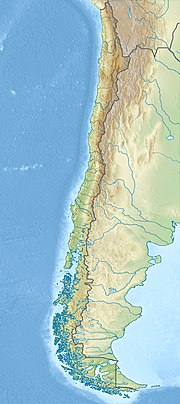
Location map of Chile


