Národní parky v Guatemale

Na území Guatemaly se v roce 2015 nacházelo 21 národních parků.[1] Jejich souhrnná rozloha je 735 240 hektarů, což představuje přibližně 6,76 % státní rozlohy. Správou národních parků i dalších chráněných území je pověřena státní organizace CONAP - Consejo Nacional de Areas Protegidas. Guatemalské národní parky, biosférické rezervace, obecní lesní rezervace, útočiště divokého života a další druhy chráněných území pokrývají na 32 % rozlohy státu. [1]
Přehled území
| Název parku | Rozloha [ha][1] | Rok vyhlášení | Departement |
|---|---|---|---|
| Cerro El Baúl | 240 | 1955 | Quetzaltenango |
| Cerro Miramundo | 902 | 1956 | Zacapa |
| Cuevas del Silvino | 8 | 1972 | Izabal |
| El Reformador | 60 | 1955 | El Progreso |
| El Rosario | 1 105 | 1980 | Petén |
| Grutas de Lanquín | 11 | 1955 | Alta Verapaz |
| Laguna del Tigre | 289 912 | 1990 | Petén |
| Laguna del Pino | 73 | 1955 | Santa Rosa |
| Laguna Lachuá | 14 301 | 1996 | Alta Verapaz |
| Las Victorias | 81 | 1980 | Alta Verapaz |
| Los Aposentos | 15 | 1955 | Chimaltenango |
| Mirador Río Azul | 116 911 | 1990 | Petén |
| Naciones Unidas | 491 | 1955 | Guatemala |
| Pacaya y Laguna de Calderas | 1 049 | 1956 | Escuintla, Guatemala |
| Riscos de Momostenango | 0,48 | 1955 | Totonicapán |
| Río Dulce | 13 000 | 1955 | Izabal |
| Iximche | 50 | 1963 | Chimaltenango |
| Sierra del Lacandón | 202 856 | 1990 | Petén |
| Sipacate-Naranjo | 2 000 | 1969 | Escuintla |
| Tikal | 55 005 | 1955 | Petén |
| Yaxhá-Nakúm-Naranjo | 37 160 | 1993 | Petén |
Reference
- ↑ a b c Listado Oficial Áreas Protegidas [online]. Consejo Nacional de Areas Protegidas (CONAP) [cit. 2019-09-01]. Dostupné v archivu pořízeném dne 2019-09-01. (španělsky)
Externí odkazy
 Obrázky, zvuky či videa k tématu Národní parky v Guatemale na Wikimedia Commons
Média použitá na této stránce
Autor: Martin23230, Licence: CC BY-SA 3.0
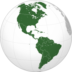
Orthographic map of the Americas with national borders added
Autor: No machine-readable author provided. Chixoy assumed (based on copyright claims)., Licence: CC BY-SA 3.0
View of Lachuà lake Street,Alta Verapaz,Guatemala
Autor: The Lilac Breasted Roller from Sullivan's Island, United States, Licence: CC BY 2.0
A scene from the rebel base of Yavin. Orginal description: I took this shot from the top of a temple at Tikal, Guatemala and knew it looked familar. When I got home and checked on the internet, I realized it was used in a scene in the first Star Wars movie as the base of the rebels before they attack the Death Star.


