Nejvyšší hory asijských zemí

#1 Mount Everest (Čína/Nepál)
#2 K2 (Pákistán)
#3 Kančendženga (Indie)
#11 Elbrus (Rusko)
#12 Damávand (Írán)
#14 Ararat (Turecko)
#22 Fudži (Japonsko)
#34 Pektusan (Severní Korea)
#38 Halla-san (Jižní Korea)

Seznam nejvyšších hor asijských zemí obsahuje seznam nejvyšších hor jednotlivých asijských zemí.

Kritéria použitá pro zařazení do seznamu jsou následující:

ZeměVýška#VrcholSouřadnice
Pohoří, poznámka
ČínaČína Čína (Tibet)8849 m1Mount Everest27°59′16″ s. š.,  86°56′40″ v. d. Himálaj; nejvyšší hora světa
NepálNepál Nepál8849 m1Mount Everest27°59′16″ s. š.,  86°56′40″ v. d. Himálaj; nejvyšší hora světa
PákistánPákistán Pákistán8611 m3K235°22′57″ s. š.,  76°30′48″ v. d. Karákóram
IndieIndie Indie8598 m4Kančendženga27°42′09″ s. š.,  88°08′54″ v. d. Himálaj
BhútánBhútán Bhútán7570 m5Gangkhar Puensum28°02′49″ s. š.,  90°27′18″ v. d. Himálaj; příp. Kula Kangri (7554 m)
TádžikistánTádžikistán Tádžikistán7495 m6Qullai Ismoili Somoni38°56′35″ s. š.,  72°00′58″ v. d. Pamír; sovětský název Pik Komunizma
AfghánistánAfghánistán Afghánistán7485 m7Nošak36°25′54″ s. š.,  71°49′42″ v. d. Hindúkuš
KyrgyzstánKyrgyzstán Kyrgyzstán7439 m8Džengiš Čokusu42°02′06″ s. š.,  80°07′32″ v. d. Ťan-šan; sovětský název Pik Pobedy
KazachstánKazachstán Kazachstán6995 m9Chan Tengri42°12′39″ s. š.,  80°10′30″ v. d. Ťan-šan
Myanmar (Barma)Myanmar (Barma) Myanmar (Barma)5881 m10Hkakabo Razi28°19′59″ s. š.,  97°28′00″ v. d. Himálaj
RuskoRusko Rusko5642 m11Elbrus43°21′18″ s. š.,  42°26′21″ v. d. Kavkaz
ÍránÍrán Írán5610 m12Damávand35°57′21″ s. š.,  52°06′31″ v. d. Alborz
GruzieGruzie Gruzie5193 m13Šchara42°59′58″ s. š.,  43°06′42″ v. d. Kavkaz
TureckoTurecko Turecko5137 m14Ararat39°42′07″ s. š.,  44°17′50″ v. d. Arménská vysočina
UzbekistánUzbekistán Uzbekistán4643 m15Khazret Sultan38°56′54″ s. š.,  68°10′20″ v. d. Pamír
ÁzerbájdžánÁzerbájdžán Ázerbájdžán4485 m16Bazardüzü41°13′28″ s. š.,  47°51′30″ v. d. Kavkaz
MongolskoMongolsko Mongolsko4374 m17Chüjtnij orgil49°08′47″ s. š.,  87°49′08″ v. d. Altaj
MalajsieMalajsie Malajsie4095 m18Mount Kinabalu 6°04′59″ s. š., 116°32′59″ v. d. Banjaran Crocker
ArménieArménie Arménie4090 m19Aragac40°30′50″ s. š.,  44°11′10″ v. d. Arménská vysočina
Tchaj-wanTchaj-wan Tchaj-wan3952 m20Jü-šan23°28′10″ s. š., 120°57′29″ v. d. Jü-šan šan-mo
IndonésieIndonésie Indonésie3805 m21Kerinci 1°41′48″ j. š., 101°15′56″ v. d. vyšší Puncak Jaya (4884 m) leží v Oceánii
JaponskoJaponsko Japonsko3776 m22Fudži35°21′29″ s. š., 138°43′52″ v. d. Japonské Alpy
JemenJemen Jemen3666 m23Nabí Šu'ajb15°16′30″ s. š.,  43°58′15″ v. d. Saravát
IrákIrák Irák3611 m24Cheekha Dar36°46′41″ s. š.,  44°55′07″ v. d. Zagros
VietnamVietnam Vietnam3143 m25Fan Si Pan22°18′12″ s. š., 103°46′30″ v. d. Hoàng Liên Sơn
TurkmenistánTurkmenistán Turkmenistán3139 m26Aýrybaba37°47′15″ s. š.,  66°33′24″ v. d. Pamír
Saúdská ArábieSaúdská Arábie Saúdská Arábie3133 m27Džabal Saudá18°16′02″ s. š.,  42°22′05″ v. d. Saravát
LibanonLibanon Libanon3088 m28Kurnat as-Saudá34°18′05″ s. š.,  36°06′54″ v. d. Libanon
OmánOmán Omán2980 m29Džabal aš-Šám23°14′13″ s. š.,  57°15′50″ v. d. Al-Hadžar
Východní TimorVýchodní Timor Východní Timor2963 m30Tatamailau 8°54′24″ j. š., 125°29′36″ v. d. Ramelau
FilipínyFilipíny Filipíny2954 m31Mount Apo 6°59′15″ s. š., 125°16′15″ v. d. Mindanao
LaosLaos Laos2819 m32Phou Bia18°58′53″ s. š., 103°09′04″ v. d. Annamnity
SýrieSýrie Sýrie2814 m33Hermon33°24′51″ s. š.,  35°51′26″ v. d. Antilibanon
Severní KoreaSeverní Korea Severní Korea2744 m34Pektusan42°00′20″ s. š., 128°03′19″ v. d. Päktu-tägan
ThajskoThajsko Thajsko2565 m35Doi Inthanon18°35′32″ s. š.,  98°29′12″ v. d. Shan Hills
Srí LankaSrí Lanka Srí Lanka2524 m36Pidurutalagala 7°00′03″ s. š.,  80°46′26″ v. d. Pidurutalagala
KyprKypr Kypr1952 m37Olympos34°56′12″ s. š.,  32°51′50″ v. d. Troodos
Jižní KoreaJižní Korea Jižní Korea1950 m38Halla-san33°21′44″ s. š., 126°32′10″ v. d. Halla
Spojené arabské emiráty Spojené arabské emiráty1910 m39Džabal Bil Ajs25°56′55″ s. š.,  56°10′09″ v. d. Al-Hadžar; vrchol hory (1934 m) je v Ománu
JordánskoJordánsko Jordánsko1854 m40Džabal Umm ad-Dámí29°18′30″ s. š.,  35°25′45″ v. d. Džabal aš-Šará
BrunejBrunej Brunej1850 m41Bukit Pagon 4°17′40″ s. š., 115°19′20″ v. d. Borneo
KambodžaKambodža Kambodža1813 m42Phnom Aural12°01′58″ s. š., 104°10′16″ v. d. Kardamomové hory
IzraelIzrael Izrael1208 m43Har Meron32°59′56″ s. š.,  35°24′43″ v. d. Horní Galilea
BangladéšBangladéš Bangladéš1052 m44Mowdok Mual21°47′19″ s. š.,  92°36′31″ v. d.
KuvajtKuvajt Kuvajt0306 m45bezejmenné místo29°07′00″ s. š.,  46°47′00″ v. d.
SingapurSingapur Singapur0163 m46Bukit Timah 1°21′17″ s. š., 103°46′35″ v. d.
BahrajnBahrajn Bahrajn0122 m47Džabal ad-Duchán26°02′20″ s. š.,  50°32′35″ v. d.
KatarKatar Katar0103 m48Kurajn Abú al-Baul24°56′46″ s. š.,  51°11′04″ v. d.
MaledivyMaledivy Maledivy0005 m49Mount Villingiliostrov Villingili

Mapa nejvyšších hor asijských zemí

0-1999 m   2000-3999 m   4000-5999 m   6000-8849 m

Související články

Externí odkazy


Média použitá na této stránce

Flag of Iran.svg
Flag of Iran. The tricolor flag was introduced in 1906, but after the Islamic Revolution of 1979 the Arabic words 'Allahu akbar' ('God is great'), written in the Kufic script of the Qur'an and repeated 22 times, were added to the red and green strips where they border the white central strip and in the middle is the emblem of Iran (which is a stylized Persian alphabet of the Arabic word Allah ("God")).
The official ISIRI standard (translation at FotW) gives two slightly different methods of construction for the flag: a compass-and-straightedge construction used for File:Flag of Iran (official).svg, and a "simplified" construction sheet with rational numbers used for this file.
Flag of Georgia (Pantone).svg
Georgian flag in Pantone MS.
Flag of Malaysia.svg
Flag of Malaysia – Jalur Gemilang (Stripes of Glory)
Flag of Indonesia.svg
bendera Indonesia
Flag of Laos.svg
Flag of Laos
Flag of the United Arab Republic.svg
Flag of Egypt (1958-1972) and flag of Syria (1958-1961) in the United Arab Republic. It also became the official flag of Syria since 1980.
Flag of the United Arab Republic (1958–1971).svg
Flag of Egypt (1958-1972) and flag of Syria (1958-1961) in the United Arab Republic. It also became the official flag of Syria since 1980.
Flag of Thailand.svg
The national flag of Kingdom of Thailand since September 2017; there are total of 3 colours:
  • Red represents the blood spilt to protect Thailand’s independence and often more simply described as representing the nation.
  • White represents the religion of Buddhism, the predominant religion of the nation
  • Blue represents the monarchy of the nation, which is recognised as the centre of Thai hearts.
Flag of Maldives.svg
Flag of Maldives. The colours used are Pantone 186 C for red and Pantone 348 C for green.
Asia on the globe (Asia centered).svg
Autor: Addicted04, Licence: CC BY-SA 3.0
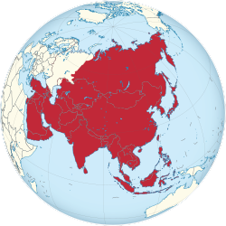
A map of the hemisphere centred on 95, 40, using an orthographic projection, created using gringer's Perl script with Natural Earth Data (1:50000 resolution, simplified to 0.25px). Asia is highlighted in red.
Asia laea relief location map.jpg
Autor: Uwe Dedering, Licence: CC BY-SA 3.0
Relief Location map of Asia.
  • Projection: Lambert azimuthal equal-area projection.
  • Area of interest:
  • N: 90.0° N
  • S: -10.0° N
  • W: 45.0° E
  • E: 145.0° E
  • Projection center:
  • NS: 40.0° N
  • WE: 95.0° E
  • GMT projection: -JA95/50/20.0c
  • GMT region: -R45.70461034279053/-25.193892806246794/-158.9850042825966/36.990936559512505r
  • GMT region for grdcut: -R-20.0/-26.0/205.0/90.0r
  • Relief: SRTM30plus.
  • Made with Natural Earth. Free vector and raster map data @ naturalearthdata.com.
Yellow pog.svg
Shiny yellow button/marker widget. Used to mark the location on a map.
Elbrus 2008.jpg
Mount Elbrus, Russia
K2 8611.jpg
Autor: Kogo, Licence: GFDL
K2 (Baltoro Muztagh, Central Karakoram, Pakistan)
White pog.svg
A white dot icon/button
Everest North Face toward Base Camp Tibet Luca Galuzzi 2006.jpg
(c) I, Luca Galuzzi, CC BY-SA 2.5
Mount Everest North Face as seen from the path to the base camp, Tibet (5,160 m).
Fuji Kawaguchi 357.JPG
Autor: Marion & Christoph Aistleitner, Licence: CC0
Mount Fuji above Lake Kawaguchi (Kawaguchi-ko) in Japan. January 19, 2014.

Baitou Mountain Tianchi.jpg
(c) Bdpmax, CC BY-SA 3.0
Nebeské jezero v kaldeře sopky Pektusan na hranicích mezi Čínskou lidovou republikou a Korejskou lidově demokratickou republikou
Brown 804000 pog.svg
Autor: One Salient Oversight, Licence: CC0
modded version of File:Blue_pog.svg
Green 008000 pog.svg
Autor: One Salient Oversight, Licence: CC0
Own work, based on Image:Blue_pog.svg (PD)
Kangch-Goechala.jpg
Autor: Ashinpt at enwiki, Licence: CC BY-SA 3.0
Picture of Kangchenjunga taken by author from Goecha La pass, 4940m, Sikkim. The peak in the image is actually the South peak of Kangchenjunga, which is about 400 ft lower than the main peak. You can also see the West peak of Kangchenjunga (Yalung Kang) as the round peak slightly to the left of the South Ridge (the ridge going left from the South peak).
Damavand in winter.jpg
Mount Damavand in winter, Iran.