Osmanský Alžír
| Regentství Alžír Dawlat al-Jazâ'ir دولة الجزائر
| |||||||||||||||||||||||||||||
| Motto الجزائر المحروسة | |||||||||||||||||||||||||||||
Geografie
| |||||||||||||||||||||||||||||
| Obyvatelstvo | |||||||||||||||||||||||||||||
cca 3–5 000 000 (rok 1808) | |||||||||||||||||||||||||||||
| Státní útvar | |||||||||||||||||||||||||||||
Vznik | |||||||||||||||||||||||||||||
Zánik | |||||||||||||||||||||||||||||
| Státní útvary a území | |||||||||||||||||||||||||||||
| |||||||||||||||||||||||||||||
Osmanský Alžír (arabsky الجزائر, Al-Jazâ'ir, počeštěle „al-Džazajr“), nepřesně Alžírsko, je historické pojmenování severoafrického státního útvaru v době 16. až 19. století, původně provincie (bejliku) Osmanské říše, od roku 1567 vazalského státu s vysokou mírou autonomie uznaného Osmanskou říší a nakonec (od roku 1710) samostatného státu (republiky) nezávislého na Osmanské říši. Rozkládalo se na území dnešní Alžírské republiky mezi osmanským regentstvím Tuniska na východě a sultanátem Maroko (od 1553) na západě. Alžírské regentství vzniklo po osmanské invazi v roce 1516, kdy bylo založeno korzárem Arujem Barbarossou. Zaniklo roku 1830, kdy bylo vojensky vyvráceno bourbonskou Francií a následně přeměněno na francouzskou kolonii Francouzské Alžírsko, která následně existovala až do roku 1962.
Pravým názvem celku bylo Regentství Alžír (arabsky دولة الجزائر, Dawlat al-Jazâ'ir) podle hlavního města Alžír (název „Alžírsko“ nebylo dosud známo, ani jako pojmenování severoafrické země).
Forma vlády
Regentství Alžír bylo po většinu času monarchií (sultanátem, bejlikem, poté pašalikem) a osmanskou provincií s proměnlivou formou vládnutí a autonomií k říši.
- sultanát (1516–1518) – vládl Aruj Barbarossa jako sultán
- bajlerbejlik (1518–1587) – administrativní celek větší rozlohy v Osmanské říši
- pašalik (1587–1659) – guvernérství Osmanské říše
- vojenská republika (1659–1830) – de facto nezávislý stát
Galerie
Symboly
Státní
- Znak
 první pol. 19. století
 do roku 1830
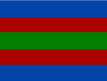
Arabské a francouzské zdroje se shodují na tom, že vlajka alžírského regentství byla červeno-zeleno-žlutá trikolóra, a to již od počátku existence státu, založeného Arujem Barbarossou, který byl osmanským korzárem.
Ostatní
- Vojenské prapory a jiné


- Námořní a obchodní prapory


Alžírští korzáři

- Prapory alžírských korzárů


Kozáři byli osmanského, alžírského i maghrebského původu, pocházeli tedy z různých zemí Severozápadní Afriky.
Externí odkazy
 Obrázky, zvuky či videa k tématu Osmanské Alžírsko na Wikimedia Commons
Média použitá na této stránce

Flag of Regency of Algiers


No official flag.

Regimental Flag of Algiers.

Autor: AliCyprus, Licence: CC BY-SA 4.0
Bandera de Hayreddin Barbarossa
.svg)
Autor: Askelaadden / Vektorizace: Mrmw, Licence: CC BY-SA 4.0
Source : - Corneille Trumelet, L' Algérie légendaire.1892.p:74-75. lire en ligne: [1]

Flag of the Regency of Algiers.
.svg)
Autor: Rayan54, Licence: CC BY-SA 4.0
Flag of Béjaïa between the 14th century and the 16th century, found in https://www.crwflags.com/fotw/flags/dz_pir.html. Based on flag depicted in the 14th-century Libro del conocimiento (Book of Knowledge of All Kingdoms).
-
 A survey of the flags used to mark the Emirate of Béjaïa on medieval European maps

_A4.svg)
(c) Reda Kerbouche, CC BY-SA 2.0
Pavillon de la Régence d'Alger (XVIIe-XVIIIe siècles)
.svg)
(c) Reda Kerbouche, CC BY-SA 2.0
Type of War Standard (Algiers)

Flag of the Zayyanid

Autor: AtlasDzMapper, Licence: CC BY-SA 3.0
Sources and Bibliography:
- Mahfoud Bennoune, The Making of Contemporary Algeria, 1830-1987, Cambridge University Press, 2002
- Charles Féraud, Histoire des sultans de Touggourt et du Sud Algérien, 2006, 162
- Histoire de l'Afrique septentrionale, Ernest MERCIER
- Voyage dans la Régence d’Alger, Dr. Shaw
- Carte des Régences d’Alger et de Tunis selon Dr. Shaw
- Historical Atlas of Islamic Word, Malise Ruthven and Azim Nanji
- African History in Maps, Michael_Kwamena-Poh, John_Tosh and Richard Waller
- History of the World Map, Peter Snow
- Atlas of Islamic, Peter Sluglett and Andrew Currie
- Histoire de l'Afrique du Nord : Des origines à 1830, JULIEN, Charles-André
- Philip's atlas of world history, Patrick O'Brien
- Work of Kayra Atakan (Qirim Xan’i) and his video « Türk Tarihi---History of Turks » ( https://www.youtube.com/watch?v=BwQINDPHbFk )
- Tachirifat de l’Eyalet et Fondation de la Régence d’Alger, traduction du livre «غزوات عروج وخير الدين » par Sander Rang et Ferdinand Denis
- Les Collections de l’Histoire, n°45 et n°63
- Atlas de l’Afrique, Le Jaguar 2009; divers cartes du site euratlas.net
- Atlas historique: L'histoire du monde, Duby George
- Revue Africaine
- Recherche sur l’Algérie à l’époque ottomane, Lemnouar Menouche
- Gens et choses de Colomb-Béchar (Sud Oranais) par L. Céard
- Wikipédia, Wikimédia common...et sites affiliée
- L’Histoire et le site lhistoire.fr et la carte https://www.lhistoire.fr/portfolio/carte-lempire-ottoman-xvie-xviiie-si%C3%A8cle
.svg)
Autor: Rayan54, Licence: CC BY-SA 4.0
Flag of Hafsid Tunisia according to Jacobo Russo (c.1550).

Autor: RootOfAllLight, Licence: CC BY-SA 4.0
The Barbary pirates, sometimes called Barbary corsairs or Ottoman corsairs, were Ottoman and Maghrebis pirates and privateers who operated from North Africa, based primarily in the ports of Salé, Rabat, Algiers, Tunis, and Tripoli. This area was known in Europe as the Barbary Coast, a term derived from the name of its Berber inhabitants. Their predation extended throughout the Mediterranean, south along West Africa's Atlantic seaboard and into the North Atlantic as far north as Iceland, but they primarily operated in the western Mediterranean. In addition to seizing merchant ships, they engaged in Razzias, raids on European coastal towns and villages, mainly in Italy, France, Spain, and Portugal, but also in the British Isles, the Netherlands, and as far away as Iceland. The main purpose of their attacks was to capture Christian slaves for the Ottoman slave trade as well as the general Arab slavery market in North Africa and the Middle East.
.svg)
Autor: Houmouvazine, Licence: CC BY-SA 4.0
Flag of the Algiers's Regency in 1541, during the Algiers expedition of Charles V
.svg)
(c) Reda Kerbouche, CC BY-SA 2.0
Type de pavillon maritime régence d'Alger

Autor: Kabyle20, Licence: CC BY-SA 3.0
Flag of Algier Regency. Own work based on :

Autor: Hierakares, Licence: CC BY-SA 3.0
The flag of the Emirate of Mascara, concepted by Emir Abd el-Kader, as displayed in the Abdelkader Museum in Miliana, Algeria. [1] [2]

Coat of arms of Algiers
.svg)
(c) Reda Kerbouche, CC BY-SA 2.0
Pavillon du day d'Alger
_A8.svg)
(c) Reda Kerbouche, CC BY-SA 2.0
Pavillon de la Régence d'Alger (XVIIe-XVIIIe siècles)
.svg)
A historical flag of Algeria, around 1700
_A3.svg)
(c) Reda Kerbouche, CC BY-SA 2.0
Pavillon de la Régence d'Alger (XVIIe-XVIIIe siècles)

Autor: AtlasDzMapper, Licence: CC BY-SA 3.0
Légendes:
  • En Orange Foncé: Elayet d’Algérie
  • En Orange: Régions vassales ou sous influence de l’Elayet d’Algérie
  • Cercle noir: Forts et Garnisons algériennes permanentes
Sources et Bibliographie :
• Charles Féraud, Histoire des sultans de Touggourt et du Sud Algérien, 2006, 162 • Histoire de l'Afrique septentrionale, Ernest MERCIER • Carte des Régences d’Alger et de Tunis selon Dr. Shaw • Voyage dans la Régence d’Alger, Dr. Shaw • Fondation de la Régence d’Alger, traduction du livre «غزوات عروج وخير الدين » par Sander Rang et Ferdinand Denis • Historical Atlas of Islamic Word, Malise Ruthven and Azim Nanji • African History in Maps, Michael_Kwamena-Poh, John_Tosh and Richard Waller • History of the World Map, Peter Snow • Atlas of Islamic, Peter Sluglett and Andrew Currie • Philip's atlas of world history, Patrick O'Brien • Work of Kayra Atakan [Qirim Xan’i] and his video « Türk Tarihi---History of Turks » (https://www.youtube.com/watch?v=BwQINDPHbFk) • Tachirifat de l’Eyalet • Les Collections de l’Histoire, n°45 et n°63; divers cartes du site euratlas.net • Atlas de l’Afrique, Le Jaguar 2009 • Atlas historique: L'histoire du monde, Duby George • Revue Africaine • Recherche sur l’Algérie à l’époque ottomane, Lemnouar Menouche • Gens et choses de Colomb-Béchar (Sud Oranais) par L. Céard • Wikipédia, Wikimédia common...et sites affiliée • L’Histoire et le site lhistoire.fr et la carte https://www.lhistoire.fr/portfolio/carte-lempire-ottoman-xvie-xviiie-si%C3%A8cle
English: Legends:
  • In Dark Orange: Elayet of Algeria
  • In Orange: Vassal region or under the influence of Elayet of Algeria
  • Black circle: Permanent Algerian Forts and Garnisons
•
.svg)
An Ottoman flag with an eight pointed star rather than the five pointed star which later became typical.
.svg)
(c) Reda Kerbouche, CC BY-SA 2.0
Algerian flag (Barbary ensign with the an Berberian head 2)

.svg)
Autor: Jasemesderfi, Licence: CC BY-SA 4.0
Coat of arms of Regency of Algiers (1710-1830)
.png)
Algerian Naval flag (flag of Algerian corsairs) before 1830 (according to K.-H. Hesmer)
_A5.svg)
(c) Reda Kerbouche, CC BY-SA 2.0
Pavillon de la Régence d'Alger (XVIIe-XVIIIe siècles)
_A9.svg)
(c) Reda Kerbouche, CC BY-SA 2.0
Pavillon de la Régence d'Alger (XVIIe-XVIIIe siècles)

Autor: Kabyle20, Licence: CC BY-SA 3.0
Flag in different painting about Algiers's ship from 18th to early 19th century reported by hukam.net[1].

Autor: Askelaadden (modifications by R Prazeres), Licence: CC BY-SA 4.0
General extent of Alawid territorial control and the territories of the Ottoman regencies in North Africa during the 17th to 19th centuries.
_A6.svg)
(c) Reda Kerbouche, CC BY-SA 2.0
Pavillon de la Régence d'Alger (XVIIe-XVIIIe siècles)
.svg)
Autor: Heralder, Licence: CC BY-SA 3.0
Royal Standard of the Crown of Castile (House of Habsburg Style)

.svg)
Flag of Algerian Land forces (Odjak of Algiers)