Přemyšlská země
| Přemyšlská země Ziemia przemyska Praemislia
| |||||||
geografie
| |||||||
rozloha: | 12 070 km² | ||||||
| obyvatelstvo | |||||||
počet obyvatel: | 32 měst a 980 vesnic (1676) | ||||||
| státní útvar | |||||||
administrativní celek polské konstituční monarchie | |||||||
| státní útvary a území | |||||||
| |||||||
Přemyšlská země (polsky Ziemia przemyska, latinsky Praemislia) byl administrativní celek Polského království s hlavním městem Přemyšl a jednou z pěti zemí v rámci Ruského vojvodství, země se nacházela na místě někdejšího Přemyšlského knížectví Kyjevské Rusi. Přemyšlská země byla v roce 1340 anektována Kazimírem Velikým a zůstala součástí polského státu v nezměněné podobě až do roku 1772, kdy se v důsledku prvního dělení Polska stala součástí Habsburské monarchie jako její provincie Halič.
Reference
V tomto článku byl použit překlad textu z článku Przemyśl Land na anglické Wikipedii.
Externí odkazy
 Obrázky, zvuky či videa k tématu Přemyšlská země na Wikimedia Commons
Média použitá na této stránce
Autor: Alex Tora, Licence: CC BY 3.0
Flags of Ruthenian lands in the battle of Tannenberg, 1410.
Sanok District Coat of Arms
Autor: Alex Tora, Licence: CC BY 3.0
Flags of Ruthenian lands in the battle of Tannenberg, 1410.
Banner of Kingdom of Poland in the 14th century
A seal of Duke Premislaus II from 1290 shows the ruler holding a banner emblazoned with a crowned eagle. During the reign of King Ladislaus (r. 1320–1333), the red cloth with the White Eagle was established as the royal banner. The orientation of the eagle on the banner varied; its head could point either upwards or towards the hoist.
Flag of historical region of Galicia and Lodomeria, in Central Europe.
Autor: Poznaniak, Licence: CC BY-SA 3.0
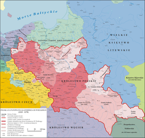
Map of Poland and territorial borders during the reign of Casimir III the Great (1333 - 1370)
Autor: KoziPLUS, Licence: CC BY-SA 4.0
Royal banner (not a flag) of the Polish-Lithuanian Commonwealth from 1569-1795
Autor: D T G, Licence: CC BY-SA 4.0
Land of Przemyśl In Poland before 1772, (thick black line) and 4 counties (thin black lines), and the state border after WW2 (red dotted line); borders are not precise, based on [1] and [2]


