Pic la Selle
| Pic la Selle | |
|---|---|
| Vrchol | 2680 m n. m. |
| Prominence | 2644 m |
| Izolace | 119 km |
| Seznamy | Ultraprominentní hory Nejvyšší hory amerických zemí |
| Poznámka | nejvyšší hora Haiti |
| Poloha | |
| Světadíl | Amerika |
| Stát | |
| Pohoří | Chaîne de la Selle |
| Souřadnice | 18°22′ s. š., 71°59′ z. d. |
| Některá data mohou pocházet z datové položky. | |
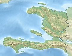
Pic la Selle (též Morne La Selle, haitsky Pik Lasel, 2680 m n. m.) je hora v pohoří Chaîne de la Selle na ostrově Hispaniola. Leží na území Haiti v departementu Ouest v arrondissementu Croix-des-Bouquets nedaleko hranic s Dominikánskou republikou. Nachází se v národním parku La Visite. Jedná se o nejvyšší horu Haiti, avšak nejvyšší horou ostrova je Pico Duarte.
Reference
V tomto článku byl použit překlad textu z článku Pic la Selle na polské Wikipedii.
Externí odkazy
Média použitá na této stránce
The national and official state flag of Haiti; arms obtained from File:Coat of arms of Haiti.svg. The civil flag can be found at here.
This is a solid red equilateral triangle, which can symbolize or indicate many things, including the the symbol for fire in the books by Franz Bardon.
Autor: Martin23230, Licence: CC BY-SA 3.0
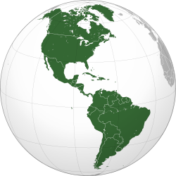
Orthographic map of the Americas with national borders added
Autor: Alexrk2, Licence: CC BY-SA 3.0
Physical Location map Haiti with departements, Equirectangular projection, N/S stretching 105 %. Geographic limits of the map:


