Pico Duarte
| Pico Duarte | |
|---|---|
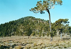
 Pico Duarte v roce 1986 | |
| Vrchol | 3098 m n. m. |
| Prominence | 3098 m ↓ Karibské moře |
| Izolace | 921 km → Sierra Nevada |
| Seznamy | Ultraprominentní hory Nejvyšší hory amerických zemí |
| Poznámka | nejvyšší hora Dominikánské republiky |
| Poloha | |
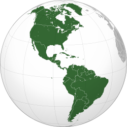
| Světadíl | Amerika |
| Stát | |
| Pohoří | Cordillera Central |
| Souřadnice | 19°1′59″ s. š., 71°0′19″ z. d. |
| Prvovýstup | 1851, Robert H. Schomburgk |
| Některá data mohou pocházet z datové položky. | |
Pico Duarte (3098 m n. m.) je hora v pohoří Cordillera Central na ostrově Hispaniola. Leží na území Dominikánské republiky v provincii San Juan. Jedná se o nejvyšší horu Dominikánské republiky a všech karibských ostrovů. Hispaniola je na šestnáctém místě v pořadí světových ostrovů podle nejvyššího bodu.[1]
Na vrchol jako první vystoupil v roce 1851 Sir Robert Hermann Schomburgk, britský konzul v Dominikánské republice. Hora je pojmenována podle Juana Pabla Duarteho, bojovníka za dominikánskou nezávislost, jehož busta se nachází na vrcholu. Za vlády Rafaela Trujilla nesla název Pico Trujillo.[2] Hora má dva vrcholy, Pelona Grande a Pelona Chica. V okolí hory byl vyhlášen národní park Josého Armanda Bermúdeze, kde roste endemický druh borovice Pinus occidentalis. Pramení zde řeky Río Yaque del Norte a Río Yaque del Sur.
Reference
V tomto článku byl použit překlad textu z článku Pico Duarte na polské Wikipedii.
- ↑ LAC Geographic Dostupné online
- ↑ The New York Times Style Magazine Dostupné online
Externí odkazy
 Obrázky, zvuky či videa k tématu Pico Duarte na Wikimedia Commons
 - Pico Duarte na SummitPost.org
- Pico Duarte na Peakware.com
- Pico Duarte na Peakbagger.com
Média použitá na této stránce
The flag of the Dominican Republic has a centered white cross that extends to the edges. This emblem is similar to the flag design and shows a bible, a cross of gold and 6 Dominican flags. There are branches of olive and palm around the shield and above on the ribbon is the motto "Dios,Patria!, Libertad" ("God, Country, Freedom") and to amiable freedom. The blue is said to stand for liberty, red for the fire and blood of the independence struggle and the white cross symbolized that God has not forgotten his people. "Republica Dominicana". The Dominican flag was designed by Juan Pablo Duarte, father of the national Independence of Dominican Republic. The first dominican flag was sewn by a young lady named Concepción Bona, who lived across the street of El Baluarte, monument where the patriots gathered to fight for the independence, the night of February 27th, 1844. Concepción Bona was helped by her first cousin María de Jesús Pina.
The flag of the Dominican Republic has a centered white cross that extends to the edges. This emblem is similar to the flag design and shows a bible, a cross of gold and 6 Dominican flags. There are branches of olive and palm around the shield and above on the ribbon is the motto "Dios,Patria!, Libertad" ("God, Country, Freedom") and to amiable freedom. The blue is said to stand for liberty, red for the fire and blood of the independence struggle and the white cross symbolized that God has not forgotten his people. "Republica Dominicana". The Dominican flag was designed by Juan Pablo Duarte, father of the national Independence of Dominican Republic. The first dominican flag was sewn by a young lady named Concepción Bona, who lived across the street of El Baluarte, monument where the patriots gathered to fight for the independence, the night of February 27th, 1844. Concepción Bona was helped by her first cousin María de Jesús Pina.
This is a solid red equilateral triangle, which can symbolize or indicate many things, including the the symbol for fire in the books by Franz Bardon.
Autor: Martin23230, Licence: CC BY-SA 3.0
Orthographic map of the Americas with national borders added
Autor: Adrian Michael, Licence: CC BY-SA 3.0
Pico Duarte in der Dominikanischen Republik, 1986
Autor: Alexrk2, Licence: CC BY-SA 3.0
Physical Location map Dominican Republic with Provinces, Equirectangular projection, N/S stretching 105 %. Geographic limits of the map:


