Portál:Geografie
Média použitá na této stránce
Aiguille-du-Midi-summer.jpg
(c) Martin Janner, CC BY-SA 3.0
Aiguille du Midi ( altitude 3 842 m), Chamonix, in summer, in the Mont-Blanc massif, Auvergne-Rhône-Alpes region, France
(c) Martin Janner, CC BY-SA 3.0
Aiguille du Midi ( altitude 3 842 m), Chamonix, in summer, in the Mont-Blanc massif, Auvergne-Rhône-Alpes region, France
Foz do Arelho MAR07-1.JPG
Autor: Alvesgaspar, Licence: CC BY-SA 2.5
Foz do Arelho, west coast of Portugal.
Autor: Alvesgaspar, Licence: CC BY-SA 2.5
Foz do Arelho, west coast of Portugal.
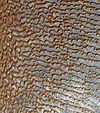
Rub' al Khali (Arabian Empty Quarter) sand dunes imaged by Terra (EOS AM-1).jpg
Image of sand dunes in Rub' al Khali, Arabia's "empty quarter". Acquired by the Advanced Spaceborne Thermal Emission and Reflection Radiometer, or ASTER, aboard NASA's Terra Earth-orbiting satellite.
Image of sand dunes in Rub' al Khali, Arabia's "empty quarter". Acquired by the Advanced Spaceborne Thermal Emission and Reflection Radiometer, or ASTER, aboard NASA's Terra Earth-orbiting satellite.
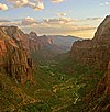
Zion angels landing view.jpg
Autor: Diliff, Licence: CC BY-SA 3.0
Zion Canyon at sunset in Zion National Park as seen from Angels Landing looking south.
Autor: Diliff, Licence: CC BY-SA 3.0
Zion Canyon at sunset in Zion National Park as seen from Angels Landing looking south.
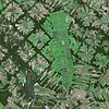
Vosges Mountains SPOT 1308.jpg
Autor: Cnes - Spot Image, Licence: CC BY-SA 3.0
Vosges Mountains by SPOT Satellite
Autor: Cnes - Spot Image, Licence: CC BY-SA 3.0
Vosges Mountains by SPOT Satellite
München - Ludwigsvorstadt (Luftbild).jpg
Autor: Maximilian Dörrbecker (Chumwa), Licence: CC BY-SA 2.5
Luftbild der Münchner Ludwigsvorstadt mit der Altstadt im Hintergrund
Autor: Maximilian Dörrbecker (Chumwa), Licence: CC BY-SA 2.5
Luftbild der Münchner Ludwigsvorstadt mit der Altstadt im Hintergrund
Santa Cruz de la Sierra SPOT 1224.jpg
Autor: Cnes - Spot Image, Licence: CC BY-SA 3.0
Santa Cruz de la Sierra by SPOT Satellite
Autor: Cnes - Spot Image, Licence: CC BY-SA 3.0
Santa Cruz de la Sierra by SPOT Satellite
Phoenix, Arizona SPOT 1316.jpg
Autor: Cnes - Spot Image, Licence: CC BY-SA 3.0
Phoenix, Arizona by SPOT Satellite
Autor: Cnes - Spot Image, Licence: CC BY-SA 3.0
Phoenix, Arizona by SPOT Satellite
Wolf Trap (national park) meadow pavilion.jpg
Autor: Gregory F. Maxwell <gmaxwell@gmail.com> PGP:0xB0413BFA, Licence: GFDL 1.2
Meadow Pavilion at Wolf Trap National park as seen from Wolf Trap Run.
Autor: Gregory F. Maxwell <gmaxwell@gmail.com> PGP:0xB0413BFA, Licence: GFDL 1.2
Meadow Pavilion at Wolf Trap National park as seen from Wolf Trap Run.
Pagramantis.jpg
Autor: Julius (User:Juliux), Licence: CC BY-SA 3.0
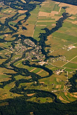
Bird's Eye view of Pagramantis, Lithuania
Autor: Julius (User:Juliux), Licence: CC BY-SA 3.0
Bird's Eye view of Pagramantis, Lithuania
Teshekpuk.ASTER.2000-08-15.jpg
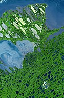
False-color image of w:Teshekpuk Lake (left side of image) and the w:Alaska North Slope. Green indicates vegetation and blue indicates water. Some bodies of water also appear in off-white or yellowish, probably due to different amounts of sediment in the water and/or the sun angle. The Beaufort Sea is at the top of the scene. The image covers an area of 58.7 by 89.9 kilometers, and is centered near 70.4 degrees North latitude, 153 degrees West longitude.
False-color image of w:Teshekpuk Lake (left side of image) and the w:Alaska North Slope. Green indicates vegetation and blue indicates water. Some bodies of water also appear in off-white or yellowish, probably due to different amounts of sediment in the water and/or the sun angle. The Beaufort Sea is at the top of the scene. The image covers an area of 58.7 by 89.9 kilometers, and is centered near 70.4 degrees North latitude, 153 degrees West longitude.
Sea of Galilee SPOT 1129.jpg
Autor: Cnes - Spot Image, Licence: CC BY-SA 3.0
Sea of Galilee by SPOT Satellite
Autor: Cnes - Spot Image, Licence: CC BY-SA 3.0
Sea of Galilee by SPOT Satellite
Surf August 2008-1.jpg
Autor: Alvesgaspar, Licence: CC BY-SA 4.0
Waves breaking at Porto Covo, west coast of Portugal
Autor: Alvesgaspar, Licence: CC BY-SA 4.0
Waves breaking at Porto Covo, west coast of Portugal
STS059-238-074 Strait of Gibraltar.jpg
The Strait of Gibraltar provides a natural physical barrier between the countries of Spain (north) and Morocco (south). In geologic terms, the 10-mile (16-kilometer) strait that separates the two countries, as well as Europe and Africa, is located where the two major tectonic plates—the Eurasian Plate and the African Plate—collide. This high-oblique, northeast-looking photograph shows the mountainous northern coast of Morocco and the coastal mountains of southern Spain, including the dagger-shaped, snow-covered Sierra Nevada Mountains of southeastern Spain. The Guadalquivir River flows from east to west along the base of the Sierra Morena Mountains in southern Spain. The famous British city of Gibraltar is located on the wedge-shaped peninsula on the east side of the bay in the southernmost protrusion of Spain. The city of Ceuta is a Spanish enclave on the extreme northeastern coast of Morocco. Ceuta, a free port with a large harbor, has remained under Spanish control since 1580.
The Strait of Gibraltar provides a natural physical barrier between the countries of Spain (north) and Morocco (south). In geologic terms, the 10-mile (16-kilometer) strait that separates the two countries, as well as Europe and Africa, is located where the two major tectonic plates—the Eurasian Plate and the African Plate—collide. This high-oblique, northeast-looking photograph shows the mountainous northern coast of Morocco and the coastal mountains of southern Spain, including the dagger-shaped, snow-covered Sierra Nevada Mountains of southeastern Spain. The Guadalquivir River flows from east to west along the base of the Sierra Morena Mountains in southern Spain. The famous British city of Gibraltar is located on the wedge-shaped peninsula on the east side of the bay in the southernmost protrusion of Spain. The city of Ceuta is a Spanish enclave on the extreme northeastern coast of Morocco. Ceuta, a free port with a large harbor, has remained under Spanish control since 1580.


