Santiago de los Caballeros
| Santiago de los Caballeros | |
|---|---|
| Poloha | |
| Souřadnice | 19°27′ s. š., 70°42′ z. d. |
| Nadmořská výška | 175 m n. m. |
| Stát | |
| Rozloha a obyvatelstvo | |
| Rozloha | 524,0 km² |
| Počet obyvatel | 1 343 423 (2021) |
| Hustota zalidnění | 2 563,7 obyv./km² |
| Správa | |
| Vznik | 1495 |
| Oficiální web | santiagodeloscaballeros |
| Některá data mohou pocházet z datové položky. | |
Santiago de los Caballeros je správní centrum provincie Santiago a druhé největší město Dominikánské republiky, má přes půl milionu obyvatel (s aglomerací 690 000). Nachází se na severu země v údolí Cibao a protéká jím řeka Río Yaque del Norte. Pro svoji vnitrozemskou polohu je nazýváno Ciudad Corazón (Město srdce).
Město založil roku 1495 Bartoloměj Kolumbus na místě zvaném Jacagua, prvními osadníky byli příslušníci Řádu svatojakubských rytířů, proto dostalo název Santiago de los Treinta Caballeros (Svatý Jakub třiceti rytířů), což se později zkrátilo na Santiago de los Caballeros nebo Santiago; je nejstarším z měst na americkém kontinentu pojmenovaných podle Jakuba Většího. Roku 1562 bylo město poničeno zemětřesením a přestěhovalo se do stávající lokality. Dne 30. března 1844 zde proběhla významná bitva, v níž dominikánská armáda porazila Haiťany. Město má tropické klima a je známé výrobou doutníků, důležitý je i potravinářský, dřevozpracující a textilní průmysl. Sídlí zde Santiagská technická univerzita. Pamětihodnostmi Santiaga jsou historické centrum s radnicí a katedrálou, pevnost San Luis a velký pomník na kopci nad městem, jehož stavbu nařídil diktátor Rafael Trujillo a po jeho svržení byl věnován hrdinům války za nezávislost z let 1863–65.
Externí odkazy
 Obrázky, zvuky či videa k tématu Santiago de los Caballeros na Wikimedia Commons
 - Ayuntamineto de Santiago Archivováno 28. 4. 2017 na Wayback Machine
- El Caribe
- Encyclopedia Britannica
Média použitá na této stránce
Autor: Cheposo, Licence: CC0
Escudo de Santiago de los Caballeros
The flag of the Dominican Republic has a centered white cross that extends to the edges. This emblem is similar to the flag design and shows a bible, a cross of gold and 6 Dominican flags. There are branches of olive and palm around the shield and above on the ribbon is the motto "Dios,Patria!, Libertad" ("God, Country, Freedom") and to amiable freedom. The blue is said to stand for liberty, red for the fire and blood of the independence struggle and the white cross symbolized that God has not forgotten his people. "Republica Dominicana". The Dominican flag was designed by Juan Pablo Duarte, father of the national Independence of Dominican Republic. The first dominican flag was sewn by a young lady named Concepción Bona, who lived across the street of El Baluarte, monument where the patriots gathered to fight for the independence, the night of February 27th, 1844. Concepción Bona was helped by her first cousin María de Jesús Pina.
(c) Lacreta na projektu Wikipedie v jazyce angličtina, CC BY-SA 3.0
Santiago City seen from the HOMS (10th floor) (Own work)
Autor: Alexrk2, Licence: CC BY-SA 3.0
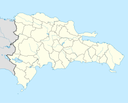
Location map Dominican Republic with Provinces, Equirectangular projection, N/S stretching 105 %. Geographic limits of the map:


