Sardašt
| Sardašt سردشت | |
|---|---|
(c) auoob farabi, CC BY-SA 3.0 Náměstí v Sardaštu | |
| Poloha | |
| Souřadnice | 36°9′ s. š., 45°28′48″ v. d. |
| Nadmořská výška | 1300 m n. m. |
| Stát | |
| provincie | Západní Ázerbájdžán |
| Rozloha a obyvatelstvo | |
| Počet obyvatel | 46 412 (2016) |
| Některá data mohou pocházet z datové položky. | |
Sardašt (persky سردشت. kurdsky Serdeşt, سهردهشت) je hlavní město Sardaštského kraje v íránské provincii Západní Ázerbájdžán. Nachází se jihozápadně od Urmijského jezera, asi deset kilometrů od hranice s iráckou provincií Sulejmánie. Podle sčítání lidu z roku 2016 má město 46 000 obyvatel a dominantní národností ve městě jsou Kurdové.[1]
Roku 1987 bylo město během irácko-íránské války jako první masivně napadeno chemickými zbraněmi. Na následky útoku zemřelo 10 lidí a více než 600 bylo vážně postiženo.[2]
Odkazy
Reference
- ↑ The population development of Sardasht
- ↑ Iranian Chemical Attacks Victims. www.payvand.com [online]. [cit. 2018-09-12]. Dostupné v archivu pořízeném z originálu dne 2011-05-22.
Externí odkazy
 Obrázky, zvuky či videa k tématu Sardašt na Wikimedia Commons
 - (anglicky) Serdeşt was the first Kurdish city where became the target of chemical bombs
- (anglicky) Sardasht, a scenic city – Iran Daily
Média použitá na této stránce
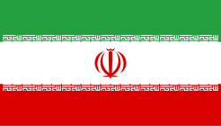
Flag of Iran. The tricolor flag was introduced in 1906, but after the Islamic Revolution of 1979 the Arabic words 'Allahu akbar' ('God is great'), written in the Kufic script of the Qur'an and repeated 22 times, were added to the red and green strips where they border the white central strip and in the middle is the emblem of Iran (which is a stylized Persian alphabet of the Arabic word Allah ("God")).
The official ISIRI standard (translation at FotW) gives two slightly different methods of construction for the flag: a compass-and-straightedge construction used for File:Flag of Iran (official).svg, and a "simplified" construction sheet with rational numbers used for this file.
Autor: Uwe Dedering, Licence: CC BY-SA 3.0
Location map of Iran.
Equirectangular projection. Stretched by 118.0%. Geographic limits of the map:
* N: 40.0° N
* S: 24.5° N
* W: 43.5° E
* E: 64.0° E
Made with Natural Earth. Free vector and raster map data @ naturalearthdata.com.


