Savojské hrabství
| Savojské hrabství Grafschaft Savoyen (de) Comté de Savoie (fr) Contea di Savouè (frp) Contà 'd Savòja (pms) Contea di Savoia (it)
| |||||||
Geografie
| |||||||
| Obyvatelstvo | |||||||
| Státní útvar | |||||||
feudální dědičná monarchie | |||||||
| Státní útvary a území | |||||||
| |||||||
Savojské hrabství (francouzsky Comté de Savoie, italsky Contea di Savoia) byl politický útvar po většinu svého trvání zapojený v rámci Svaté říše římské. Existoval mezi roky 1003 a 1416 a byl řízen panovníky ze savojské dynastie. Vznikl stejně jako svobodné švýcarské obce vydělením z Arelatského království v 11. století a jeho prvním hrabětem a zakladatelem dynastie byl Humbert I. Zanikl tím, že byl povýšen na Savojské vévodství císařem Zikmundem Lucemburským, který udělil titul vévody Amadeovi VIII. Savojskému.
Symbolika
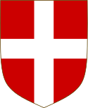
- starý znak savojských hrabat
- novější znak savojských
- savojští na znamení věrnosti k Říši používali císařskou zástavu
Reference
Externí odkazy
 Obrázky, zvuky či videa k tématu Savojské hrabství na Wikimedia Commons
Média použitá na této stránce
Autor: MostEpic, Licence: CC BY-SA 4.0
Coat of arms of the house of Savoy (Ancient)
Autor: Pce13, Licence: CC BY-SA 4.0
Armoiries attribuées au Royaume d'Arles par des héraldistes médiévaux (XVe s.) ː "D'or à deux pals de gueule".
Autor:
- derivative work: Fry1989
Shield of the coat of arms of the Kingdom of Italy and of the Royal House of Savoy.
Autor: Alphathon /ˈæɫfə.θɒn/ (talk), Licence: CC BY-SA 4.0
A map of the County of Savoy and its possessions within the Holy Roman Empire during the time of the Hohenstaufen Emperors. The highlighted area shows the rest of the Kingdom of Arles/Burgundy. Note that some of Savoy's territory lies outside of that kingdom (instead being part of the the Kingdom of Italy). Note that while it uses the same scheme as standard location/locator maps, this map technically does not conform to the standard, as it is not in equirectangular projection. Therefore grid lines for latitude and longitude are also included on the sub-map.
State Flag of the Savoyard States (late 16th - late 18th century).
Autor: Vlastní dílo, Ronald Preuss (eagle), Licence: CC BY-SA 4.0
Royal banner (Königsbanner) of the German kings and emperors in the early to mid 14th century. The upright rectangular shape of the field approximates the proportions of 14th-century military banners, see e.g. File:Codex Balduini Trevirensis - Alpenüberquerung Heinrich VII.JPG


