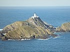
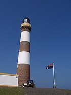
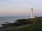
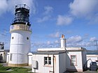
Seznam majáků ve Skotsku
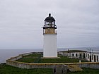
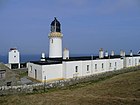
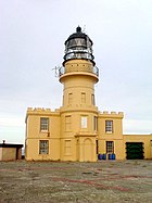
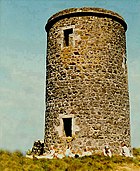
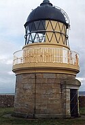
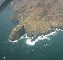
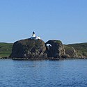
Toto je seznam majáků ve Skotsku. Za většinu majáků ve Skotsku odpovídá Rada severní majáků (Northern Lighthouse Board), z níž pochází většina informací[1], ale odpovědnost za majáky v hlavních ústích řek předala přístavním úřadům. Mnohé z menších světelných zdrojů zde nejsou uvedeny. Maják, který již není v provozu, je označen datem uzavření ve sloupci Ve správě/ Uzavřen. Pokud jsou uvedena dvě data, maják byl přestavěn.
Téměř všechny majáky v tomto seznamu navrhly a většinu z nich postavily čtyři generace jedné rodiny, včetně Thomase Smithe, který byl nevlastním otcem i tchánem Roberta Stevensona. Robertovi synové a vnuci nejenže postavili většinu majáků, často v těch nejhorších podmínkách, ale byli také průkopníky mnoha vylepšení osvětlení a signalizace, která snížila obrovské ztráty na životech při lodní dopravě kolem skotského pobřeží.[2][3]
Seznam majáků ve Skotsku
| Název majáku | Obrázek | Souřadnice | Ostrov/Pevnina | Rok výstavby | Architekt/Stavitel | Ve správě/ Uzavřen | Výška majáku [m] | Výška světla [m n. m.] | Dosvit [nm (km)] | Charakteristika | Poznámka Zdroj | |
|---|---|---|---|---|---|---|---|---|---|---|---|---|
| 1 | Ailsa Craig | (c) James T M Towill, CC BY-SA 2.0 | Jižní Ayrshire | Ailsa Craig | 1886 | Thomas Stevenson, David A Stevenson | Northern Lighthouse Board | 11 | 18 | 17 (31) | Fl W 4s | památka kategorie B[4] |
| 2 | Ardnamurchan |  | Highland | pevnina | 1849 | Alan Stevenson | Northern Lighthouse Board | 35 | 55 | 22 (44) | Fl (2) W 20s | památka kategorie A[7] |
| 3 | Auskerry | (c) Ian Balcombe, CC BY-SA 2.0 | Orkneje | Auskerry | 1866 | David Stevenson, Thomas Stevenson | Northern Lighthouse Board | 34 | 34 | 20 (37) | Fl W 20s | památka kategorie B[9] |
| 4 | Barns Ness | (c) Steve F, CC BY-SA 2.0 | East Lothian | pevnina | 1899 | David A Stevenson, Charles A Stevenson | deaktivován 2005 | 37 | 36 | 10 (19) | Iso W 4s | památka kategorie B[11] |
| 5 | Barra Head | (c) Bob Jones, CC BY-SA 2.0 | Vnější Hebridy | Barra Head | 1833 | Robert Stevenson | Northern Lighthouse Board | 18 | 208 | 18 (33) | Fl W 15s | památka kategorie A[13] |
| 6 | Bass Rock |  | East Lothian | Bass Rock | 1902 | David Stevenson | Northern Lighthouse Board | 20 | 46 | 10 (19) | Fl (3) W 20s | památka kategorie C |
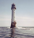
| 7 | Bell Rock | (c) Derek Robertson, CC BY-SA 2.0 | Angus | Inchcape | 1810 | Robert Stevenson | Northern Lighthouse Board | 36 | 28 | 18 (33) | Fl W 5s | památka kategorie A |
| 8 | Bressay |  | Shetlandy | Bressay | 1858 | David Stevenson, Thomas Stevenson | Northern Lighthouse Board (do roku 2012), Lerwick Port Authority (od 2012) | 16 | 32 | 23 (43), 10 (19) | Fl(2) W 20s | [18] |
| 9 | Brough of Birsay | (c) Rob Burke, CC BY-SA 2.0 | Orkneje | Brough of Birsay | 1925 | David Alan Stevenson | Northern Lighthouse Board | 11 | 52 | 18 (33) | FI(3) W 25s | [19][20] |
| 10 | Buchan Ness | (c) Richard Slessor, CC BY-SA 2.0 | Aberdeenshire | pevnina | 1827 | Robert Stevenson | Northern Lighthouse Board | 35 | 40 | 18 (33) | Fl W 5s. | památka kategorie A |
| 11 | Butt of Lewis | (c) Rob Burke, CC BY-SA 2.0 | Vnější Hebridy | poloostrov Lewis | 1862 | David Stevenson | Northern Lighthouse Board | 37 | 52 | 25 (46) | Fl W 5s. | [23] |
| 12 | Cantick Head | (c) Calum McRoberts, CC BY-SA 2.0 | Orkneje | South Walls | 1858 | David Stevenson, Thomas Stevenson | Northern Lighthouse Board | 22 | 35 | 13 (24), 18 (33) | Fl W 20s. | [24][25] |
| 13 | Cape Wrath | (c) Anne Burgess, CC BY-SA 2.0 | Highland | pevnina | 1828 | Robert Stevenson | Northern Lighthouse Board | 20 | 122 | 22 (41) | Fl (4) W 30s. | [26] |
| 14 | Chanonry |  | Highland, Fortrose | poloostrov Black Isle | 1846 | Alan Stevenson | Northern Lighthouse Board | 13 | 12 | 15 (28) | Oc W 6s. | památka kategorie A.[27] |
| 15 | Cloch | (c) Tom Caldwell, CC BY-SA 2.0 | Inverclyde | pevnina | 1797 | Thomas Smith, Robert Stevenson | Clyde Port Authority | 23 | 24 | 8 (15) | Fl. W 3s. | [29] |
| 16 | Copinsay | (c) Dave Simpson, CC BY-SA 2.0 | Orkneje | Copinsay | 1915 | David A Stevenson | Northern Lighthouse Board | 16 | 79 | 21 (39) | FI(5) W 30s | památka kategorie B |
| 17 | Corran Point | Highland | pevnina | 1817 | Thomas Smith, Robert Stevenson | Northern Lighthouse Board | 13 | 12 | 10 (19 bílá, 7 (13) červená a zelená | Iso WRG 4s. | [31][32] | |
| 18 | Corsewall | (c) Mary and Angus Hogg, CC BY-SA 2.0 | Dumfries a Galloway | pevnina | 1817 | Robert Stevenson | Northern Lighthouse Board | 34 | 34 | 22 (44) | Fl (5) W 30s | [33][34] |
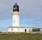
| 19 | Covesea Skerries |  | Moray, Lossiemouth and Branderburgh | pevnina | 1846 | Alan Stevenson | Northern Lighthouse Board do 2012 | 36 | 49 | 24 (44) bílá, 20 (37) červená | Fl WR 20s. | [35] |
| 20 | Crammag Head | 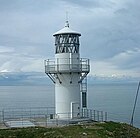 | Dumfries a Galloway | pevnina | 1913 (2009)[36] | David A Stevenson | Northern Lighthouse Board | 7 | 35 | 18 (33) | Fl W 10s. | [37][38] |
| 21 | Cromarty | (c) Michael Shepherd, CC BY-SA 2.0 | Highland | pevnina | 1846 | Alan Stevenson | deaktivován 2006[39] | 13 | 18 | 15 (28) bílá. 11 () červená | Oc WR 10s | památka kategorie A |
| 22 | Davaar | (c) Leslie Barrie, CC BY-SA 2.0 | Argyll a Bute | Davaar | 1854 | David Stevenson, Thomas Stevenson a John Barr & Co | Northern Lighthouse Board | 20 | 37 | 23 (43) | FI(2) W 10s. | [41][42] |
| 23 | Dubh Artach | (c) Donald MacDonald, CC BY-SA 2.0 | Argyll a Bute | Dubh Artach | 1872 | Thomas Stevenson | Northern Lighthouse Board | 38 | 44 | 20 (37) | Fl(2) W 30s | [43][44][45] |
| 24 | Duncansby Head | (c) Chris Downer, CC BY-SA 2.0 | Highland | pevnina | 1924 | David A Stevenson | Northern Lighthouse Board | 11 | 67 | 22 (41) | Fl W 12 s | [46] |
| 25 | Dunnet Head | (c) Jonathan Billinger, CC BY-SA 2.0 | Highland | pevnina | 1831 | Robert Stevenson | Northern Lighthouse Board | 20 | 105 | 23 (43) | Fl(4) W 30s | [47] |
| 26 | Eilean Glas | (c) simon stewart, CC BY-SA 2.0 | Vnější Hebridy | Scalpay | 1789 | Thomas Smith | Northern Lighthouse Board | 30 | 43 | 23 (43) | Fl (3) W 20s. | [48] |
| 27 | Elie Ness | (c) Jim Bain, CC BY-SA 2.0 | Fife | pevnina | 1908 | James Laurie | Forth Ports | 11 | 15 | 17 (31) | Fl W 6s | památka kategorie C[49] |
| 28 | Esha Ness |  | Shetlandy | Mainland (Shetlandy) | 1925 | David A Stevenson | Northern Lighthouse Board | 12 | 61 | 25 (46) | Fl W 12s | [52] |
| 29 | Fair Isle North | (c) Alan Reid, CC BY-SA 2.0 | Shetlandy | Fair Isle | 1892 | David A Stevenson, Charles A Stevenson | Northern Lighthouse Board | 14 | 80 | 22 (41) | FI(2) W 30s | |
| 30 | South | (c) Ron Ireland, CC BY-SA 2.0 | Shatlandy | Fair Isle | 1892 | David A Stevenson, Charles A Stevenson | Northern Lighthouse Board | 26 | 32 | 22 (41) | FI(2) W 30s | [53] |
| 31 | Fidra |  | East Lothian | Fidra | 1885 | David A Stevenson, Thomas Stevenson | Forth Ports | 17 | 12 | 15 (28) | Fl(4) W 30s | památka kategorie C |
| 32 | Fife Ness | (c) Anne Burgess, CC BY-SA 2.0 | Fife | pevnina | 1975 | Peter H. Hyslop | Northern Lighthouse Board | 5 | 12 | 21 (39) bílá, 20 (37) červená | Iso WR 10s. | [55] |
| 33 | Firths Voe | (c) Mike Pennington, CC BY-SA 2.0 | Shetlandy | Mainland (Shetlandy) | 1909 | David A Stevenson | Northern Lighthouse Board | 9 | 9 | 15 (28) bílá. 10 (19) zelená, 10 (19) červená | Oc WRG 8s | [56] |
| 34 | Flannan Isles | (c) JJM, CC BY-SA 2.0 | Vnější Hebridy | Eilean Mòr | 1899 | David A Stevenson | Northern Lighthouse Board | 23 | 101 | 20 (37) | Fl (2) W 30s. | |
| 35 | Foula | (c) Julian Paren, CC BY-SA 2.0 | Shetlandy | Foula | 1986 | James Johnson | Northern Lighthouse Board | 8 | 36 | 18 (33) | FI(3) W 15s | [57] |
| 36 | Girdleness |  | Aberdeen City | pevnina | 1833 | Robert Stevenson | Northern Lighthouse Board | 37 | 56 | 22 (41) | Fl(2) W 20s. | památka kategorie A [58] [59] |
| 37 | Holburn Head |  | Highland | pevnina | 1862 | David Stevenson, Thomas Stevenson | deaktivován 2003 | 17 | 23 | 15 (28) | Fl WR 10s | [60] |
| 38 | Holy Isle Inner | (c) L J Cunningham, CC BY-SA 2.0 | Severní Ayrshire | Holy Island | 1877 | David Stevenson, Thomas Stevenson | Northern Lighthouse Board | 17 | 14 | 6 (11) | FI G 3s | [61] |
| 39 | Holy Isle Outer |  | Severní Ayrshire | Holy Island | 1905 | David Stevenson, Thomas Stevenson | Northern Lighthouse Board | 23 | 38 | 25 (46) | FI(2) W 20s | [62] |
| 40 | Hoxa Head | (c) Bill Boaden, CC BY-SA 2.0 | Orkneje | South Ronaldsay | 1901 1996 | David A Stevenson | Northern Lighthouse Board | 7 | 15 | 9 (17) bílá), 6 (11) červená) | FI WR 3s[63] | [64][65][66] |
| 41 | Hoy Sound High | (c) Fabio Sassi, CC BY-SA 2.0 | Orkneje | Graemsay | 1851 | Alan Stevenson | Northern Lighthouse Board | 33 | 35 | 20(37) bíá.16 (30) červená | Oc WR 8s | |
| 42 | Hoy Sound Low | (c) Fabio Sassi, CC BY-SA 2.0 | Orkneje | Graemsay | 1851 | Alan Stevenson | Northern Lighthouse Board | 12 | 17 | 12 (22) | Iso W 3s | |
| 43 | Hyskeir | (c) Fin'n'Liz, CC BY-SA 2.0 | Highland | Hyskeir | 1904 | David A Stevenson, Charles A Stevenson | Northern Lighthouse Board | 39 | 41 | 24 (44) | Fl (3) W 30s. | [67] |
| 44 | Inchkeith | (c) ronnie leask, CC BY-SA 2.0 | Fife | Inchkeith | 1804 | Thomas Smith, Robert Stevenson | Forth Ports (od června 2013), Northern Lighthouse Board (od 1804 do června 2013) | 19 | 67 | 14 (26) | Fl W 15s. | [68] |
| 45 | Isle of May |  | Fife | Isle of May | 1816 | Robert Stevenson | Northern Lighthouse Board | 24 | 73 | 22 (41) | Fl(2) W 15s | |
| 46 | Isle of May Low |  | Fife | Isle of May | 1843 | Robert Stevenson | deaktivovám 1887 | 12 | [69] | |||
| 47 | Old Isle of May | (c) John McMillan, CC BY-SA 2.0 | Fife | Isle of May | 1636 1635 | James Maxwell, 1st Earl of Dirletoun | [70] | |||||
| 48 | Killantringan | (c) David Dixon, CC BY-SA 2.0 | Dumfries a Galloway 54°51′42,37″ s. š., 5°8′48,84″ z. d. | pevnina | 1900 | David A Stevenson | deaktivován 2007 | 22 | 49 | 25 (46) | FI(2) W 15s | [71] |
| 49 | New Kinnaird Head | (c) Luca Sironi, CC BY 3.0 | Aberdeenshire | pevnina | 1991 | Northern Lighthouse Board | 10 | 25 | 22 (41) | Fl W 5s | [72] | |
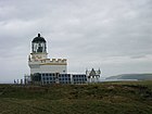
| 50 | Kinnaird Head |  | Aberdeenshire | pevnina | 1787 | Thomas Smith | Northern Lighthouse Board (od 1787 do 1991), Museum of Scottish Lighthouses (od 1991) | 22 | W Fl 15s | |||
| 51 | Lady Isle |  | Jižní Ayrshire | ostrov Lady | 1903 | David A Stevenson | Northern Lighthouse Board | 15 | 19 | 11 (20) | Fl (4) W 30 s | [73][74][75] |
| 52 | Lismore |  | Argyll a Bute | Eilean Musdile | 1833 | Robert Stevenson | Northern Lighthouse Board | 26 | 31 | 17 /31) | Fl W 10s. | [76] |
| 53 | Little Cumbrae Old | (c) Raibeart MacAoidh, CC BY-SA 2.0 | Severní Ayrshire | Little Cumbrae Island | 1757 | James Ewing | 1757–1793 | 8,5 | [77] | |||
| 54 | Cumbrae | (c) Doug Lee, CC BY-SA 2.0 | Severní Ayrshire | Little Cumbrae Island | 1793 | Thomas Smith | Northern Lighthouse Board | 11 | 28 | |||
| 55 | Nový maják Little Cumbrae | (c) Richard Webb, CC BY-SA 2.0 | Severní Ayrshire | Little Cumbrae Island | 1997 | Clyde Port Authority | 28 | 14 (26 | FI W 6s | |||
| 56 | Little Ross | (c) David R Collin, CC BY-SA 2.0 | Dumfries a Galloway | ostrov Little Ross | 1843 | Alan Stevenson | Northern Lighthouse Board | 22 | 50 | 12 (22) | Fl W 5 s | [78][79] |
| 57 | Lother Rock Light | Orkneje | Lother Rock | 1910 | David A Stevenson | Northern Lighthouse Board | 12 | 13 | 6 (11) | Fl W 2s | [80][81] | |
| 58 | Old Monach | (c) Bob Jones, CC BY-SA 2.0 | Vnější Hebridy | Shillay | 1864 | Thomas Stevenson, David Stevenson | Northern Lighthouse Board | 41 | 47 | 18 (33) | ||
| 59 | New Monach | (c) Bob Jones, CC BY-SA 2.0 | Vnější Hebridy | Shillay | 1997 | Northern Lighthouse Board | 5,5 | 10 (19) | Fl (2) W 15s. | |||
| 60 | Muckle Flugga | (c) John Dally, CC BY-SA 2.0 | Shetlandy | Muckle Flugga | 1854 | Thomas Stevenson, David Stevenson | Northern Lighthouse Board | 20 | 66 | 22 (41) | Fl (2) W 20s. | |
| 61 | Mull of Galloway |  | Dumfries a Galloway | pevnina | 1830 | Robert Stevenson | Northern Lighthouse Board | 26 | 99 | 28 (52) | FI W 20s | |
| 62 | Mull of Kintyre | (c) Steve Partridge, CC BY-SA 2.0 | Argyll a Bute | pevnina | 1788 | Thomas Smith | Northern Lighthouse Board | 12 | 91 | 24 (44) | Fl (2) W 20s | památka kategorie A |
| 63 | Neist Point | (c) Richard Dorrell, CC BY-SA 2.0 | Highland | ostrov Skye | 1909 | David A Stevenson | Northern Lighthouse Board | 19 | 43 | 16 (30) | Fl W 5s | památka kategorie B |
| 64 | North Rona | (c) Roddy MacDonald, CC BY-SA 2.0 | Vnější Hebridy | North Rona | 1984 | Northern Lighthouse Board | 13 | 114 | 24 (44) | Fl (3) W 20 s | ||
| 65 | North Ronaldsay | (c) John Tustin, CC BY-SA 2.0 | Orkneje | North Ronaldsay | 1852 | Alan Stevenson | Northern Lighthouse Board | 42 | 43 | 24 (41) | Fl W 10s | [83] |
| 66 | Dennis Head Old Beacon | (c) John Tustin, CC BY-SA 2.0 | Orkneje | North Ronaldsay | 1789 | Thomas Smith, Robert Stevenson | deaktivován 1809 | 21 | Scheduled monument od 1997 (kulturní památka) | |||
| 67 | Noss Head | (c) Doug Lee, CC BY-SA 2.0 | Highland | pevnina | 1849 | Alan Stevenson | Northern Lighthouse Board | 18 | 53 | 25 (46) bílá, 21 (39) červená | Fl WR 20s | [84] |
| 68 | Noup Head |  | Orkneje | ostrov Westray | 1898 | David A Stevenson, Charles A Stevenson | Northern Lighthouse Board | 24 | 79 | 22 (41) | Fl W 30s. | |
| 69 | Ornsay | (c) John Allan, CC BY-SA 2.0 | Highland | Ornsay | 1857 | Thomas Stevenson, David Stevenson | Northern Lighthouse Board | 19 | 18 | 12 (22) | Oc W 8 s | [85] |
| 70 | Bound Skerry | (c) joost, CC BY-SA 2.0 | Shetlandy | Bound Skerry | 1858 | David Stevenson, Thomas Stevenson | Northern Lighthouse Board | 30 | 44 | 20 (37) | Fl W 20s | |
| 71 | Oxcars | (c) Simon Johnston, CC BY-SA 2.0 | Fife | skalisko | 1886 | David A Stevenson, Thomas Stevenson | Forth Ports | 22 | 16 | 13 (24) bílá, 12 (22) červená[86] | Fl(2) WR 7s | památka kategorie B |
| 72 | Pentland Skerries High Light | (c) George Brown, CC BY-SA 2.0 | Orkneje | Muckle Skerry | 1794 | Thomas Smith, Robert Stevenson | Northern Lighthouse Board | 36 | 52 | 23 (43) | Fl (3) W 30s. | [88] |
| 73 | Pladda | (c) Tony Page, CC BY-SA 2.0 | Severní Ayrshire | Pladda | 1790 | Thomas Smith | Northern Lighthouse Board | 29 | 40 | 17 (31) | Fl (3) W 30 s | |
| 74 | Fethaland | (c) Gordon Brown, CC BY-SA 2.0 | Shetlandy | Shetland Mainland | 1977 | Northern Lighthouse Board | 7 | 67 | 19 (35) bílá,15 (28) červená | Fl(3) WR 15s | [89] | |
| 75 | Point of Sleat | (c) Roger McLachlan, CC BY-SA 2.0 | Highland | ostrov Skye | 2003 | Northern Lighthouse Board | 5 | 20 | 9 (17) | Fl W 3s | ||
| 76 | Rattray Head | (c) Anne Burgess, CC BY-SA 2.0 | Aberdeenshire | skála s hrází | 1895 | David A Stevenson, Charles A Stevenson | Northern Lighthouse Board | 34 | 28 | 18 (33) | Fl (3) W 30s. | |
| 77 | Rinns of Islay | (c) Thomas Keetley, CC BY-SA 2.0 | Argyll a Bute | Orsay | 1825 | Robert Stevenson | Northern Lighthouse Board | 29 | 46 | 24 (44) | Fl W 5s | [90] |
| 78 | Rona | (c) Calum McRoberts, CC BY-SA 2.0 | Higland | South Rona | 1825 | David Stevenson, Thomas Stevenson | Northern Lighthouse Board | 13 | 69 | 19 (35) | FI W 12s | |
| 79 | Rua Reidh |  | Higland | pevnina | 1912 | David A Stevenson | Northern Lighthouse Board | 25 | 37 | 24 (44) | Fl (4) W 15s | |
| 80 | Rubha nan Gall | Argyll a Bute | ostrov Mull | 1857 | Thomas Stevenson, David Stevenson | Northern Lighthouse Board | 19 | 17 | 15 (28) | FI W 5s | ||
| 81 | Ruvaal |  | Argyll a Bute | Islay | 1859 | David Stevenson, Thomas Stevenson | Northern Lighthouse Board | 34 | 45 | 19 (35) | Fl (3) W 15s | |
| 82 | Sanda Island | (c) David Robson, CC BY-SA 2.0 | Argyll a Bute | Sanda Island | 1850 | Alan Stevenson | Northern Lighthouse Board | 15 | 50 | 15 (28) | Fl W 10s | |
| 83 | Scarinish | (c) Roger McLachlan, CC BY-SA 2.0 | Argyll a Bute | Tiree | 1897 | David A Stevenson | Northern Lighthouse Board | 3,5 | 11 | 12 (22) | Fl W 3s | |
| 84 | Scurdie Ness | (c) Karen Vernon, CC BY-SA 2.0 | Angus | pevnina | 1870 | David Stevenson | Northern Lighthouse Board | 39 | 38 | 23 (43) | Fl (3) W 20s. | |
| 85 | Skerryvore | 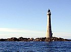 | Argyll a Bute | Skerryvore | 1844 | Alan Stevenson | Northern Lighthouse Board | 48 | 46 | 23 (43) | FI W 10s | |
| 86 | Southerness | (c) cisko66, CC BY 3.0 | Dumfries a Galloway | pevnina | 1749 | Deaktivován v roce 1931 | 10 | 17 | ||||
| 87 | St. Abbs | (c) Lisa Jarvis, CC BY-SA 2.0 | Scottish Borders | pevnina | 1862 | Alan Stevenson, David Stevenson | Northern Lighthouse Board | 9 | 68 | 26 (48) | Fl W 10s | |
| 88 | Start Point |  | Orkneje | Sanday | 1806 | Robert Stevenson | Northern Lighthouse Board | 25 | 24 | 18 (33) | Fl (2) W 20s. | |
| 89 | Stoer Head |  | Highland | pevnina | 1870 | Thomas Stevenson, David Stevenson | National Trust for Scotland, Northern Lighthouse Board | 14 | 59 | 24 (44) | ||
| 90 | Strathy Point | (c) Rog Frost, CC BY-SA 2.0 | Highland | pevnina | 1958 | Peter H. Hyslop | Northern Lighthouse Board do roku 2012) | 14 | 45 | 26 (48) | Fl W 20s. | |
| 91 | Stroma | (c) Ron Ireland, CC BY-SA 2.0 | Highland | ostrov Stroma | 1890 | Charles A Stevenson, David A Stevenson | Northern Lighthouse Board | 23 | 32 | 20 (37) | FI(2) W 20s | |
| 92 | Sule Skerry | (c) Michael Earnshaw, CC BY-SA 2.0 | Orkneje | Sule Skerry | 1895 | David A Stevenson, Charles A Stevenson | Northern Lighthouse Board | 27 | 34 | 21 (39) | Fl (2) W 15s | |
| 93 | Sumburgh Head | (c) Nicholas Mutton, CC BY-SA 2.0 | Shetandy | Mainland (Shetlandy) | 1821 | Robert Stevenson | Northern Lighthouse Board | 17 | 91 | 23 (43) | Fl (3) W 30s. | |
| 94 | Tarbat Ness | (c) Steven Brown, CC BY-SA 2.0 | Highland | pevnina | 1830 | Robert Stevenson | Northern Lighthouse Board | 41 | 53 | 24 (44) | Fl(4) W 30s | |
| 95 | Tiumpan Head | Vnější Hebridy | Lewis | 1900 | David A Stevenson, Charles A Stevenson | Northern Lighthouse Board | 21 | 55 | 25 (46) | Fl (2) W 15s. | ||
| 96 | Todhead |  | Aberdeenshire | pevnina | 1897 | David A Stevenson | Northern Lighthouse Board (do roku 2007) Deaktivován 2007 | 13 | 41 | 18 (33) | památka kategorie B [91] | |
| 97 | Tor Ness | (c) Calum McRoberts, CC BY-SA 2.0 | Orkneje | Hoy | 1980 | John Smith | Northern Lighthouse Board | 8 | 21 | 17 (31) | Fl W 5s | |
| 98 | Toward Point | (c) John Ferguson, CC BY-SA 2.0 | Argyll a Bute | pevnina | 1812 | Robert Stevenson | Clyde Port Authority | 19 | 21 | 22 (41) | Fl. W 10s | |
| 99 | Turnberry | 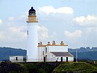 | Jižní Ayrshire | pevnina | 1873 | David Stevenson, Thomas Stevenson | Northern Lighthouse Board | 24 | 29 | 24 | ||
| 100 | Ushenish | (c) Neil King, CC BY-SA 2.0 | Vnější Hebridy | South Uist | 1857 | Thomas Stevenson, David Stevenson | Northern Lighthouse Board | 12 | 54 | 19 (35) | FI WR 20s | |
| 101 | Vaternish | (c) Nigel Homer, CC BY-SA 2.0 | Highland | Skye | 1980 | David A Stevenson, Charles A Stevenson | Northern Lighthouse Board | 7 | 21 | 8 (15) | Fl W 20s. | |
| 102 | Vaternish Point | Highland | Skye | 1924 | John Smith | Northern Lighthouse Board | ||||||
| 103 | Weavers Point | (c) James Allan, CC BY-SA 2.0 | Vnější Hebridy | North Uist | 1980 | John Smith | Northern Lighthouse Board | 4 | 24 | 7 (13) | Fl W 3s |
Odkazy
Reference
V tomto článku byl použit překlad textu z článku List of lighthouses in Scotland na anglické Wikipedii.
- ↑ Lighthouses. Northern Lighthouse Board [online]. [cit. 2021-11-15]. Dostupné online. (anglicky)
- ↑ BATHURST, Bella. The lighthouse Stevensons : the extraordinary story of the building of the Scottish lighthouses by the ancestors of Robert Louis Stevenson. [s.l.]: New York : HarperCollinsPublishers, 1999. 314 s. Dostupné online. ISBN 978-0-06-019427-7.
- ↑ KRAUSKOPF, Sharma. Scottish lighthouses. Belfast: Appletree, 2001. 93 s. Dostupné online. ISBN 0-86281-803-6, ISBN 978-0-86281-803-6. OCLC 46434803
- ↑ LIGHTHOUSE AILSA CRAIG (LB1151). portal.historicenvironment.scot [online]. [cit. 2022-12-17]. Dostupné online.
- ↑ Reeds PBO small craft almanac 2014.. London: [s.n.], 2014. 416 s. Dostupné online. ISBN 978-1-4081-9330-3, ISBN 1-4081-9330-2. OCLC 858311580
- ↑ Ailsa Craig. Northern Lighthouse Board [online]. [cit. 2021-11-15]. Dostupné online. (anglicky)
- ↑ ARDNAMURCHAN LIGHTHOUSE, KEEPERS' HOUSES, SUNDIAL FORMER STEADING AND ENCLOSING PERIMETER WALL (LB521). portal.historicenvironment.scot [online]. [cit. 2022-12-17]. Dostupné online.
- ↑ Ardnamurchan. Northern Lighthouse Board [online]. [cit. 2021-11-15]. Dostupné online. (anglicky)
- ↑ AUSKERRY LIGHTHOUSE (LB18638). portal.historicenvironment.scot [online]. [cit. 2022-12-17]. Dostupné online.
- ↑ Auskerry. Northern Lighthouse Board [online]. [cit. 2021-11-15]. Dostupné online. (anglicky)
- ↑ BARNS NESS LIGHTHOUSE WITH KEEPERS' COTTAGES AND RETAINING WALLS (LB1465). portal.historicenvironment.scot [online]. [cit. 2022-12-17]. Dostupné online.
- ↑ Barns Ness Lighthouse from The Gazetteer for Scotland. www.scottish-places.info [online]. [cit. 2021-11-16]. Dostupné online. (anglicky)
- ↑ BARRA HEAD LIGHTHOUSE, KEEPER'S HOUSE, GRAVEYARD, ANCILLARY STRUCTURES, GARDEN AND BOUNDARY WALLS (LB5893). portal.historicenvironment.scot [online]. [cit. 2022-12-17]. Dostupné online.
- ↑ Barra Head. Northern Lighthouse Board [online]. [cit. 2021-11-16]. Dostupné online. (anglicky)
- ↑ Bass Rock History. web.archive.org [online]. 2008-05-02 [cit. 2021-11-18]. Dostupné v archivu pořízeném z originálu dne 2008-05-02.
- ↑ Bellrock.org.uk : Lighthouse : Description of the Rock. www.bellrock.org.uk [online]. [cit. 2021-11-18]. Dostupné online.
- ↑ Bell Rock. Northern Lighthouse Board [online]. [cit. 2021-11-18]. Dostupné online. (anglicky)
- ↑ Bressay Lighthouse History | Lighthouse Holidays. www.shetlandlighthouse.com [online]. [cit. 2021-11-18]. Dostupné v archivu pořízeném z originálu dne 2021-09-17.
- ↑ Brough Of Birsay. Northern Lighthouse Board [online]. [cit. 2021-11-18]. Dostupné online. (anglicky)
- ↑ Lighthouse: Brough of Birsay Lighthouse. www.photographers-resource.co.uk [online]. [cit. 2021-11-18]. Dostupné online.
- ↑ Buchan Ness. Northern Lighthouse Board [online]. [cit. 2021-11-18]. Dostupné online. (anglicky)
- ↑ Buchan Ness Lighthouse from The Gazetteer for Scotland. www.scottish-places.info [online]. [cit. 2021-11-18]. Dostupné online. (anglicky)
- ↑ Butt Of Lewis. Northern Lighthouse Board [online]. [cit. 2021-11-18]. Dostupné online. (anglicky)
- ↑ About Cantick Head Lighthouse. cantickhead.com [online]. [cit. 2021-11-18]. Dostupné online.
- ↑ Cantick Head. Northern Lighthouse Board [online]. [cit. 2021-11-18]. Dostupné online. (anglicky)
- ↑ Cape Wrath. Northern Lighthouse Board [online]. [cit. 2021-11-18]. Dostupné online. (anglicky)
- ↑ CHANONRY CHANONRY LIGHTHOUSE, KEEPER'S HOUSE, WALL AND GATEPIERS (LB31799). portal.historicenvironment.scot [online]. [cit. 2022-12-17]. Dostupné online.
- ↑ Chanonry. Northern Lighthouse Board [online]. [cit. 2021-11-19]. Dostupné online. (anglicky)
- ↑ Cloch Lighthouse from The Gazetteer for Scotland. www.scottish-places.info [online]. [cit. 2021-11-19]. Dostupné online. (anglicky)
- ↑ Copinsay. Northern Lighthouse Board [online]. [cit. 2021-11-19]. Dostupné online. (anglicky)
- ↑ Corran Point. Northern Lighthouse Board [online]. [cit. 2021-11-19]. Dostupné online. (anglicky)
- ↑ Corran Lighthouse Accommodation|Corran Lighthouse Lodge. www.corranlighthouselodge.com [online]. [cit. 2021-11-19]. Dostupné online.
- ↑ Corsewall. Northern Lighthouse Board [online]. [cit. 2021-11-19]. Dostupné online. (anglicky)
- ↑ Corsewall Lighthouse | Canmore. canmore.org.uk [online]. [cit. 2021-11-19]. Dostupné online. (anglicky)
- ↑ Covesea Lighthouse. covesealighthouse.co.uk [online]. [cit. 2021-11-19]. Dostupné online.
- ↑ Lighthouse: Crammag Head Lighthouse. www.photographers-resource.co.uk [online]. [cit. 2021-11-20]. Dostupné online.
- ↑ Crammag Head. Northern Lighthouse Board [online]. [cit. 2021-11-20]. Dostupné online. (anglicky)
- ↑ Crammag Head. uklighthousetour [online]. [cit. 2021-11-20]. Dostupné online. (anglicky)
- ↑ Cromarty Lighthouse. www.rampantscotland.com [online]. [cit. 2021-11-20]. Dostupné online.
- ↑ GEORGE STREET, LIGHTHOUSE AND LIGHTHOUSE KEEPER'S HOUSE (LB23680). portal.historicenvironment.scot [online]. [cit. 2021-11-20]. Dostupné online.
- ↑ Davaar. Northern Lighthouse Board [online]. [cit. 2021-11-20]. Dostupné online. (anglicky)
- ↑ Lighthouse: Davaar Lighthouse. www.photographers-resource.co.uk [online]. [cit. 2021-11-20]. Dostupné online.
- ↑ Dubh Artach. Northern Lighthouse Board [online]. [cit. 2021-11-20]. Dostupné online. (anglicky)
- ↑ Dubh Artach Lighthouse. www.rampantscotland.com [online]. [cit. 2021-11-20]. Dostupné online.
- ↑ Dubh Artach, Lighthouse | Canmore. canmore.org.uk [online]. [cit. 2021-11-20]. Dostupné online. (anglicky)
- ↑ Dunnet Head. Northern Lighthouse Board [online]. [cit. 2021-11-20]. Dostupné online. (anglicky)
- ↑ Dunnet Head Lighthouse | Canmore. canmore.org.uk [online]. [cit. 2021-11-20]. Dostupné online. (anglicky)
- ↑ Eilean Glas. Northern Lighthouse Board [online]. [cit. 2021-11-20]. Dostupné online. (anglicky)
- ↑ ELIE NESS LIGHTHOUSE (LB8997). portal.historicenvironment.scot [online]. [cit. 2022-12-17]. Dostupné online.
- ↑ Elie & Earlsferry History Society - Elie Ness Lighthouse. Elie & Earlsferry History Society [online]. 2014-04-28 [cit. 2021-11-20]. Dostupné online.
- ↑ Elie Ness. www.enschrage.nl [online]. [cit. 2021-11-20]. Dostupné online.
- ↑ Esha Ness. Northern Lighthouse Board [online]. [cit. 2021-11-20]. Dostupné online. (anglicky)
- ↑ Lighthouse: Fair Isle South Lighthouse. www.photographers-resource.co.uk [online]. [cit. 2021-11-20]. Dostupné online.
- ↑ Fidra Lighthouse | Canmore. canmore.org.uk [online]. [cit. 2021-11-20]. Dostupné online. (anglicky)
- ↑ Fife Ness. Northern Lighthouse Board [online]. [cit. 2021-11-21]. Dostupné online. (anglicky)
- ↑ Firths Voe. www.enschrage.nl [online]. [cit. 2021-11-21]. Dostupné online.
- ↑ Foula Lighthouse from The Gazetteer for Scotland. www.scottish-places.info [online]. [cit. 2021-11-21]. Dostupné online. (anglicky)
- ↑ GIRDLENESS LIGHTHOUSE, GREYHOPE ROAD, INCLUDING FOG SIGNAL AT SOUTH SIDE AT NJ 9724 0530 (LB20078). portal.historicenvironment.scot [online]. [cit. 2023-05-25]. Dostupné online.
- ↑ Girdle Ness. Northern Lighthouse Board [online]. [cit. 2021-11-21]. Dostupné online. (anglicky)
- ↑ Scrabster, Holborn Head Lighthouse And Keeper's House | Canmore. canmore.org.uk [online]. [cit. 2021-11-21]. Dostupné online. (anglicky)
- ↑ Holy Island. www.enschrage.nl [online]. [cit. 2021-11-21]. Dostupné online.
- ↑ Holy Island (Outer). Northern Lighthouse Board [online]. [cit. 2021-11-21]. Dostupné online. (anglicky)
- ↑ Maritime Safety Information. msi.nga.mil [online]. [cit. 2021-11-21]. Dostupné online.
- ↑ South Ronaldsay, Hoxa Head Lighthouse | Canmore. canmore.org.uk [online]. [cit. 2021-11-21]. Dostupné online. (anglicky)
- ↑ Geograph:: Hoxa Head Lighthouse and Balfour Battery © David Dixon. www.geograph.org.uk [online]. [cit. 2021-11-21]. Dostupné online. (anglicky)
- ↑ Hoxa Head Lighthouse from The Gazetteer for Scotland. www.scottish-places.info [online]. [cit. 2021-11-21]. Dostupné online. (anglicky)
- ↑ Hyskeir. Northern Lighthouse Board [online]. [cit. 2021-11-21]. Dostupné online. (anglicky)
- ↑ Inchkeith Lighthouse from The Gazetteer for Scotland. www.scottish-places.info [online]. [cit. 2021-11-21]. Dostupné online. (anglicky)
- ↑ Isle of May. www.enschrage.nl [online]. [cit. 2021-11-21]. Dostupné online.
- ↑ Wonderful Fife and the Isle of May. uklighthousetour.com [online]. [cit. 2021-11-21]. Dostupné online.
- ↑ Northern Lighthouse Board - Killantringan. archive.wikiwix.com [online]. [cit. 2021-11-26]. Dostupné online.
- ↑ Kinnaird Head. Northern Lighthouse Board [online]. [cit. 2021-11-26]. Dostupné online. (anglicky)
- ↑ Scotland - South Ayrshire / Lady Isle Lighthouse - World of Lighthouses. www.lightphotos.net [online]. [cit. 2021-11-27]. Dostupné online.
- ↑ Lady Isle Lighthouse. www.rampantscotland.com [online]. [cit. 2021-11-27]. Dostupné online.
- ↑ Lady Isle. www.enschrage.nl [online]. [cit. 2021-11-27]. Dostupné online.
- ↑ Lismore. Northern Lighthouse Board [online]. [cit. 2021-11-27]. Dostupné online. (anglicky)
- ↑ Little Cumbrae Old Lighthouse from The Gazetteer for Scotland. www.scottish-places.info [online]. [cit. 2021-11-27]. Dostupné online. (anglicky)
- ↑ Little Ross (Rear). Northern Lighthouse Board [online]. [cit. 2021-11-27]. Dostupné online. (anglicky)
- ↑ Little Ross Island & Lighthouses [online]. 2017-10-04 [cit. 2021-11-27]. Dostupné online. (anglicky)
- ↑ Scotland - Orkney Islands / South Ronaldsay / Lother Rock light - World of Lighthouses. www.lightphotos.net [online]. [cit. 2021-11-27]. Dostupné online.
- ↑ Lighthouses of the United Kingdom: Orkney, Scotland. www.ibiblio.org [online]. [cit. 2021-11-27]. Dostupné online.
- ↑ Mull Of Kintyre. Northern Lighthouse Board [online]. [cit. 2021-11-27]. Dostupné online. (anglicky)
- ↑ North Ronaldsay. Northern Lighthouse Board [online]. [cit. 2021-11-27]. Dostupné online. (anglicky)
- ↑ Noss Head. Northern Lighthouse Board [online]. [cit. 2021-11-28]. Dostupné online. (anglicky)
- ↑ Ornsay. Northern Lighthouse Board [online]. [cit. 2021-11-29]. Dostupné online. (anglicky)
- ↑ Lighthouse: Oxcars Lighthouse. www.photographers-resource.co.uk [online]. [cit. 2021-11-29]. Dostupné online.
- ↑ Oxcars Lighthouse · [online]. [cit. 2021-11-29]. Dostupné online. (anglicky)
- ↑ Pentland Skerries. Northern Lighthouse Board [online]. [cit. 2021-11-29]. Dostupné online. (anglicky)
- ↑ Point of Fethaland. www.enschrage.nl [online]. [cit. 2021-12-09]. Dostupné online.
- ↑ Rhinns Of Islay. Northern Lighthouse Board [online]. [cit. 2021-12-09]. Dostupné online. (anglicky)
- ↑ TODHEAD LIGHTHOUSE (LB9535). portal.historicenvironment.scot [online]. [cit. 2023-05-27]. Dostupné online.
Literatura
- KRAUSKOPF, Sharma. Scottish Lighthouses. Belfast: Appletree Press, 2001. 93 s. ISBN 978-0-86281-803-6.
Externí odkazy
 Obrázky, zvuky či videa k tématu Seznam majáků ve Skotsku na Wikimedia Commons
- Lighthouses of the United Kingdom: Southwestern Scotland
- Lighthouses of the United Kingdom: Scotland's Western Isles
- Lighthouses of the United Kingdom: Scotland Highlands
- Lighthouses of the United Kingdom: Argyll and Bute, Scotland
- Lighthouses of Eastern Scotland
- Lighthouses of the United Kingdom: Orkney, Scotland
- Lighthouses of Scotland: Shetland
- LIGHTPHOTOS.NET
- Lighthouses of Scotland Archivováno 24. 6. 2021 na Wayback Machine.
Média použitá na této stránce
(c) George Brown, CC BY-SA 2.0
Muckle Skerry Lighthouse Muckle Skerry lighthouse seen from the perimeter wall. Completed in 1794, it was the first lighthouse built by Robert Stevenson and T Smith. It originally consisted of two light towers but this was changed to a more powerful single light in 1895. The main lighthouse is 36 metres high. It became automated in 1994.
Autor: BriYYZ from Toronto, Canada, Licence: CC BY-SA 2.0
Impressive lighthouse
(c) Anne Burgess, CC BY-SA 2.0
Fife Ness Lighthouse. Located at the easternmost point of Fife, marking the north side of the entrance to the Firth of Forth. An example of a low-rise lighthouse. The dark hut below and to the right is a birdwatching hide. Large numbers of birds pass close by just offshore on migration every spring and autumn.
(c) Alan Reid, CC BY-SA 2.0
Fair Isle North lighthouse from the fog horn
(c) Anne Burgess, CC BY-SA 2.0
Rattray Head Lighthouse. The lighthouse and the rocks it stands on are the only land in this square. The GPS told me I was in square when I took the shot, which is just as well because the tide was rising and the rocky causeway is amazingly slippery!
(c) Chris Downer, CC BY-SA 2.0
Duncansby Head: the lighthouse The Pentland Skerries can be seen in the distance.
(c) JJM, CC BY-SA 2.0
St. Flannan's Cell and Flannan Isles Lighthouse. Here is the source of one of the world's great mysteries for at the turn of the century three lightkeepers disappeared without trace.
(c) Tom Caldwell, CC BY-SA 2.0
The Cloch Lighthouse
(c) Anne Burgess, CC BY-SA 2.0
Cape Wrath Lighthouse One of the last lights to be automated, Cape Wrath was still a manned light until 1998.
Autor: secretlondon123, Licence: CC BY-SA 2.0
South East light house on Holy Isle, off the Isle of Arran, Scotland.
(c) Bob Jones, CC BY-SA 2.0
The lighthouses on Shillay, Monach Islands/Heisgeir.
The old lighthouse became redundant in 1942; the newer light was installed in 1997.(c) John Ferguson, CC BY-SA 2.0
Lighthouse at Toward Point
(c) Michael Earnshaw, CC BY-SA 2.0
The lighthouse on Sule Skerry
Sule Skerry is one of the remotest lighthouses off the north coast of Scotland. It was first operational in 1895.
There is a large bank of solar panels, facing south of course. But I imagine that in these northern locations they provide only a small amount of the energy needed to run the light.© User:Colin / Wikimedia Commons, CC BY-SA 4.0
Corran Point Lighthouse, near Corran.
(c) Nicholas Mutton, CC BY-SA 2.0
Sumburgh Head lighthouse
(c) Bill Boaden, CC BY-SA 2.0
Modern lighthouse and older defences above Scarf Skerry
(c) joost, CC BY-SA 2.0
Bound Skerry Lighthouse The characteristic Out Skerries lighthouse can be seen from almost anywhere on the islands. It is located on a small rocky island named Bound Skerry, the most easterly island of the Skerries.
(c) Steve F, CC BY-SA 2.0
Baroness lighthouse Light established 1901 discontinued 27th October 2005, height 36m.
(c) John McMillan, CC BY-SA 2.0
May Isle first lighthouse
Lady Isle, South Ayrshire. Scotland. A view of the island with the lighthouse, bird observatory and 'beacon' in the background. The Trig point sits just in front of the observatory.
Autor: Vcarceler, Licence: CC BY-SA 3.0
Chanonry Point Lighthouse Overlooking a popular Dolphin spotting area.
Autor: Sionnach1, Licence: CC BY-SA 3.0
Ardnamurchan Lighthouse close to Ardnamurchan Point
Autor: Otter, Licence: CC BY-SA 3.0
Kinnaird Head Castle Lighthouse, Fraserburgh, Aberdeenshire, Scotland.
(c) Fin'n'Liz, CC BY-SA 2.0
Oigh Sgier. Island of Hyskeir (Oigh Sgier) showing lighthouse (built in 1904 - by Stevenson family). Basaltic rocks visible in the distance. Island is covered by ground nesting seabirds.
(c) Mike Pennington, CC BY-SA 2.0
Taken from the sea, from an inter-island ferry taking a diversion to Vidlin as the linkspan at Toft was broken.
(c) Jonathan Billinger, CC BY-SA 2.0
Dunnet Head Lighthouse With a foghorn pointing out onto the Pentland Firth.
(c) Roger McLachlan, CC BY-SA 2.0
Point of Sleat lighthouse. I was surprised when I got here to find this solar powered concrete structure.
(c) Nigel Homer, CC BY-SA 2.0
Lighthouse, Waternish Point.
(c) Rog Frost, CC BY-SA 2.0
The Light House at Strathy Point.
Autor: Finavon, Licence: CC BY 3.0
Rua Reidh Lighthouse near Gairloch, Wester Ross, Scotland
(c) John Dally, CC BY-SA 2.0
Muckle Flugga and its lighthouse, the most northerly in the British Isles, as seen from Hermaness, Unst, Shetland.
(c) Gordon Brown, CC BY-SA 2.0
The Point of Fethaland light
Autor: Alan Jamieson from Aberdeen, Scotland, Licence: CC BY 2.0
Girdle Ness Lighthouse
Autor: Gestumblindi, Licence: CC0
Holburn Head Lighthouse near Scrabster Harbour, Scotland.
(c) Roddy MacDonald, CC BY-SA 2.0
North Rona Stornoway fishing boat Calina approaching the 'Toa', North Rona, the steep cliff which has the lighthouse built on top of it.
(c) Dave Simpson, CC BY-SA 2.0
Copinsay Lighthouse
© User:Colin / Wikimedia Commons, CC BY-SA 3.0
This is a photo of listed building number
Autor: Ellievking1, Licence: CC BY-SA 4.0
This is a photo of listed building number
Autor: Barry Boxer, Licence: CC BY 2.0
New lighthouse at Crammag Head
(c) Calum McRoberts, CC BY-SA 2.0
Cantick Head Lighthouse, Orkney Islands, Scotland
(c) Rob Burke, CC BY-SA 2.0
Lighthouse buildings, Butt of Lewis / Rubha Robhanais.
Autor: S McKechnie, Licence: CC BY-SA 2.0
Turnberry lighthouse
(c) John Tustin, CC BY-SA 2.0
North Ronaldsay Lighthouse Viewed from the approach road, this lighthouse lies at the north of the island at Point of Sinsoss and boasts Britain's tallest land based lighthouse tower.
(c) Roger McLachlan, CC BY-SA 2.0
Beach near Scarinish Haven't managed to work out whether the structure in the background is the lighthouse.
(c) Donald MacDonald, CC BY-SA 2.0
Dubh Artach Lighthouse
Autor: Jim Anderson, Chairman, West Lothian SAC, Licence: CC BY-SA 3.0
Skerryvore lighthouse
Autor: Alan Jamieson from Aberdeen, Scotland, Licence: CC BY 2.0
Todhead Point Lighthouse
(c) L J Cunningham, CC BY-SA 2.0
Lighthouse, Holy Island, Arran. This is the lighthouse at the Southern end of Holy Island, taken from the Holy Island Ferry. I have also submitted a photo of the unusual lighthouse on the East side of the Island.
(c) Mary and Angus Hogg, CC BY-SA 2.0
Corsewell Lighthouse and Hotel
(c) Doug Lee, CC BY-SA 2.0
Cumbrae Lighthouse. Built in 1793, automated in 1977 and last used in 1997 the lighthouse tower, associated buildings and facilities are now gradually rotting away.
(c) Richard Dorrell, CC BY-SA 2.0
Neist Point lighthouse The building contractor for the lighthouse and dwellings was W. Hugh MacDonald from Oban. The building cost was £4,350.
The lantern was made by Dove & Co., costing £1,100 and the lightroom machine, made by Milne & Co.,cost £418. The light tower is 43 metres tall, and the light can be seen from 16 miles distance. The light began operation on 1st November 1909 but the fog signal, which has since been discontinued, was not completed until 25th June 1910. The station was converted to automatic operation in 1990 and the lightkeepers withdrawn.
The lightkeepers accommodation is now offered as self catering holiday accommodation.(c) Lisa Jarvis, CC BY-SA 2.0
St Abbs Lighthouse The light is at 255 feet and is reached by a flight of steps leading down the cliff from the lightkeepers' house above.
Originally the light was oil powered, converted to electric operation in 1966 and
automated in 1993.(c) simon stewart, CC BY-SA 2.0
Eilean Glas lighthouse Scalpay.
(c) Derek Robertson, CC BY-SA 2.0
Bell Rock Lighthouse. Situated 11 miles out from Arbroath the lighthouse was built by Robert Stevenson in 1811, upon the infamous Inchcape reef. At high water the reef is hidden about 12 foot below the water level, at low water it is 4 foot above the sea.
(c) Karen Vernon, CC BY-SA 2.0
Scurdie Ness Lighthouse.
(c) Calum McRoberts, CC BY-SA 2.0
Tor Ness Lighthouse (A3600) Looking over a memorial cross from a narrow spit of land with an exposed drop on either side. The light was built in 1937.
(c) Ron Ireland, CC BY-SA 2.0
Stroma Lighthouse (or Swilkie Point lighthouse) with Pentland Firth & Orkney in distance. Stroma, Pentland Firth, Scotland
(c) Ron Ireland, CC BY-SA 2.0
Fair Isle South light Note the German bomb crater on right of picture, it was the third of a stick of four, the fourth hit the lighthouse accommodation killing one of the keepers wife. Still visible today.
(c) Bob Jones, CC BY-SA 2.0
Entrance to Dun Sron an Duin, Berneray
(c) David Dixon, CC BY-SA 2.0
Black Head, Killantringan Lighthouse
Autor: Krzysztof Hryniewski, Licence: CC BY-SA 3.0
This is a photo of listed building number
(c) Raibeart MacAoidh, CC BY-SA 2.0
Wee Cumbrae Lighthouse (old)
(c) Rob Burke, CC BY-SA 2.0
Brough Head Lighthouse.
Autor: Odd Wellies, Licence: CC BY 2.0
Low Light, Isle of May
Autor: Unukorno, Licence: CC BY 4.0
Esha Ness Lighthouse, Shetland (Scotland)
Autor: Hajotthu, Licence: CC BY 3.0
Bressay Lighthouse, Shetland Islands, Scotland
(c) Neil King, CC BY-SA 2.0
Ushenish (Uisinis) Lighthouse, South Uist. On the east coast of South Uist viewed from the Loganair (British Airways) Twin Otter en route from Barra to Benbecula
Covesea Lighthouse; Leuchtturmvon Lossiemouth
Das Covesea Lighthouse von Lossiemouth ist 36 Meter hoch, der Leuchtturm wurde im Jahre 1844 von Alan Stevenson errichtet. Es handelt sich um einen von vier Leuchttürmen mit insgesamt neun Wohnungen in Schottland, der über den National Trust for Scotland (ntsholidays.com) vermietet werden. Man wohnt natürlich nicht in dem runden Turm, sondern in sehr geräumigen Wohnungen ebenerdig am Fuße. Wir hatten die linke Wohnung, die für sechs Personen ausgelegt war. Es gab
- drei Schlafzimmer (ein Zimmer davon mit Etagenbett),
- ein schönes Wohnzimmer mit TV & DVD-Player,
- ein Esszimmer mit großem stabilen Esstisch, sowie Radio/CD-Standgerät,
- Küche mit Geschirrspüler, Waschmaschine, großer Kühlgefrierkombination,
- Badzimmer mit Dusche (Durchlauferhitzer) und Badewanne,
- Speisekammer, Besenkammer und Kofferversteck.
(c) John Tustin, CC BY-SA 2.0
The Old Beacon As featured on the front cover of Sheet 5 OS Landranger Series.
(c) David R Collin, CC BY-SA 2.0
Little Ross Lighthouse tower and keepers' houses
(c) ronnie leask, CC BY-SA 2.0
Inchkeith Lighthouse, Firth of Forth Inchkeith Lighthouse was erected by Thomas Smith & lighted on 14th September 1804. Thomas Smith was step father of Robert Stevenson, founder of the famous family of lighthouse builders, and grandfather of Robert Louis Stevenson.
Autor: Tom Parnell from Scottish Borders, Scotland, Licence: CC BY-SA 2.0
Stoer Head Lighthouse
Autor: Odd Wellies, Licence: CC BY 2.0
Start Point Lighthouse_2, Sanday, Orkney
(c) Calum McRoberts, CC BY-SA 2.0
Lighthouse, South Rona
(c) Richard Webb, CC BY-SA 2.0
Generator and newest Cumbrae Lighthouse
(c) Richard Slessor, CC BY-SA 2.0
Buchan Ness Lighthouse, Boddam This lighthouse was built by Robert Stevenson in 1827. The area is prone to fog and mist so the lighthouse acquired the red stripes in 1907 to help improve its visibility. It has been electrified since 1978 and fully automated since 1988.
(c) Steven Brown, CC BY-SA 2.0
Tarbat Ness Lighthouse The lighthouse at Tarbat Ness including the track leading up to it.
Autor: No machine-readable author provided. JeremyA assumed (based on copyright claims)., Licence: CC BY-SA 2.5
Stevenson lighthouse on the Isle of May, Scotland. © Jeremy Atherton, 2000.
(c) Simon Johnston, CC BY-SA 2.0
Oxcars Lighthouse. At high tide these rocks are covered. 118759
Autor: Odd Wellies, Licence: CC BY 2.0
Rubh a' Mhail Lighthouse
(c) Steve Partridge, CC BY-SA 2.0
Mull of Kintyre Lighthouse.
(c) James T M Towill, CC BY-SA 2.0
Ailsa Craig Lighthouse
(c) James Allan, CC BY-SA 2.0
Weavers Point Lighthouse on Rubha an Fhigheadair, North Uist, with a small islet, Madadh Beag in the foreground
(c) David Robson, CC BY-SA 2.0
Sanda Island Lighthouse. Sand Island lighthouse standing on a rocky promontory known as the ship, on the south side of Sanda at a height of 50 metres.


