Seznam okruhů Formule 1
Formule 1, zkráceně F1, je nejvyšší třídou automobilových závodů, kterou spravuje Mezinárodní automobilová federace (FIA).[1] Sezóna F1 se skládá ze série závodů, známých jako Grand Prix, které se obvykle konají na účelových okruzích a v několika případech i v uzavřených městských ulicích. Výsledky závodů určují konečné pořadí dvou každoročních šampionátů – šampionát jezdů (Mistrovství světa jezdců F1) a šampionát konstruktérů (Mistrovství světa konstruktérů F1).[2]
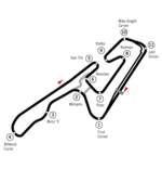
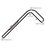
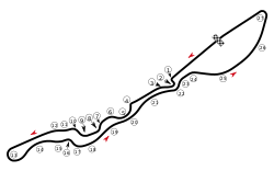
Tento seznam zobrazuje okruhy, které hostily závody mistrovství světa od roku 1950 až do současnosti.
Historie
První Grand Prix se konala v roce 1950 na okruhu Silverstone, od té doby se alespoň jeden závod odjel na 76 tratích. Mnoho klasických (starších) okruhů hostilo Grand Prix v různých konfiguracích trati, například Nürburgring, na kterém měl první závod mistrovství světa jeden okruh délku 22,835 km; kvůli obavám o bezpečnost se ale následně začala používat kratší a bezpečnější konfigurace okruhu.[3] V prvních letech šampionátu byly okruhy F1 převážně v Evropě, ale jak se tento motorsport rozrůstal, tak se rozšiřovalo i umístění jeho okruhů. Z 20 okruhů, které hostily závody v sezóně 2012, téměř polovina nebyla v kalendáři před sezónou 1999.[4] Okruh Monza hostil nejvíce závodů mistrovství světa.[5] Jediná sezóna, ve které okruh chyběl, byla sezóna 1980, kdy se Grand Prix Itálie konala na okruhu v Imole.
Las Vegas Strip Circuit se stal 77. okruhem, který hostil Grand Prix, když se na něm v sezóně 2023 jela první Grand Prix Las Vegas. Nejdelším okruhem, který hostil Grand Prix, je okruh Pescara, na kterém se jela Grand Prix Pescary 1957. Okruh měřil 25,8 km a závod vyhrál Stirling Moss.[6]
Protože některé okruhy hostily Grand Prix v různých konfiguracích, je v tabulce níže uvedena poslední konfigurace, která byla pro závod použita.
Okruhy
| Legenda | |
|---|---|
| ✔ | Aktuální okruhy (pro sezónu 2024) |
Odkazy
Poznámky
Reference
V tomto článku byl použit překlad textu z článku List of Formula One circuits na anglické Wikipedii.
- ↑ The FIA [online]. FIA [cit. 2023-08-13]. Dostupné online. (anglicky)
- ↑ 2020 Formula One Sporting Regulations [online]. FIA, 2020-04-07 [cit. 2020-04-15]. Dostupné online. (anglicky)
- ↑ HUGHES, Mark; TREMAYNE, David. The concise encyclopedia of Formula One [online]. Parragon, 2002 [cit. 2023-08-13]. S. 70–93. Dostupné online. (anglicky)
- ↑ GILL, Pete. A truly global sport [online]. Sky Sports, 2011-10-31 [cit. 2012-06-18]. Dostupné v archivu pořízeném dne 2012-01-03. (anglicky)
- ↑ Facts and figures – Italian Grand Prix [online]. Formula 1, 2006-09-07 [cit. 2012-06-22]. Dostupné v archivu pořízeném dne 2011-12-24. (anglicky)
- ↑ Pescara Circuit [online]. ESPN, 2012-06-18 [cit. 2012-06-18]. Dostupné v archivu pořízeném dne 2013-10-29. (anglicky)
- ↑ United States Grand Prix history [online]. formula1.com, 2004-06-16 [cit. 2012-07-05]. Dostupné v archivu pořízeném dne 2007-09-30. (anglicky)
Média použitá na této stránce
Flag of Australia, when congruence with this colour chart is required (i.e. when a "less bright" version is needed).
See Flag of Australia.svg for main file information.Flag of Portugal, created by Columbano Bordalo Pinheiro (1857-1929), officially adopted by Portuguese government in June 30th 1911 (in use since about November 1910).
This is the national flag of Belgium, according to the Official Guide to Belgian Protocol. It has a 13:15 aspect ratio, though it is rarely seen in this ratio.
Its colours are defined as Pantone black, Pantone yellow 115, and Pantone red 032; also given as CMYK 0,0,0,100; 0,8.5,79,0; and 0,94,87,0.Flag of Canada introduced in 1965, using Pantone colors. This design replaced the Canadian Red Ensign design.
Autor: GabrielStella, Licence: CC BY-SA 3.0
First version of the Jeddah Street Circuit, without pit lane.
Used color: National flag | South African Government and Pantone Color Picker
| zelená | rendered as RGB 0 119 73 | Pantone 3415 C |
| žlutá | rendered as RGB 255 184 28 | Pantone 1235 C |
| červená | rendered as RGB 224 60 49 | Pantone 179 C |
| modrá | rendered as RGB 0 20 137 | Pantone Reflex Blue C |
| bílá | rendered as RGB 255 255 255 | |
| černá | rendered as RGB 0 0 0 |
Autor: Will Pittenger, Licence: CC BY-SA 3.0
Track map of Mugello Circuit in Italy with 15 turns/corners numbered
Autor: Micap, Licence: CC BY-SA 3.0
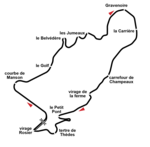
Circuit de Rouen-les-Essarts track layout from 1955 to 1971.
Autor: Cherkash, Licence: CC BY-SA 4.0
Derivative of File:BlankMap-World.svg. Countries marked in green are those that have hosted (or are scheduled to host) a Grand Prix in 2025. Those in dark gray had hosted a Formula One Grand Prix in the previous seasons, according to the List of Formula One circuits. Black dots show locations where races are scheduled to take place in 2025, while white dots show locations where races were held in the previous years. Note that for some areas where there were several tracks in close proximity such as Spain, Portugal, Italy, Austria, and USA, the dots may partially overlap. Countries shaded in light gray indicate countries that had never hosted a Formula One Grand Prix before 2025.
Autor: Sentoan, Licence: CC BY-SA 3.0
Imagen de los trazados actuales del cuircuito de Hockenheimring
Autor: Cherkash, Licence: CC BY-SA 4.0
Marina Bay street circuit, as used in Formula 1 starting in 2023.
Autor: Pitlane02, Licence: CC BY-SA 3.0
Direction of race tracks: First part is clockwise
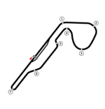
Track map of Circuito Permanente del Jarama, layout 1980-1989
Autor: HumanBodyPiloter5, Licence: CC0
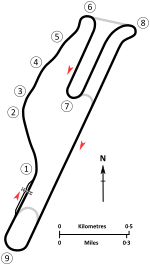
A map of the Formula One motor circuit in Baku as it was used for the 2016 European Grand Prix and the 2017, 2018, 2019, and 2021 Azerbaijani Grands Prix. This map is valid for races which use this layout and corner numbering scheme, please upload a new file for races which use different layouts or corner numbering schemes rather than replacing this file. As this is a free-hand map drawn by an enthusiast rather than a professional cartographer's work it may contain some errors, although checking it against other maps it appears accurate enough for most purposes. The track is shown in black with a grey outline, while the pit lane is shown in blue. A scale showing the length of one kilometre (with increments of 100 metres) is given, to allow viewers to contextualise and understand what they are looking at. Corner numbers and other important text is given an off-white background to avoid transparency issues rendering it illegible on certain devices. A line with a chequered flag pattern crossing the track and pit lane shows the location of the start/finish line also known as the control or timing line; while the location of pole position is indicated by a white line, crossing only the track, marked with a large mauve arrow, which indicates the direction of travel. The salmon arrow marked "N" shows the direction of north.
AVUS circuit
Autor: Will Pittenger, Licence: CC BY-SA 3.0
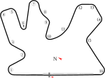
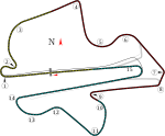
Track map of Losail International Circuit in w:Qatar.
Autor: Franck rive, Licence: CC BY-SA 4.0
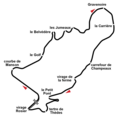
original track, Charade Clermont-Ferrand (France)
Autor: Tento vektorový obrázek byl vytvořen programem Inkscape ., Licence: CC BY-SA 4.0
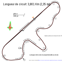
Circuito Dijon-Prenois. Calcado de OpenStreetMap con adiciones propias.
Valencia Street Circuit map.
Autor: Dr Enslin, Licence: CC BY-SA 4.0
Kyalami Grand Prix Circuit Layout used from 1992-1993 and from 2009-2015.
Autor: Will Pittenger, Licence: CC BY-SA 3.0
Track map of Fuji Speedway (despite the name, the track is NOT a speedway; it was originally designed as one but construction was halted because of financing midway through its construction; half of the banking was finished but the other half was not).
Autor: Will Pittenger, Licence: CC BY-SA 3.0
Track map of the former downtown Detroit street circuit. (Don't confuse this circuit with the one on Belle Isle.)
Autor: John Chapman, Licence: CC BY-SA 4.0
A diagram of the Riverside International Raceway motor racing circuit c. 1967, prior to the reprofiling of Turns 1 and 9. Circuit outline per USGS map sheet AMS 2551 IV NE-SERIES V895 (1967). Turn numbers per contemporary race program diagrams.
Autor:
- Formula1 Circuit Catalunya.svg: Will Pittenger
- odvozené dílo: HorsePunchKid, Cs-wolves, Sentoan, Gpmat
Grand Prix Circuit without Chicane (2021–present)
Autor: Will Pittenger, Licence: CC BY-SA 3.0
Track map for use with Circuit de Spa-Francorchamps. Some data taken from File:Circuit Spa 2007.png.
Autor: Will Pittenger, Licence: CC BY-SA 3.0
Track map for use with Autódromo José Carlos Pace (AKA Interlagos).
Autor: AEPA Racing, Licence: CC BY-SA 4.0
Albert Park Circuit (2021-present)
Autor: Restu20, Licence: CC BY-SA 4.0
Jerez de la Frontera Grand Prix Circuit from 1994 to 2003. The source for the track s here.
Autor: Sas1998, Licence: CC BY-SA 3.0
The Korean International Circuit with the new pit exit
Historical track map of Sebring International Raceway as of 1952.
Autor: Will Pittenger, Licence: CC BY-SA 3.0
Track map for Istanbul Park. The colored dashed lines mark the Formula 1 sectors. The gray line marks where pavement appears in Google Earth that might or might not be used for racing.
Autor: GabrielStella, Licence: CC BY-SA 4.0
F1 layout of the Autódromo Internacional do Algarve. Derivate by File:Autódromo do Algarve alt.svg
Autor: Will Pittenger, Licence: CC BY-SA 3.0
Track map for use with Circuit Gilles Villeneuve
Autor: HumanBodyPiloter5, Licence: CC0
This is a version of File:Le Castellet circuit map Formula One 2019 and 2021 without corner names English June 2019.svg with corner names added, for contexts where that may be considered useful. This is an altered version of File:Le Castellet circuit map Formula One 2018 without corner names June 2021.svg with the key solely in English and a few other alterations. This is a map of the Le Castellet motor circuit as it was used by w:en:Formula One for the w:en:2019 French Grand Prix and the w:en:2021 French Grand Prix, after the pit lane entrances and exits were reconfigured, and includes corner numbers and other information sourced from the FIA's map of the circuit. This map is valid for races which use this layout and corner numbering scheme, please upload a new file for races which use different layouts or corner numbering schemes rather than replacing this file. As this is a free-hand map drawn by an enthusiast rather than a professional cartographer's work it may contain some errors, although checking it against other maps it appears accurate enough for most purposes. The track is shown in black with a grey outline, while the pit lane is shown in blue. A scale showing the length of one kilometre (with increments of 100 metres) is given, to allow viewers to contextualise and understand what they are looking at. Corner numbers and other important text is given an off-white background to avoid transparency issues rendering it illegible on certain devices. A thick white line covering the track and the pit lane, marked with a chequered flag, shows the location of the start/finish line, also known as the control or timing line. A thinner white line, covering only the track, shows the location of pole position, and is marked with a large black arrow indicating the direction of travel. There are also thin white lines crossing the track which indicate the ends of the first and second timing sectors used by Formula One; these are marked with smaller black arrows, which also indicate the direction of travel. The mauve arrow marked "N" shows the direction of north. Corner names are sourced from the venue's web-site.
- First and second corners: Verrerie
- Third and fourth corners: Hôtel
- Fifth corner: Camp
- Sixth corner: Ste Baume
- Seventh corner leads onto the Mistral Straight
- Eighth and ninth corners form the Montréal chicane
- Tenth corner: Signes
- Eleventh corner: Beausset
- Twelfth corner: Bendor
- Thirteenth corner: Garlaban
- Fourteenth corner: Lac
- Fifteenth corner: Pont
- Arrow pointing north
- Pit lane
- Links corner number to location of corner
- Used to mark centreline of first sector (visible at higher resolutions)
- Used to mark centreline of middle sector (visible at higher resolutions)
- Used to mark centreline of final sector (visible at higher resolutions)
Autor: Tento vektorový obrázek byl vytvořen programem Inkscape ., Licence: CC BY-SA 2.0
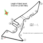
Circuit Austin
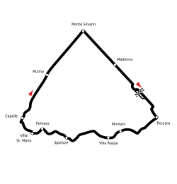
Circuit diagram of the Pescara track, Italy
Autor: Ilmar Fernandes de Souza Junior, Licence: CC BY-SA 4.0
Old version of Jacarepaguá circuit utilized by Formula One from 1978 to 1989
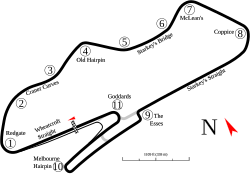
Circuit diagram of the Aintree track, England
Autor: Will Pittenger, Licence: CC BY-SA 3.0
Track map of Ain-Diab Circuit based on modern imagery. Because the imagery was current rather than from 50 years ago, there may be some inaccuracies. Also, the location of Pit Road was uncertain. The existing image (below) showed it in a place that currently is just empty ground. Other than that, all that could be done is guess.
United States Grand Prix West 1983
Autor: Will Pittenger, Licence: CC BY-SA 3.0
Track map for use with Adelaide Street Circuit. This version shows the longer route.
Autor: I, User:HumanBodyPiloter5, created this SVG map as a derivative work based on the satellite image of the Spielberg circuit released by w:en:Planet Labs under CC-BY-SA 4.0 in 2018, Licence: CC BY-SA 4.0
This is a map of the w:en:Red Bull Ring, formerly known as the A1-Ring and the Österreichring, in w:en:Spielberg, Austria. It shows the circuit roughly as it has been in the period spanning 2014-2021. Corner numbers are marked with the numbers "1" through "10", the start/finish line is marked with a checkered flag and a large arrow showing a direction of travel. The marker "S1" shows the end of the first sector, and the marker "S2" shows the end of the second sector. The location of these markers was sourced from the FIA's official Formula One circuit map. The arrow marked "N" shows the direction of north. The track layout is in black, while the pit lane is shown in blue. The corner names are as given on the venue's website in the year 2021. The dashed lines show the sectors in roughly the same colours that Formula One's official graphics do, although this has been edited to fit with a colour palette intended to reduce the likelihood of issues occurring for colourblind viewers. Sector 1 is salmon, sector 2 is cyan, and sector 3 is yellow.
Autor: GabrielStella, Licence: CC BY-SA 3.0
First version of the Hard Rock Stadium Circuit.
Autor: Hazim Fikri A., Licence: CC BY-SA 4.0
Las Vegas Street Circuit 2023 (COMPLETE REDESIGN)
Autor: Pitlane02, Licence: CC BY-SA 3.0
Formula One circuit called "Olympic Park Circuit" project in Sochi, Russia
Autor: Lispir, Licence: CC BY-SA 3.0
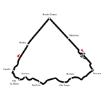
Circuit Bremgarten - dawny tor wyścigowy położony w Bremgarten pod Bernem w Szwajcarii
Autor: Will Pittenger, Licence: CC BY-SA 3.0
Track map as of 2005 for use with Suzuka Circuit.
Autor: Will Pittenger, Licence: CC BY-SA 3.0
For use with Bahrain International Circuit. Shows the Grand Prix circuit.
Autor: Will Pittenger, Licence: CC BY-SA 3.0
Track map for Donington Park as of 2006. This may or may not be the current version of the track. Changes are expected by w:2010. This is as shown in Google Earth as of the creation date.
Autor: Anthony Alessio Tralongo, Licence: CC BY-SA 4.0
Layout of the Yas Marina Circuit
Track map of Montjuïc circuit. Gray lines are streets. Green text are either turn names or track section names. Black text (with out the circle) are street names.
Autor: Will Pittenger, Licence: CC BY-SA 3.0
For use with Bahrain International Circuit. Shows the "Outer Circuit".
Autor: Pitlane02, Licence: CC BY-SA 3.0
Direction of race tracks: Clockwise
Autor: Pitlane02, Licence: CC BY-SA 3.0
Autódromo Hermanos Rodríguez 2015
Autor: Will Pittenger, Licence: CC BY-SA 3.0
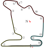
Track map for Hungaroring. The color dashed lines are the Formula 1 sectors.
New version based on Image:Circuit Mont-Tremblant Track Map.svg. As such, the image is rotated to better show the pit area, should be more accurate, and more possible configurations are shown.
Autor: Anthony Alessio Tralongo, Licence: CC BY-SA 4.0
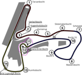
Zandvoort Circuit Layout (2020–present)
Autor: Hmdwgf, Licence: CC BY-SA 4.0
The Watkins Glen Grand Prix course from 1975 to 1983.
Autor: Anthony Alessio Tralongo, Licence: CC BY-SA 4.0
Silverstone Circuit vector map
PNG version of Bugatti Circuit.svg for those with browsers like IE7 that don't support SVG. Created with Inkscape. Previous version didn't line up well with the current track. I have fixed that.
Map of the road course of Indianapolis Motor Speedway.
Track map for Phoenix street circuit. This version applies only to 1991. The track changed that year. For the version of the track as of 1989-1990, please see Image:Phoenix Grand Prix Route - 1989, 1990.svg (below).
Autor: Will Pittenger, Licence: CC BY-SA 3.0
Monaco street circuit
Autor: Ilmar Fernandes de Souza Junior, Licence: CC BY-SA 4.0
Estoril Racetrack 1994-1999
Autor: User:Cherkash, Licence: CC BY-SA 4.0
Scandinavian Raceway in 1978–1997: this is a track layout that was used after Norra corner was modified for the 1978 Swedish Grand Prix.
(c) Gustavo Girardelli, CC BY-SA 4.0
Autódromo Osca y Juan Gálvez Circuito N° 6 con la S de Senna
Autor: Will Pittenger, Licence: CC BY-SA 3.0
Track map of the Grand Prix circuit at Autodromo Nazionale Monza. The hi-speed track is shown in the background.
Autor: Pitlane02, Licence: CC BY-SA 3.0
Direction of race tracks: Anti-clockwise
Autor: Spyder_Monkey, Licence: CC BY 3.0
Map of the oval at the Indianapolis Motor Speedway.
Autor: John Chapman, Licence: CC BY-SA 4.0
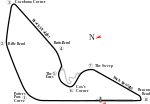
Diagrammatic map of the Brands Hatch Grand Prix motor racing circuit (Indy Circuit in grey) as it existed between 1976 and 1987. 1976 saw major revisions to both the profile of Paddock Hill Bend and the location of the Bottom Straight. In addition to the physical works, many parts of the circuit were renamed at the same time, including Bottom Straight (Cooper Straight), Top Straight (Brabham Straight), Bottom Bend (Granham Hill Bend), the latter part of Clearways (Clark Curve), and Portobello Straight (Derek Minter Straight).
Autor: Will Pittenger, Licence: CC BY-SA 3.0
Track map of Shanghai International Circuit.


