Valencia (jezero)
| Valencia | |
|---|---|
 | |
| Poloha | |
| Světadíl | Jižní Amerika |
| Stát | |
| Venezuelské státy | Carabobo, Aragua |
| Zeměpisné souřadnice | 10°11′ s. š., 67°44′ z. d. |
| Rozměry | |
| Rozloha | 350 km² |
| Délka | 31,9 km |
| Šířka | 18,7 km |
| Objem | 6 750 000 000 m³ |
| Max. hloubka | 75 m |
| Ostatní | |
| Nadm. výška | 416 m n. m. |
| Přítok vody | Güigüe, Turmero, El Limón, Cabriales, Los Guayos, Aragua, Güey |
| Ostrovy | El Burro, Burrito, Otama, El Horno, El Zorro, Caigüire, Chambergo |
| Sídla | Valencia, Maracay, Mariara, San Joaquín, Güigüe, Palo Negro, Magdaleno, Yuma |
| Některá data mohou pocházet z datové položky. | |
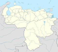
Valencia (španělsky Lago de Valencia nebo Lago de Tacarigua) je jezero na severu Jižní Ameriky ve státech Carabobo a Aragua ve Venezuele. Nachází se v podlouhlé dolině Karibských And. Má rozlohu 350 km². Dosahuje maximální hloubky 75 m. Leží v nadmořské výšce 416 m.
Pobřeží
Jezero obklopuje nížinný pás, který je dřívějším dnem jezera. Na jezeře se nacházejí ostrovy El Burro, Burrito, Otama, El Horno, El Zorro, Caigüire a Chambergo.
Vodní režim
Do jezera přitékají řeky Güigüe, Turmero, El Limón, Cabriales, Los Guayos, Aragua a Güey. Jezero nemá odtok.
Využití
Na jezeře je rozvinutá místní vodní doprava. Na pobřeží leží města Valencia, Maracay, Mariara, San Joaquín, Güigüe, Palo Negro, Magdaleno a Yuma.
Literatura
- V tomto článku byly použity informace z Velké sovětské encyklopedie, heslo „Валенсия“.
Externí odkazy
 Obrázky, zvuky či videa k tématu Valencia na Wikimedia Commons
Média použitá na této stránce
Lake Valencia (Lago de Valencia) is located in north-central Venezuela, and is the largest freshwater lake in the country.
- The lake was formed approximately 2-3 million years ago due to faulting and subsequent damming of the Valencia River. The lake has been completely dry during several discrete periods of its geologic history. Since 1976 Lake Valencia water levels have risen due to diversion of water from neighboring watersheds—it currently acts as a reservoir for the surrounding urban centers (such as Maracay).
- The vivid green algal blooms present in this image result from a continual influx of untreated wastewater from the surrounding urban, agricultural, and industrial land uses. This contributes to ongoing eutrophication, contamination, and salinization of the lake. Despite its picturesque location between the Cordillera de la Costa to the north and the Serrania del Interior to the south, Lake Valencia’s poor water quality limits opportunities for tourism and recreational activities.
- Astronaut photograph ISS010-E-5194 was acquired October 27, 2004 with a Kodak K-760C digital camera with a 180 mm lens and is provided by the ISS Crew Earth Observations experiment and the Image Science & Analysis Group, Johnson Space Center. The International Space Station Program supports the laboratory to help astronauts take pictures of Earth that will be of the greatest value to scientists and the public, and to make those images freely available on the Internet. Additional images taken by astronauts and cosmonauts can be viewed at the NASA/JSC Gateway to Astronaut Photography of Earth.


